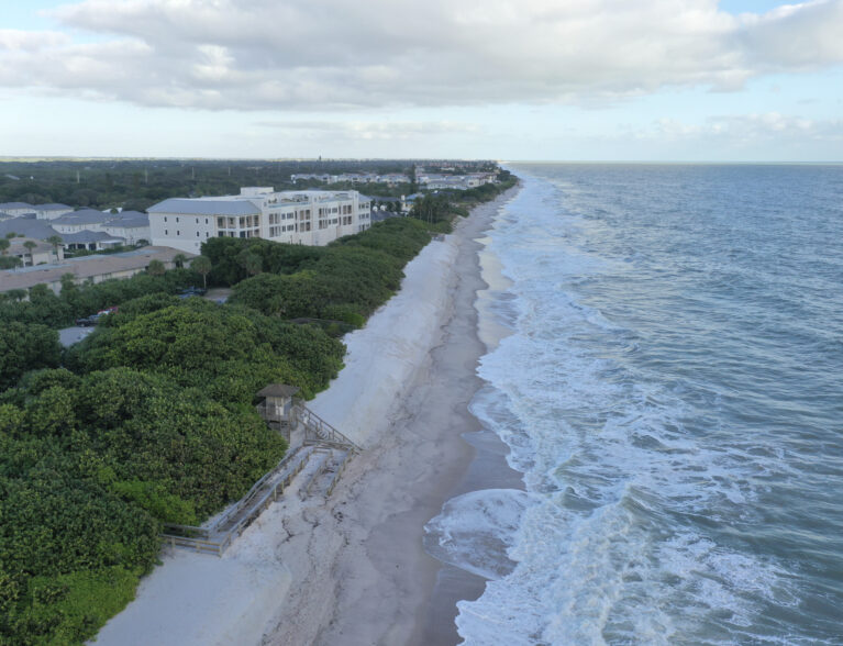
While turtle nesting season ended this week, Indian River Shores residents waiting to get much-needed sand trucked onto their beaches will likely need to wait until this time next year as Indian River County’s permits are still pending, and only a fraction of the required easements from oceanfront property owners have been secured.
Last week, county staff told commissioners plans to replenish the span of shore that runs from John’s Island to the Tracking Station Beach Park behind the CVS Pharmacy, referred to in the county’s beach plan as Sector 4, are still in the design and permitting phase.
“The permit the County is to receive for the Sector 4 dune nourishment project is expected to contain requirements for the County to monitor the physical changes associated with a nourishment project on a semi-annual basis to determine the long-term performance of the project and if infrastructure may be vulnerable to storm damage,” a staff report reads.
The county extended its surveying agreement with Morgan and Eklund, Inc. to conduct surveys in January and February, with reports due in March to meet permit requirements.
Engineers will survey a three-quarter mile area to sample the 2.8-mile sector.
The county has only recently begun collecting the necessary easements for the project. So far, it has collected 15 easement signatures, while 32 more are under review. Of the 88 total easements being sought, 41 are still pending response. There have been no outright denials so far. At least 85 percent or 68 easement agreements must be collected before construction can proceed.
Indian River Shores’ beaches suffered “significant erosional impacts” from 2022’s late-season hurricanes, but are still not considered critically eroded by the Federal Emergency Management Agency (FEMA). Yet the Florida Department of Environmental Protection (FDEP), recognized the damage and set aside $2.3 million – nearly half of the anticipated total needed – to fund the project.
That funding expires on Dec. 31, 2025. In July, county engineers said the time frame was ample, barring all-too-familiar easement collection roadblocks. A large-scale beach replenishment project slated for south island beaches had to be shelved this year due to insufficient granting of easements by property owners.
Sector 3’s replenishment project – stretching 6.6 miles from Seaview, north of Windsor, to Turtle Trail Beach – still lacks a timeline. FDEP sand loss estimates differ significantly from FEMA’s, causing major funding deficits for the conceptual project.
FDEP measures sand lost from the dry beach and dunes, while FEMA measures sand lost from the overall system, even the part underwater.
“Hurricanes Ian and Nicole impacted the Sector 3 beach by moving sand from the dune and dry beach and depositing it just offshore,” a staff report reads. “Since the sand ‘in the system’ is not expected to rebuild the dune, the County’s estimate of 246,000 cubic yards loss more closely reflects the storms’ impacts to the dry beach, as opposed to the 92,800 cubic yards loss determination made by FEMA to the system.”
County engineers estimated a north island project to replace more than 90,000 cubic yards of sand would cost $15 million to replace just the FDEP’s sand-loss estimate on the dry beach and dunes, and the county would be responsible for $7 million of that.


