6 p.m. update Aug. 2, 2020
A tropical storm warning for the Treasure Coast was downgraded to a wind advisory Sunday evening as Isaias continued to head north off the coast of southern Brevard County, officials said.
“The core of the storm has passed,” National Weather Service in Melbourne Meteorologist Cassie Leahy said. “Strong winds will start to subside this evening.”
The wind advisory remains in effect until 11 p.m. Sunday, according to the National Weather Service in Melbourne. Forecasters said Isaias will still bring 30 to 35 mph winds to the Treasure Coast, with gusts up to 45 mph.
6pm| Tropical Storm Warnings have been replaced by a Wind Advisory for the Treasure Coast counties, with conditions improving this evening as Isaias continues northward.
Conditions worsening through the evening for the Space & Volusia coasts, especially along the barrier islands pic.twitter.com/jY1JQGaFwr
— NWS Melbourne (@NWSMelbourne) August 2, 2020
Tropical Storm Isaias slightly strengthened to maximum sustained winds of 70 mph Sunday afternoon, according to the National Hurricane Center. Isaias would need to reach 74 mph maximum sustained winds to regain hurricane strength, forecasters said.
The storm was traveling northwest off the coast of east-central Florida Sunday evening at 9 mph.
Weather officials had not received reports of localized flooding Sunday, Leahy said. Leahy said most of the heavy rain bands from Isaias were in the eastern quadrant offshore over the Atlantic Ocean.
Leahy said weather conditions for Indian River County were expected to improve Sunday evening.
Florida Power & Light Co.’s power outage map showed 3,810 customers in Indian River County lost power at some point Sunday. More than half of those power outages were restored by Sunday evening.
There were 370 customers still without power about 7 p.m., the map showed. FPL serves 98,000 customers total in Indian River County.
11 a.m. update Aug. 2, 2020
Isaias, still a tropical storm, was no longer expected to regain hurricane strength when it brushes the shore off the Treasure Coast, forecasters said Sunday.
Aug 2 12pm | Tropical Storm Warnings have been replaced with Lake Wind Advisories for inland counties, but continue along the coast.
Here's an update to the "reasonable worst case" scenario for ECFL from TS #Isaias Remember, you can find that here: https://t.co/7jjote9QWw pic.twitter.com/KFOu7ZZM4x
— NWS Melbourne (@NWSMelbourne) August 2, 2020
The storm was not forecast to make landfall, but residents should still remain cautious and alert of the weather conditions, National Weather Service in Melbourne Meteorologist Cassie Leahy said. As of 11 a.m. Sunday, Tropical Storm Isaias brought heavy rainfall and strong wind gusts to the Bahamas and moved northwest near the coast of Palm Beach County, officials said.
8:15am | A glance at the radar shows the center of #Isaias is now off the coast of Palm Beach County.
In ECFL, outer bands are moving onshore into Volusia and northern Brevard counties. Brief moderate to heavy downpours and wind gusts up to 50 mph will be possible through 11am. pic.twitter.com/IhUGmUdKyl
— NWS Melbourne (@NWSMelbourne) August 2, 2020
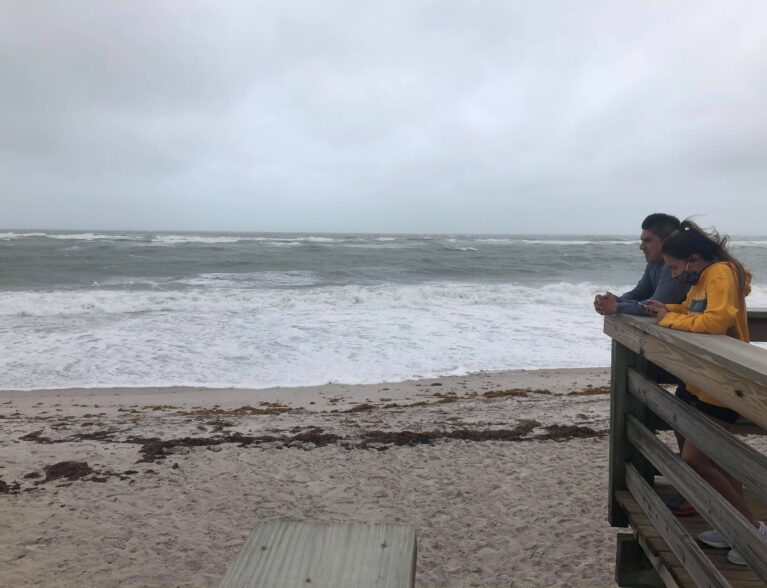
“Residents should remain vigilant of what’s going on today,” Leahy said. “Residents need to be careful, especially on the beaches. The waves are rough. Be mindful of the weather today.”
Isaias, carrying 65 mph maximum sustained winds, was traveling northwest at 8 mph, forecasters said. The storm would need to carry at least 74 mph maximum sustained winds to regain hurricane strength, according to the National Hurricane Center.
A hurricane warning issued for the Treasure Coast was downgraded to a tropical storm warning Sunday, Leahy said. A tropical storm warning means tropical storm-force winds were expected in the area within 36 hours.
The barrier island in Indian River County was already experiencing strong winds and rain bands Sunday morning, with 35 to 45 mph winds with gusts up to 55 mph, National Weather Service in Melbourne Meteorologist Melissa Watson. The county had an 80 percent chance of rain for Sunday evening, forecasters said.
Watson said the wind speeds will gradually decrease as they reach the mainland. Forecasters said the mainland will experience 20 mph to 30 mph wind speeds.
The barrier island also might experience flooding rain and storm surge from Isaias, forecasters said. Residents should monitor alerts from the weather service, the county and local news for updates.
5 p.m. update Aug. 1, 2020
Isaias weakened to a tropical storm Saturday afternoon, but could regain hurricane-force winds overnight, weather experts said.
Tropical Storm Isaias was carrying maximum sustained wind speeds of 70 mph about 5 p.m. Saturday, according to the National Hurricane Center. The storm would need to gain at least 74 mph maximum sustained wind speeds to be considered a Category 1 hurricane again.
Aug 1 520pm | Isaias has been downgraded to a tropical storm, but our message has NOT changed:
▶️Hurricane conditions possible along the coast
▶️Tropical storm conditions possible inlandConditions will deteriorate overnight. Be sure to complete your preparations this evening. pic.twitter.com/fbdllJiOpE
— NWS Melbourne (@NWSMelbourne) August 1, 2020
Isaias also slowed in speed, traveling northwest at 10 mph, forecasters said. With Isaias expected to strengthen back into a hurricane as it approaches the southeastern Florida coast, forecasters urged residents to have all arrangements in place by Saturday evening.
“It could become a hurricane again over the next 12 hours when it nears the Treasure Coast,” National Weather Service in Melbourne Meteorologist Jessie Smith said. “We already have outer rain bands moving across Martin County that will move further north.”
A hurricane warning and a storm surge watch remain in effect Saturday for the Treasure Coast area, weather forecasters said. Smith said the barrier islands will most likely experience hurricane-force winds, while the mainland will have tropical storm-force winds.
“The eyewall will be near the coast,” Smith said.
The storm was expected to bring 60 to 75 mph winds, with gusts up to 85 mph, in Indian River County, officials said. Tropical storm-force winds were expected to reach the area early Sunday and last at least eight hours.
Isaias could cause at least 4 inches of flooding rain and at least 1 foot of storm surge, officials said. Other threats from Isaias include beach erosion, rip currents, isolated tornadoes along the coast, dangerous surf and rough intracoastal waters.
County officials issued voluntary evacuations for residents on the barrier island, in mobile homes and areas known to flood. Authorities also opened three county shelters as a last resort for evacuees.
11 a.m. update July 31, 2020
Isaias strengthened into a Category 1 hurricane late Thursday, prompting weather officials to issue a hurricane watch over parts of the Treasure Coast Friday morning, followed by a hurricane warning and a storm surge watch.
As of 11 a.m., Isaias was swirling over the southeastern Bahamas and the Turks and Caicos Islands, according to the National Hurricane Center. Isaias was moving northwest at 16 mph, carrying maximum sustained winds of 75 mph.
The hurricane warning, an upgrade from a hurricane watch, could bring heavy rain, flooding and strong winds to Indian River County this weekend.
A hurricane watch means hurricane-force winds are possible in the area within the next 48 hours, weather experts said. A hurricane warning means hurricane-force winds are expected in the area within 36 hours.
The same principle applies to tropical storm watches and warnings. A storm surge watch means life-threatening floods, caused by rising water moving inland from the coastline, are possible in the area within the next 48 hours, forecasters said.
Residents should monitor alerts from local news, weather officials and county emergency services. To sign up for emergency text alerts, visit the county website.
Jul 31, 11 AM | Hurricane #Isaias has shifted closer towards the coast. The storm is forecast to be just east of our area this weekend. Tropical Storm to Hurricane conditions are possible along the coast starting Saturday. Tropical Storm Warnings in effect for the Treasure Coast. pic.twitter.com/ZQJJDfH9mT
— NWS Melbourne (@NWSMelbourne) July 31, 2020
Category 1 hurricanes carry maximum sustained wind speeds between 74 mph and 95 mph, according to the National Hurricane Center. The maximum winds speeds for Isaias would need to strengthen to between 96 mph and 110 mph to upgrade to a Category 2 hurricane.
Category 3 hurricanes have wind speeds between 111 mph and 129 mph, forecasters said. Category 4 hurricanes have wind speeds between 130 mph and 156 mph.
Any storm carrying maximum wind speeds greater than 157 mph are placed into Category 5, considered the deadliest of all hurricanes and the highest on the Saffir-Simpson Scale.
The 2020 Atlantic Hurricane Season began June 1 and will end November 30. Those who want more information on hurricane preparedness can visit the National Weather Service website.
5 p.m. update July 30, 2020
INDIAN RIVER COUNTY — Heavy rain, flooding and strong winds are possible this weekend as weather officials issued a tropical storm watch for south Florida Thursday, including the Treasure Coast.
The tropical storm watch comes as Tropical Storm Isaias continues to slowly move northwest toward Florida at 20 mph. As of 5 p.m. Thursday, Isaias brought heavy rainfall to parts of the Dominican Republic and carried maximum sustained wind speeds of 60 mph, according to the National Hurricane Center.
Forecasters predict Isaias could strengthen into a hurricane sometime Friday. The tropical storm would need to carry maximum sustained winds of at least 74 mph to be upgraded to a hurricane, weather officials said.
Residents should take precautions to make sure they have supplies and a safety plan in place.
National Weather Service in Melbourne issued the tropical storm watch about 5 p.m. Thursday for areas on the Treasure Coast, including Indian River County, down to parts of Miami-Dade County, officials said. The watch will be in effect until further notice.
A tropical storm watch means tropical storm-force winds are possible within 48 hours. Meteorologist Matt Volkmer said the tropical storm watch will likely upgrade to a tropical storm warning sometime Friday.
A tropical storm warning means tropical storm-force winds are expected in the affected areas within 36 hours. The storm could bring 58 to 73 mph winds to the area, damage homes, uproot trees, push large debris in the roadways, cause flooding and power outages, forecasters said.
Indian River County will have a 50-to-60 percent chance of showers Friday through Sunday, meteorologists said. The days will have temperatures in the low 90s, while the evenings will dip to the high 70s.
Friday was expected to have heat index values as high as 103 degrees, weather experts said.
Residents should monitor websites and social media for the National Hurricane Center, National Weather Service in Melbourne and Indian River County Emergency Services Department for updates. To sign up for emergency text alerts, visit the county website.
The 2020 Atlantic Hurricane Season began June 1 and will end November 30. Those who want more information on hurricane preparedness can visit the National Weather Service website.