About 85 percent of properties in Vero Beach’s 32963 zip code are currently at risk for some type of major or minor flooding, with the risk increasing to about 93 percent in 30 years – the life of the average home mortgage – due to future environmental conditions wrought by climate change.
That’s the gist of a new report by the First Street Foundation, a nonprofit research and technology group whose more than 80 scientists have developed flood-risk models across the U.S. they say identify millions more flood-prone properties than are classified by the Federal Emergency Management Agency (FEMA).
“We’ve spent our entire time defining America’s flood risk,” said First Street executive director Matthew Eby. “Our whole reason is to fully inform average Americans about flood risk today and how it will change in the future.”
The foundation says its modeling incorporates current climate data and adjusts for future environmental conditions such as changing sea levels, increased precipitation, and warming oceans and atmosphere which, it says, FEMA flood maps don’t do.
Eby says sophisticated investors for years have purchased that type of flood risk information from private, for-profit firms. But he says his group’s data, available free to the public, “levels the playing field” so that individual homeowners have equal access to make informed decisions about protecting their property.
In Vero Beach, says Dr. Jeremy Porter – First Street’s director of research and development – FEMA has flood zones accurately identified on the beach and along the Indian River Lagoon. But not so further inland.
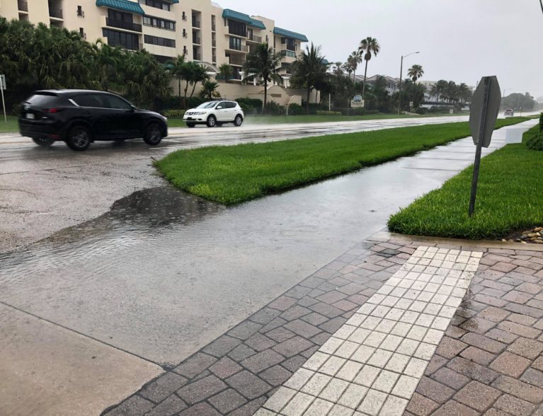
“Folks away from the coast do in some areas have extreme flood risk,” Porter said. “Anything around 6th Avenue in Vero Beach all the way out to 43rd Avenue is almost empty of FEMA zones. But when there’s heavy rainfall, there’s flooding. These rain events, surge events, tidal events – they’re not always mapped properly by FEMA.”
As for the prospects of a dreaded 100-year flood event, Porter says Vero’s risk increases from about 63 percent to about 77 percent in 30 years.
Vero Beach real estate broker Sally Daly says she’s interested in learning more about the First Street models.
“To some degree, it’s an education,” Daly said. “The more information that’s out there for a consumer, the better the decision. I’m for total transparency. If it’s another tool, bring it on. Every person has an individual tolerance for risk.”
Daly wonders if FEMA will take another look at its flood risk maps based on the new research.
“The $64,000 question is what are FEMA and the insurers going to do about it?” she said. “Are people going to give this work product a chance or are they going to rely on FEMA?”
The report suggests numerous solutions to mitigate flood risk for individuals such as flood-proofing homes; purchasing flood insurance; and even considering relocating out of a flood zone.
For communities, recommendations include performing a risk assessment of current flooding and finding ways to future-proof buildings and other infrastructure; setting development standards to achieve greater resilience; preserving open space and restoring marshes and wetlands to control flooding; renourishing beaches and dunes; and installing rain gardens and living shorelines.