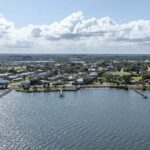
SEBASTIAN – The Sebastian Parks and Recreation Committee is on the lookout for sidewalks, bike paths and places where a residents can launch a canoe or kayak.
The group wants to create a master map that shows how interconnected the city is, along with the locations of all the city’s parks, to help encourage more recreational activity throughout Sebastian.
The committee also wants to work on a connector to the county’s 12-foot-wide multipurpose path that will eventually run from the North County Aquatics Center to Interstate 95 and, later, from the highway to Blue Cypress.
Committee member Scott Simpson has suggested that the trail hook into preserve behind Sebastian City Hall and wrap around the lake.
“I’m excited about getting that connection,” he said.
Simpson has been pushing for the map showing the city’s greenways and blueways. Blueways are navigable areas by water, while greenways are typically sidewalks, bike paths and trails for pedestrians or bicycles.
Simpson said that once a map were created, they could review the big picture – see where new connections need be made and determine what other needs the city’s recreation has.
“There are some great sidewalks around the city if you know where they are,” Simpson told his fellow committee members.
As for the blueways, Simpson has suggested the committee revisit a potential canoe/kayak launch at Stonecrop Park, a 28-acre undeveloped park site that borders the south prong of the St. Sebastian River.
In the past, residents in the area have objected to having such a waterway access.
During a recent Sebastian City Council meeting when Simpson presented the idea of Stonecrop, council members suggested the city hold a public workshop with those residents to find out if their feelings have changed regarding the canoe and kayak access.
On Monday, Simpson also suggested a potential trailhead site near Laconia and Concha for access to the river. Simpson said he had spoken with a homeowner there who told him that, some years ago, canoeists and kayakers would often park on the vacant land there and put in their watercraft.
“That would be the ideal trailhead,” Simpson said.
Committee members have agreed to move forward with plotting out the parks, sidewalks and trails, and current access points to the river on a master map.