INDIAN RIVER COUNTY — Meteorologists continued scrolling through pages of data and combing through tornado-damaged areas, finding evidence that three more tornadoes hit the county last week. This brings the total number of tornadoes to at least six that swept through the area on Oct. 9 as Hurricane Milton’s outer rain bands plowed across Indian River County.
In a Friday update, weather experts said two tornadoes struck western Indian River County, a less populated and rural area. The EF rating, or Enhanced Fujita Scale that rates the strength of tornadoes, and exact tracks were not immediately known for those tornadoes, said Megan Tollefsen, a meteorologist with the National Weather Service in Melbourne.
“Those (tornado confirmations) were based off of radar readings (from Oct. 9),” Tollefsen said on Friday. “People are still reporting stuff in. Our crews haven’t been able to get out there yet and survey damage.”
Meteorologists said an EF1 tornado, with 80-to-90 mph peak winds, developed in northern St. Lucie County and traveled northwest into Indian River County. That tornado – which lasted from 3:05 p.m. to 3:19 p.m. – traveled 8.5 miles and spanned 100 yards.
“The tornado moved briefly into Indian River County as it crossed 25th Street Southwest and dissipated,” meteorologists said. The tornado traveled across a mostly rural area and caused minor-to-moderate damage to homes and businesses, according to a weather report.
No fatalities were reported for Indian River County.
Meteorologists previously confirmed the EF-3 tornado that formed in St. Lucie County, killing at least six people, traveled northeast into Indian River County. The tornado, which slightly weakened to an EF2 and EF1, destroyed homes in the Highlands, swirled above the Indian River Lagoon and knocked down more residences on the barrier island.
The tornado had peak winds of 155 mph, traveled 21 miles and spanned 500 yards, meteorologists said. Meteorologists said the tornado lasted from 4:59 p.m. to 5:30 p.m.
Two tornadoes formed over downtown Vero Beach within 20 minutes of each other, reports show. Weather experts rated both tornadoes as an EF1 with up to 100 mph peak winds.
The first downtown tornado lasted from 3:48 p.m. to 3:57 p.m., traveled 4.5 miles and spanned 150 yards, weather reports show. The other tornado to hit downtown lasted from 4:09 p.m. to 4:16 p.m., traveled 3.4 miles and spanned 100 yards.
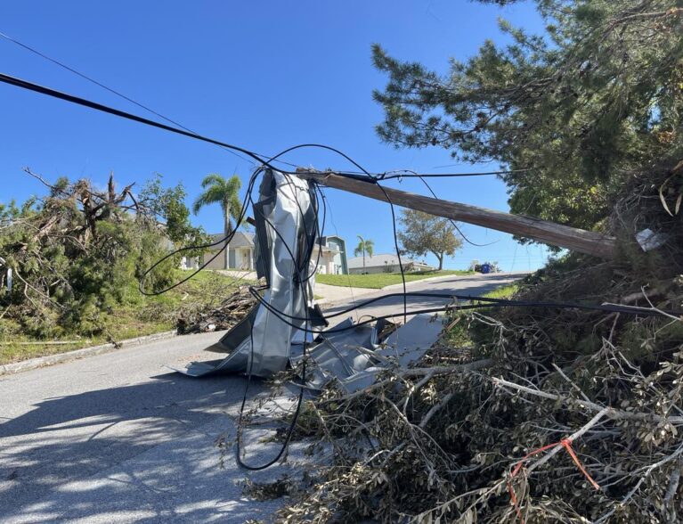
Those tornadoes toppled trees, damaged roofs, knocked down utility poles and even caused a warehouse to collapse near the tracks at 19th Place, weather reports show. The tornadoes quickly weakened as they approached Gifford.
“The National Weather Service Office in Melbourne sends its sincerest thanks to the Indian River County Emergency Management, Police Department, and Public Works for their extensive and ongoing coordination,” NWS officials said in a statement. “Appreciation is also extended to local broadcast media, trained spotters, and local residents for providing information before and during the storm survey.”
The EF scale classifies tornadoes into five categories:
EF0…..65 to 85 mph
EF1…..86 to 110 mph
EF2…..111 to 135 mph
EF3…..136 to 165 mph
EF4…..166 to 200 mph
EF5…..>200 mph