11 a.m. update Sept. 27, 2024
Helene downgraded to a Tropical Storm and continued on a northward track, according to the 5 a.m. Friday update from the National Hurricane Center. While the storm brought historic flooding to portions of western Florida and the Carolinas, there were no major weather impacts in Indian River County, meteorologists said.
At least one death was reported in Tampa after a highway sign fell on top of a vehicle on westbound I-4. On Friday morning, Helene was traveling north at 32 mph with 45 mph maximum sustained winds, weather officials said.
Weather officials previously issued tornado watches and warnings for areas throughout Florida, which have expired. There was no confirmation of tornadoes forming at all, meteorologists said.
Vero Beach received 1.49 inches of rainfall as of 8:30 a.m. Friday, weather officials said. Sebastian had 1.3 inches of rain and Fellsmere had .55 inches of rain.
7 p.m. update Sept. 26, 2024
Helene intensified into a Category 4 hurricane, packing 130-mph maximum sustained winds, according to the 7 p.m. Thursday update from the National Hurricane Center. Weather experts said the powerful storm will make landfall sometime overnight near Florida’s Big Bend area on the western part of the state.
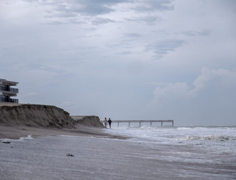
Helene, the 8th-named storm for this year’s hurricane season, will approach from the Gulf Coast and have a wind field stretching across the state, bringing strong wind gusts to Indian River County. The mighty winds could be felt Thursday evening in Vero Beach.
Vero Beach had southeast wind gusts reaching a peak of up to 46 mph about 6 p.m., which dropped to 36 mph at 7 p.m., said Scott Kelly, a meteorologist with the National Weather Service in Melbourne. A tornado watch issued earlier for Indian River County expired at 8 p.m.
So far, there have been no reports of tornadoes forming in the county, said Megan Tollefsen, a meteorologist with the National Weather Service in Melbourne. Tollefsen offered safety tips for residents if a tornado develops.
“Get to a safe place. Stay away from doors and windows. Get away from exterior walls. Get to the most interior place in your home,” Tollefsen said. “If you’re driving, scan the area and look for a building you can shelter in.”
A tropical storm warning issued for Indian River County remains in effect until further notice, meteorologists said. A flood watch remains in effect until 8 a.m. Friday, while a high surf advisory will expire at 11 a.m. Friday.
Helene was traveling north northeast at 23 mph, according to weather experts. Details on closings from Hurricane Helene can be found on the county website.
Earlier story:
INDIAN RIVER COUNTY — Weather officials issued several weather advisories – including a tornado watch – on Thursday as Helene was expected to make landfall near the Gulf Coast area. Helene will approach Florida from the Gulf, but the wind field will stretch across the state, bringing strong wind gusts and rain to Indian River County.
The tornado watch for Indian River County remains in effect until 8 p.m. Thursday, according to the National Weather Service in Melbourne. A tornado watch is issued when tornadoes could possibly form in and around the watch area.
A tropical storm warning remains in effect until further notice.
A flood watch issued for Indian River County will expire at 8 a.m. Friday. A high surf advisory remains in effect until 11 a.m. Friday.
Helene strengthened into a Category 2 hurricane Thursday morning, said Robert Haley, a meteorologist with the National Weather Service in Melbourne. Weather experts said Helene will intensify into a major hurricane – a high-end Category 3 storm – later tonight when it makes landfall near Florida’s Big Bend area located on the western side of the state.
Helene was traveling north northeast at 14 mph with 105 mph maximum sustained winds, according to the 10 a.m. Thursday update from the National Hurricane Center.
Locally, Thursday and Friday will have a 70 percent chance of showers. Wind gusts on Friday will be as high as 35 mph, meteorologists said. Saturday will have a 70 percent chance of storms.
The School District of Indian River County and Indian River State College were closed Thursday ahead of the storm. The Indian River County Sheriff’s administrative offices also closed on Thursday.
More information on closings for Helene can be found on the county website.