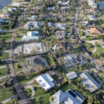
The questions kept coming in the aftermath of the barrage of Hurricane Milton-spawned tornadoes, including the one monstrous twister that wreaked havoc in Vero’s picturesque Central Beach community.
As homeowners, clean-up crews and teams of volunteers sifted though the devastating trail of destruction from Riomar to Bethel Creek, people wanted to know: What caused this unprecedented outbreak?
How did a rain-filled feeder band that arrived here while Hurricane Milton was still out at sea, more than 100 miles away – more than three hours before it made landfall on the far side of the state – bring this horror to Vero?
Was it the result of some rare confluence of marine, weather and atmospheric conditions? Or is this the beginning of some new normal?
“I would consider this to be an extraordinary event,” said Jared Heil, a meteorologist for the National Weather Service’s Melbourne office, in a phone interview late Sunday afternoon. “The set of circumstances was incredibly uncommon.”
For Florida’s East Coast, the flurry of twisters that prompted the Weather Service to deliver to cellphones 126 tornado warnings – the most ever in this state and the second-highest number issued in a single day anywhere in the U.S. – was totally without precedent.
“It was certainly the tornadoes that made this storm memorable,” Heil added.
For some in northern St. Lucie County, where six people were killed when the tornado that ultimately made it to Vero viciously swept through Spanish Lakes Country Club Village, this storm will be unforgettable.
Even here, where no fatalities were reported, many of the Central Beach residents whose homes were damaged – or, in some cases, obliterated – are likely to be haunted by the thought of what might’ve happened.
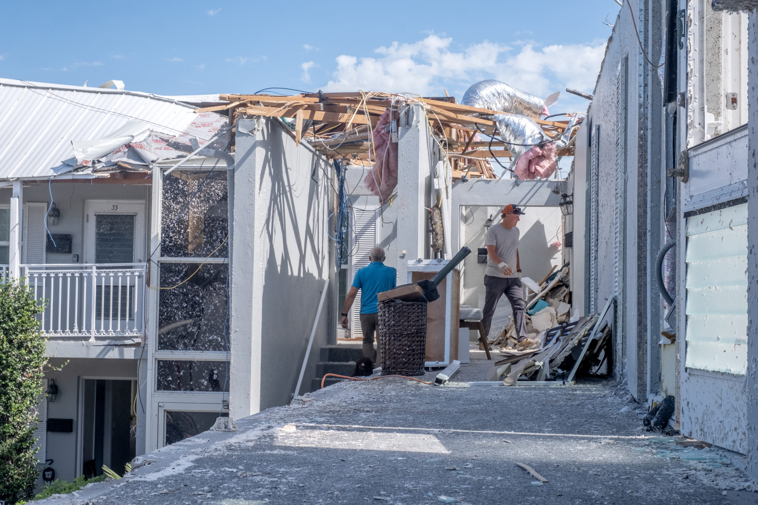
In addition to the wonderful stories of how members of our community have come to together to help their neighbors, we’re hearing numerous accounts from people who narrowly escaped harm, leaving a room only seconds before a ceiling fell, or a wall collapsed, or a tree crashed through a window.
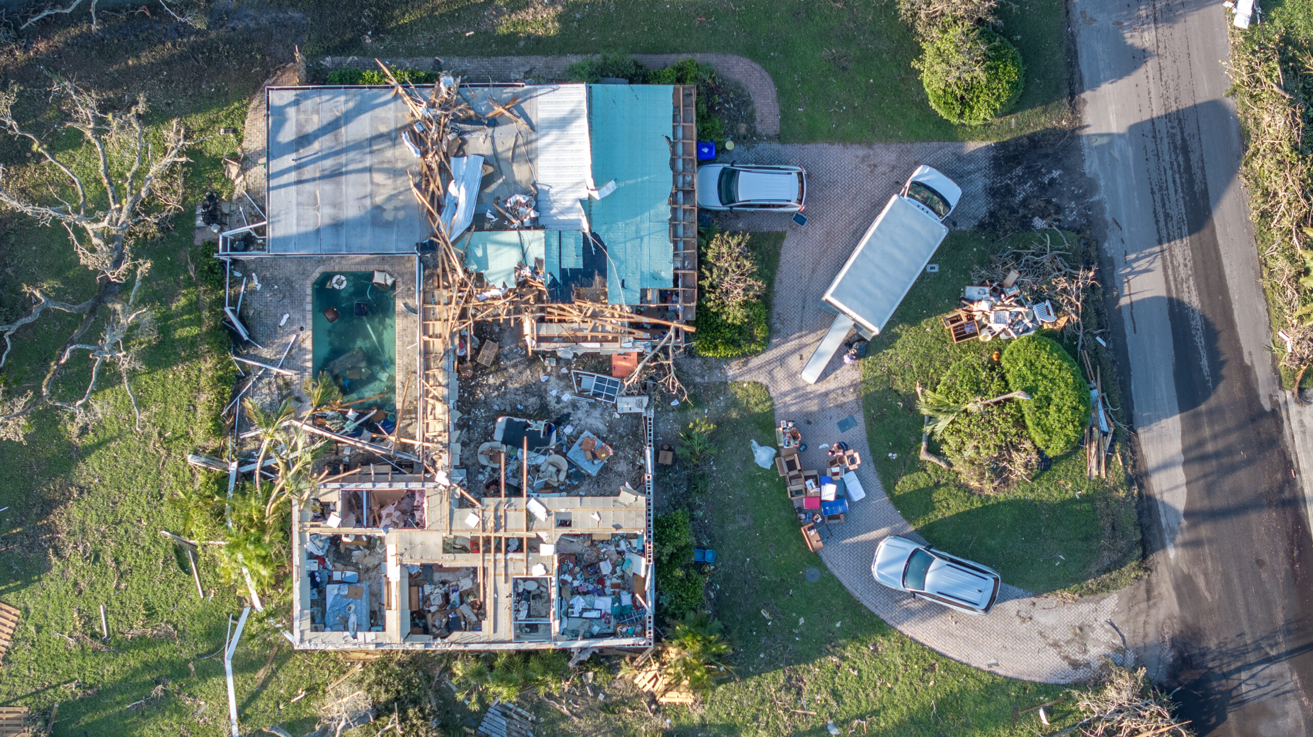
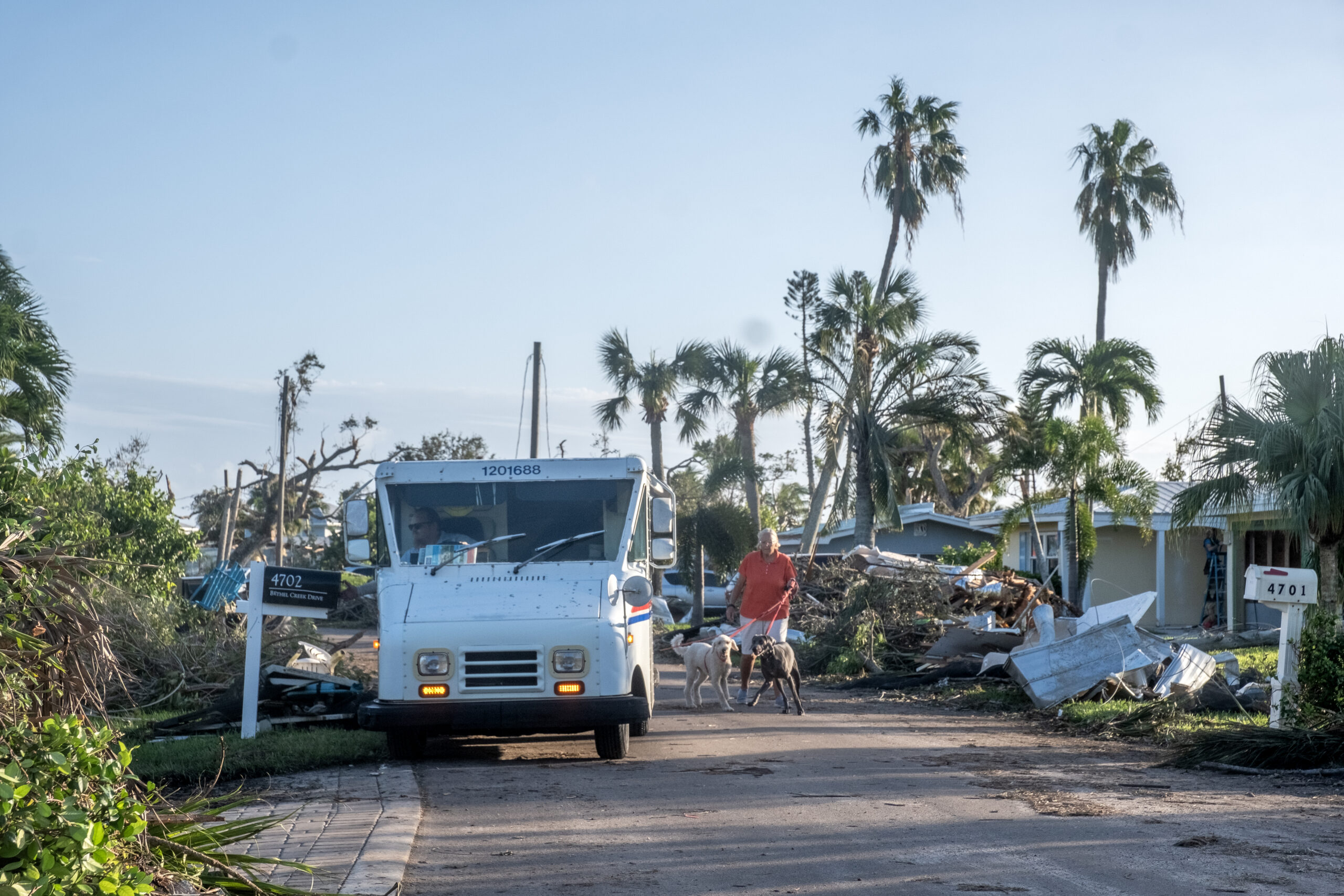
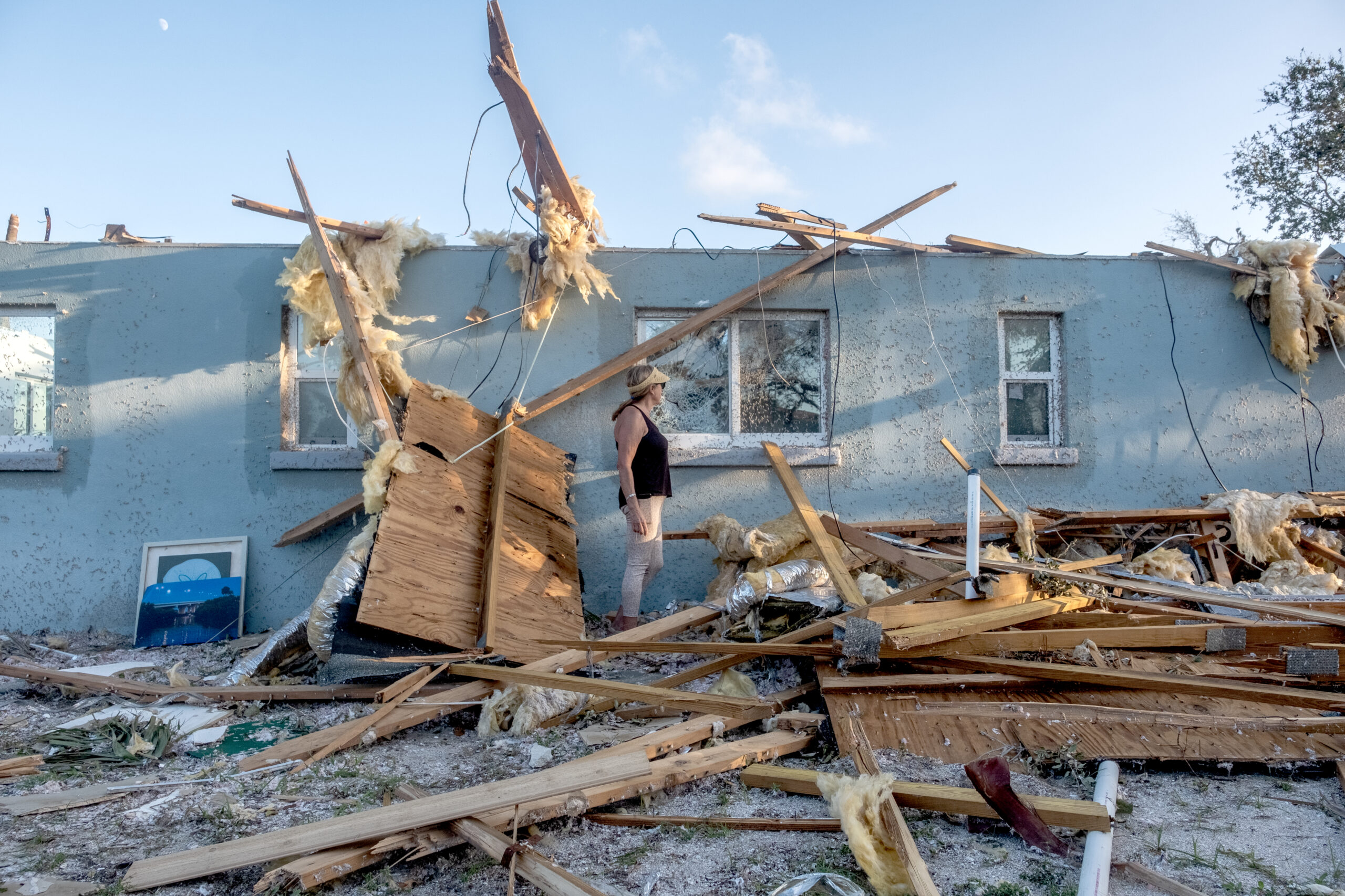
One such story was told by a Bethel Creek Drive woman who averted disaster when she noticed her dog behaving oddly and followed her into a bedroom closet, moments before the roof blew off her home and a wall collapsed.
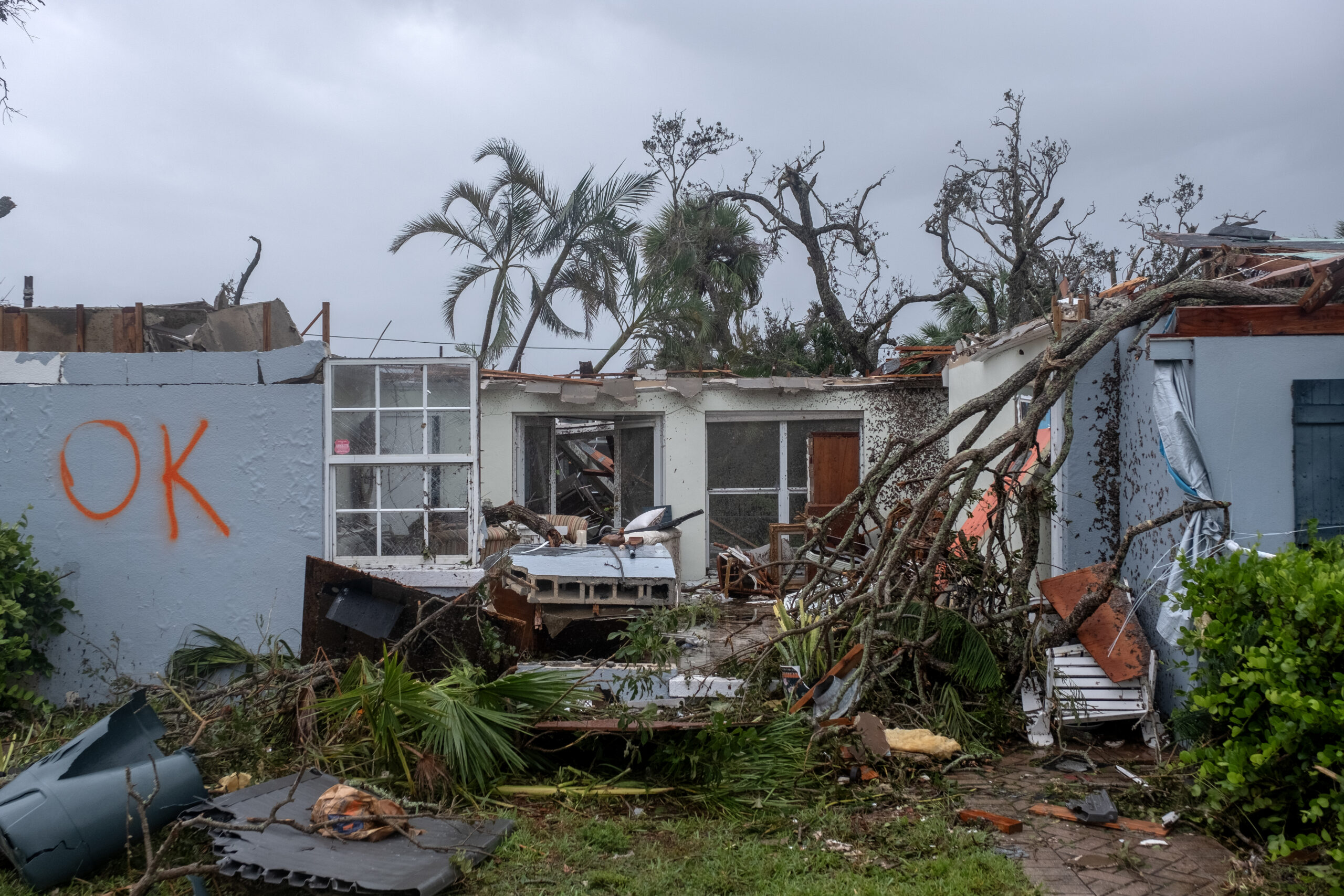
“See the wall that collapsed?” Stacey Clark told a Vero Beach 32963 photographer at the scene. “I think I’d be dead, if were still standing there.” (See her dog Sweetie’s first-hand account in an interview with Bonzo in our Special Tornado Section, Page 29.)
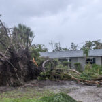
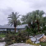
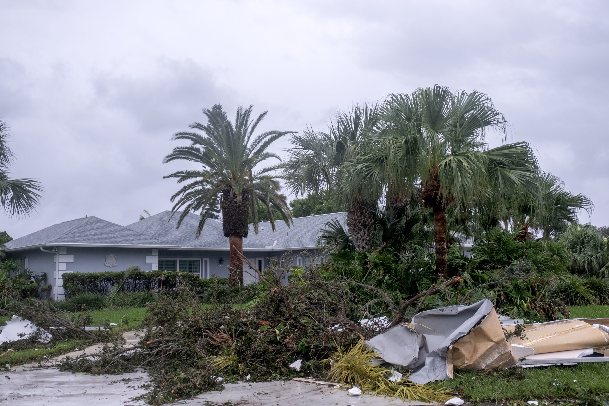
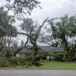
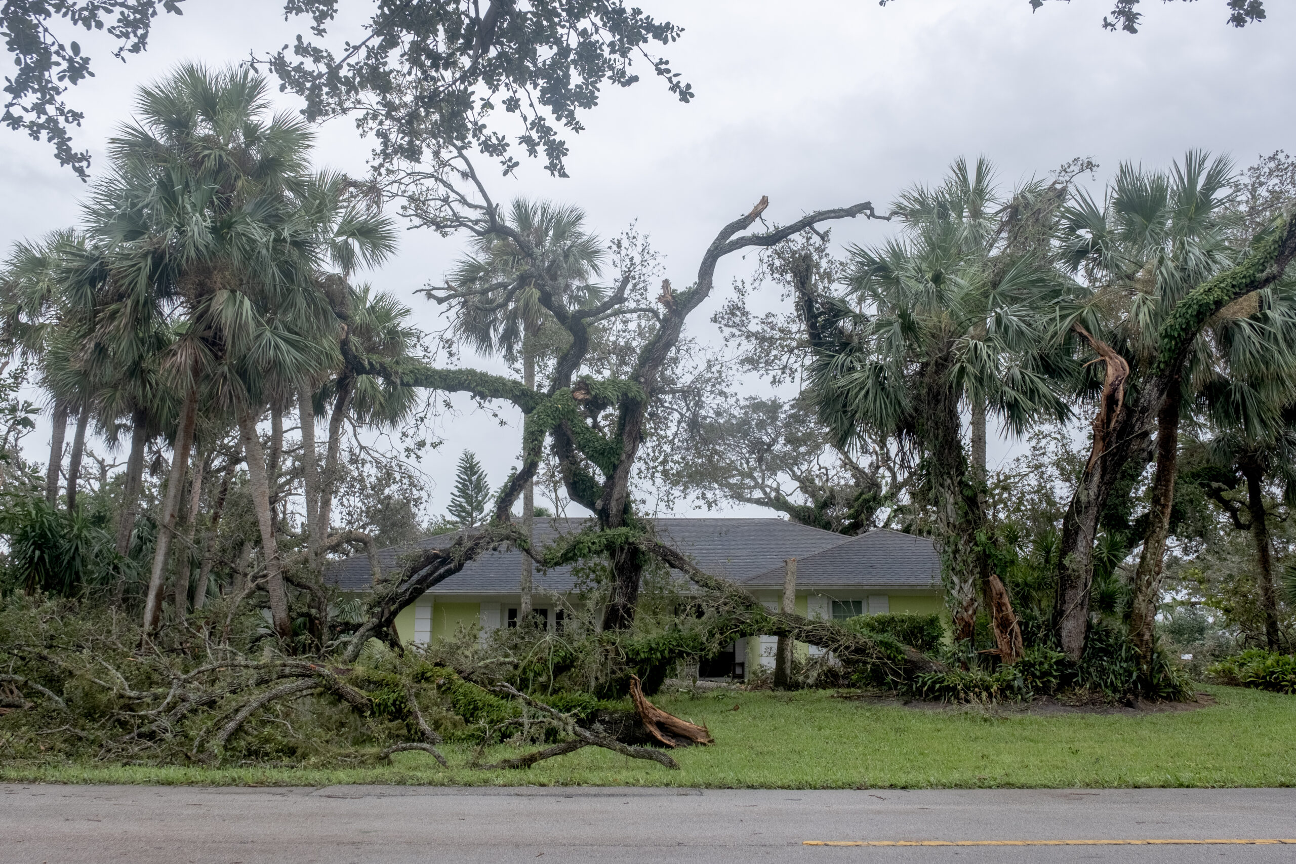
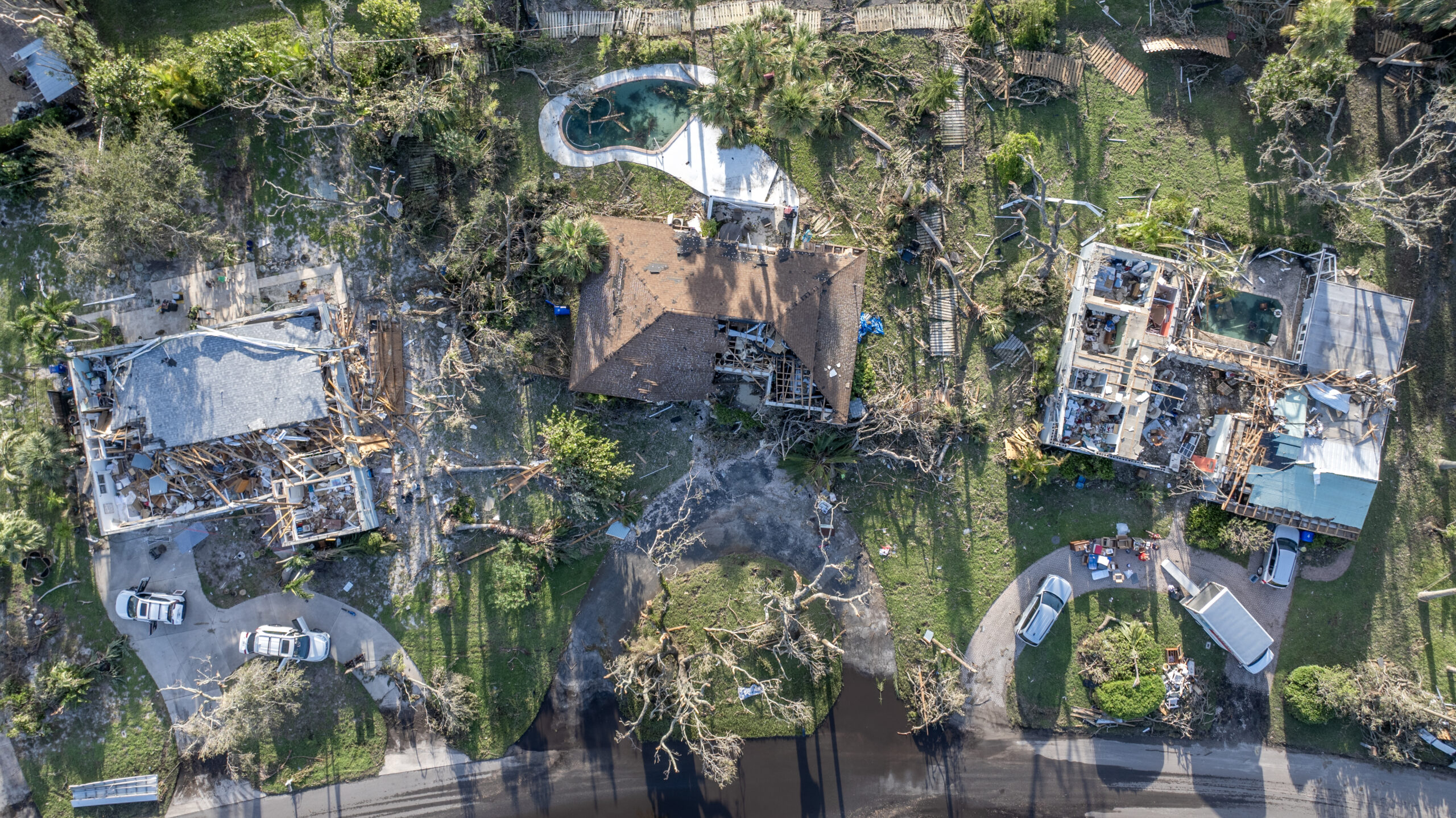
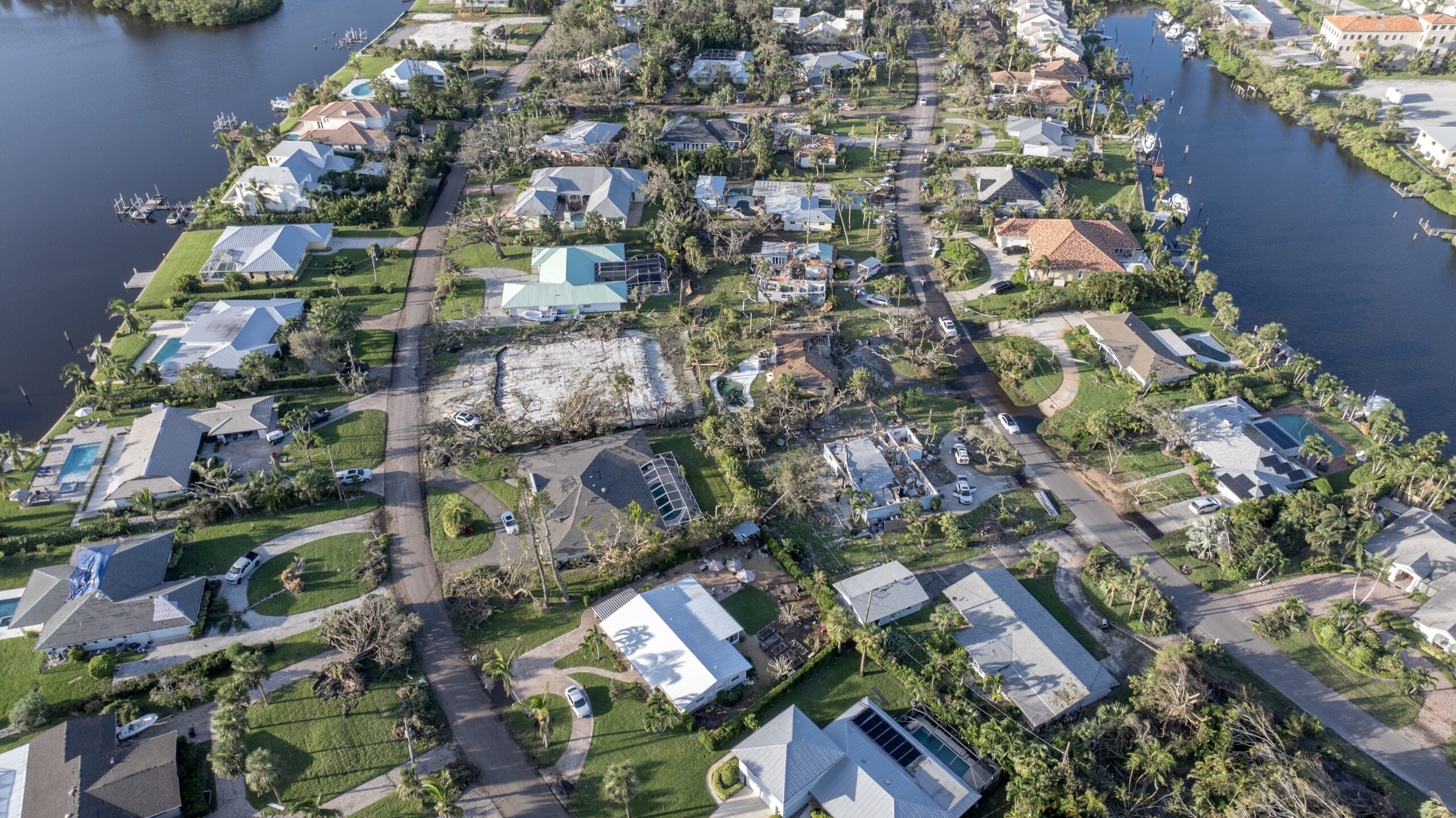
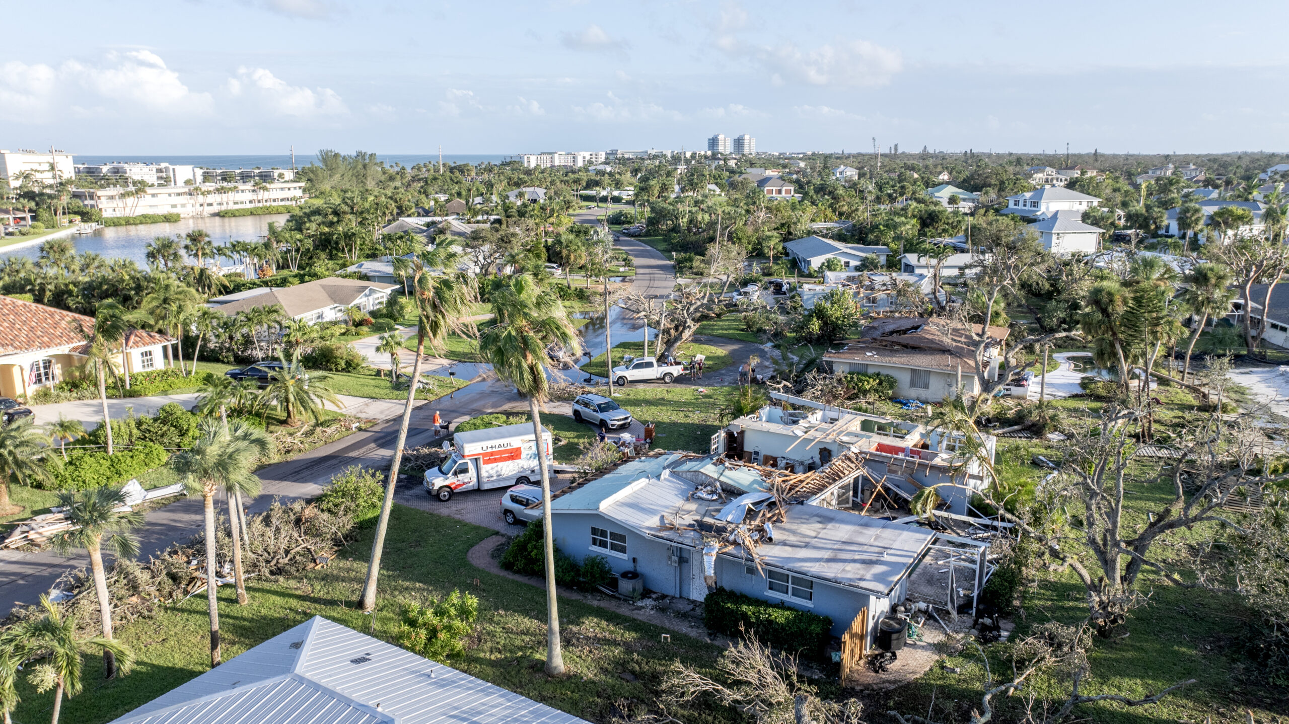
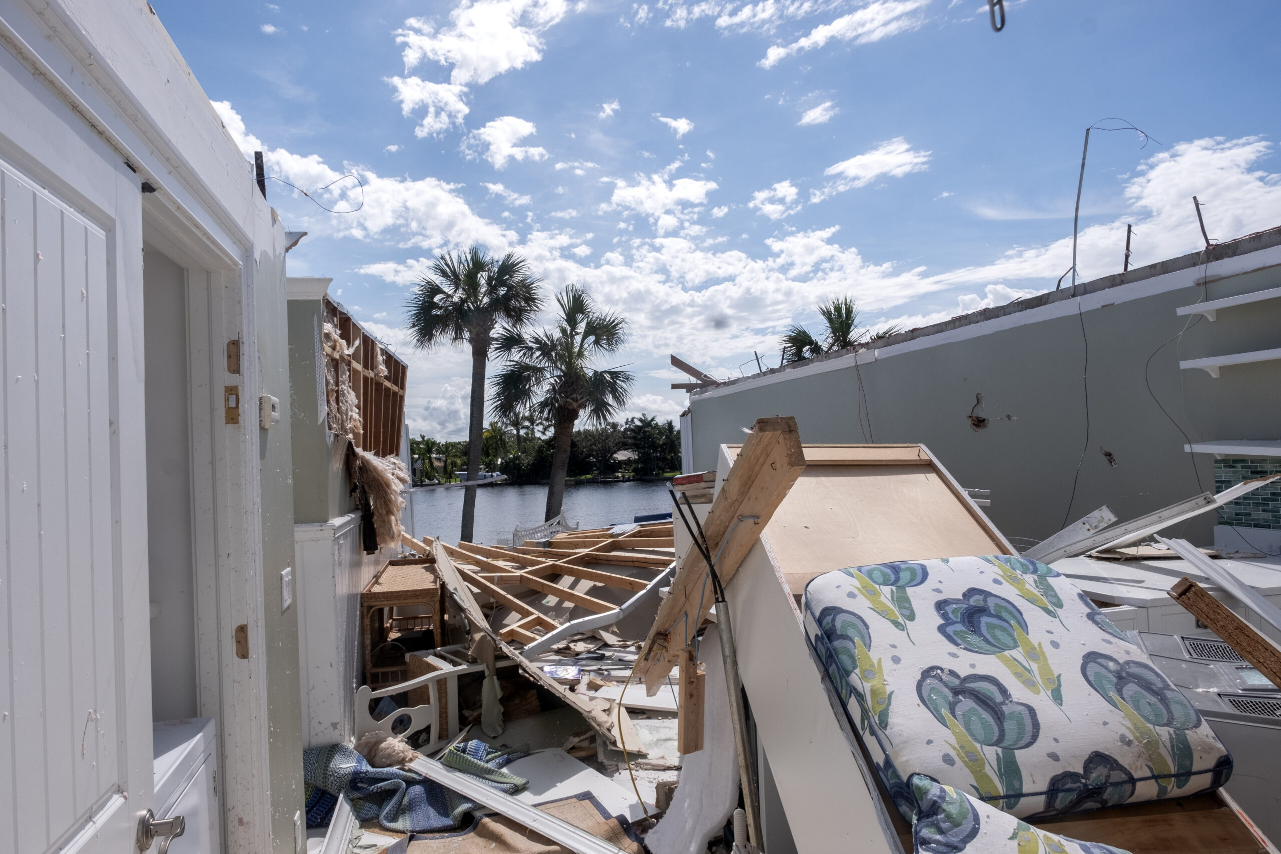
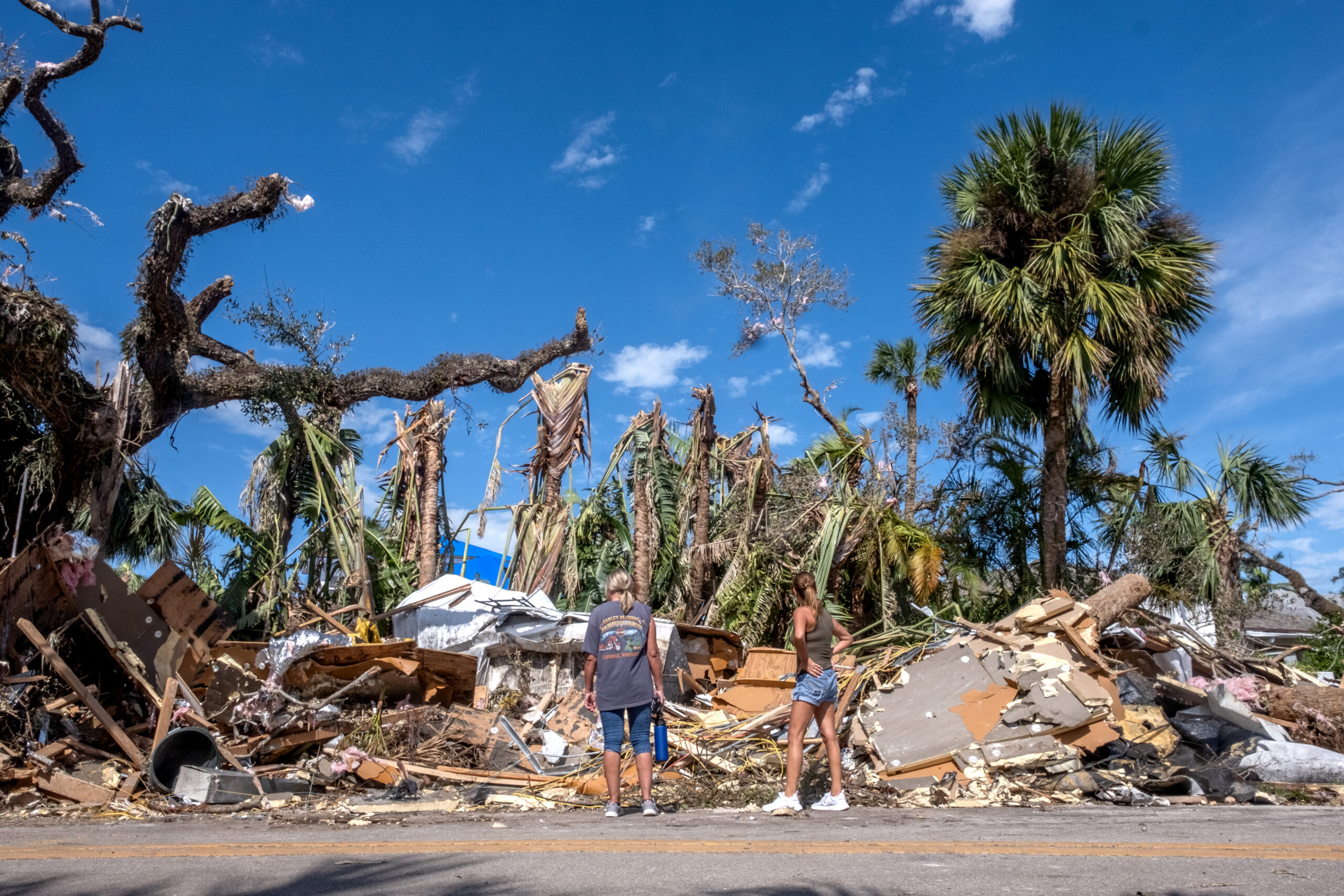
Not to diminish the substantial damage done elsewhere in the Central Beach community, but the level of destruction in the Bethel Creek/Cache Cay area, which resembled a war zone, is jarring.
Vero Beach Mayor John Cotugno, whose Fiddlewood Road home sustained relatively minor damage, said Monday the images he had seen from that neighborhood made him “want to cry.”
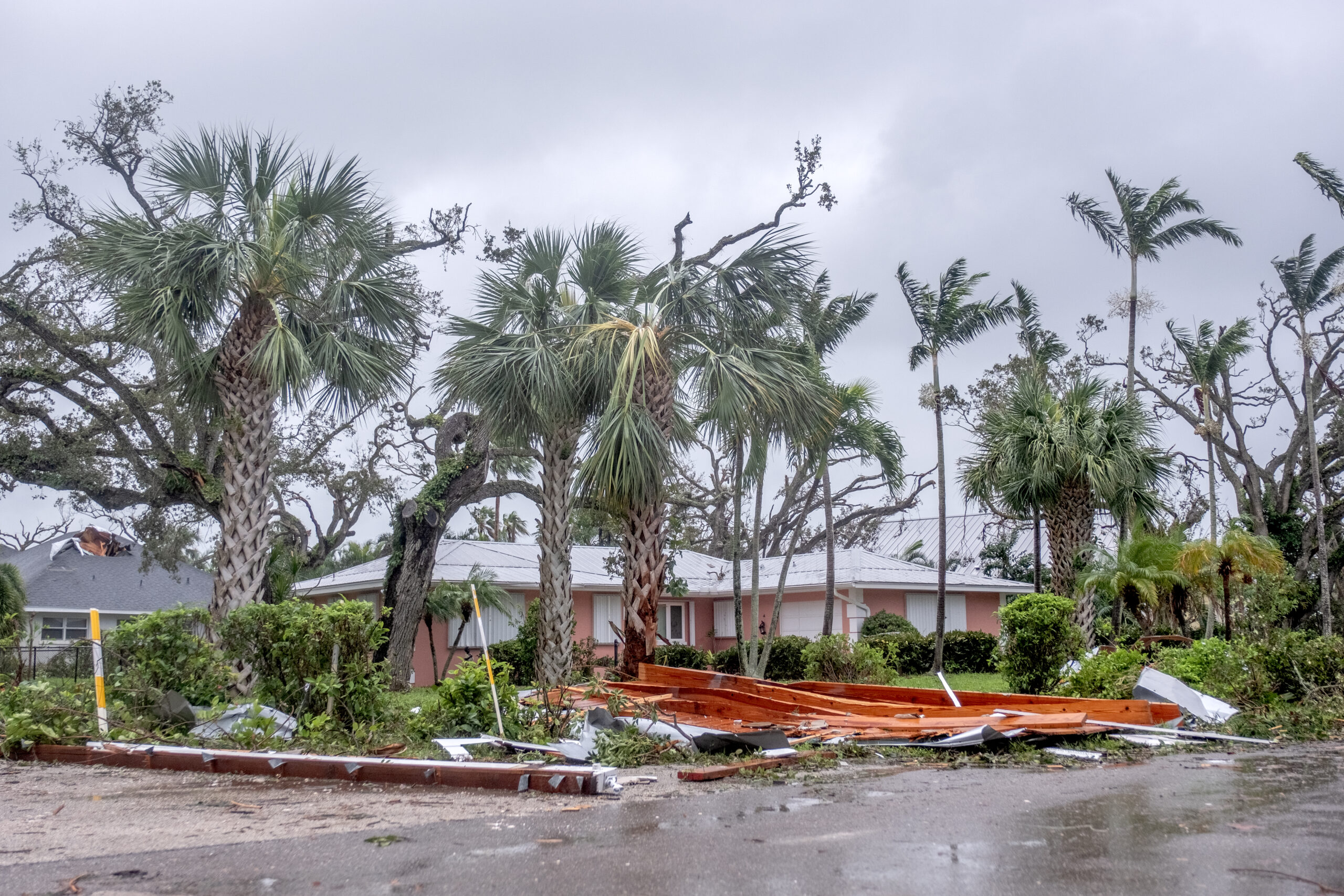
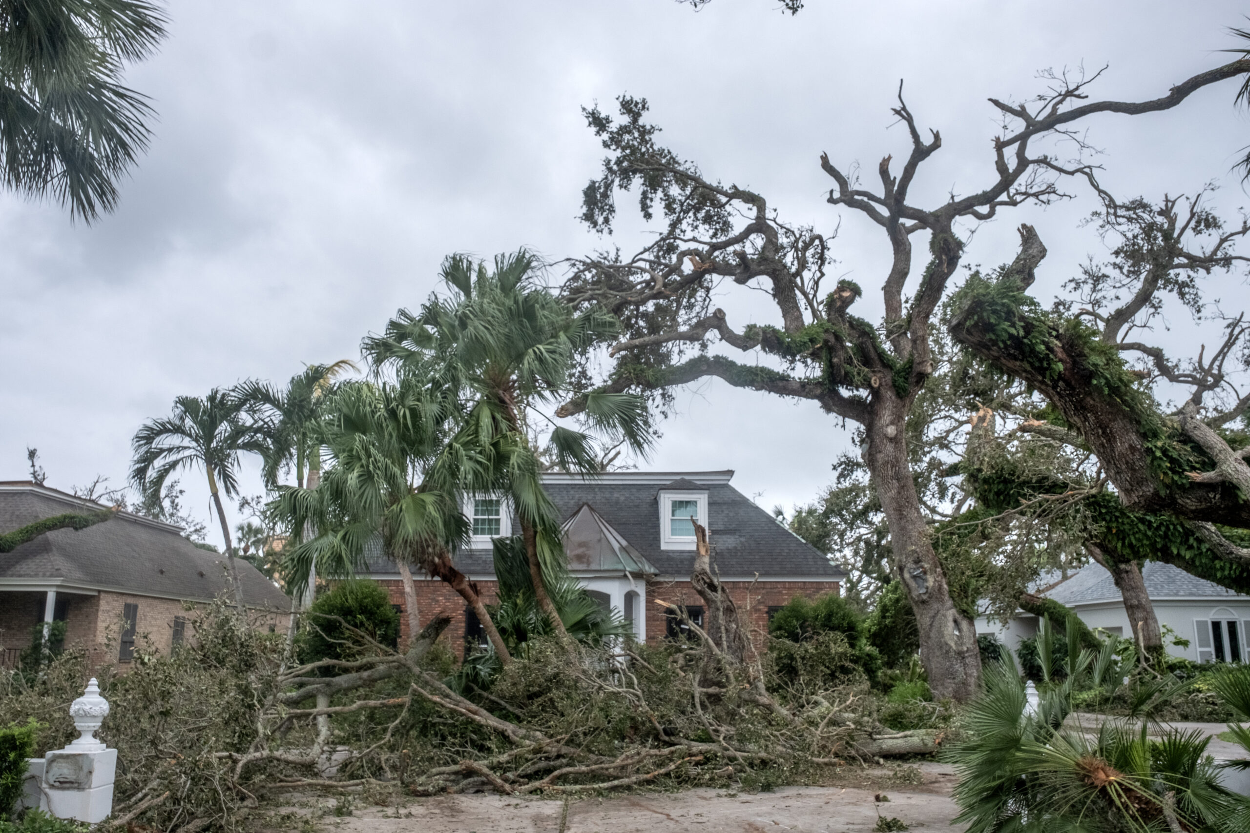
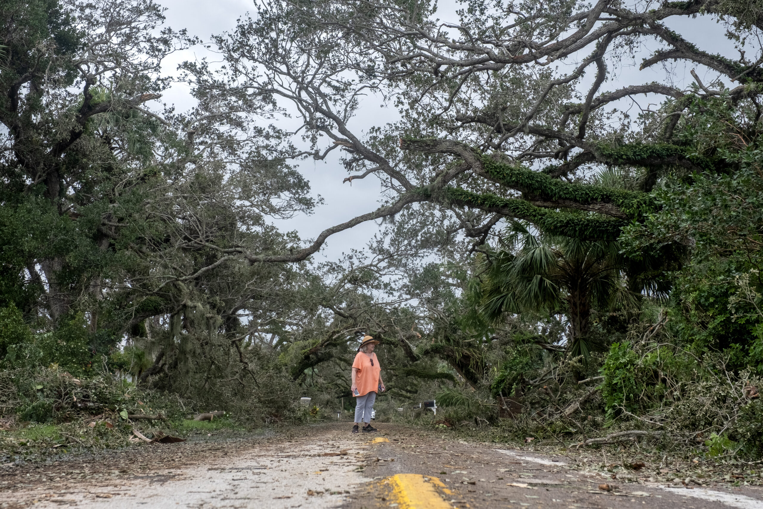
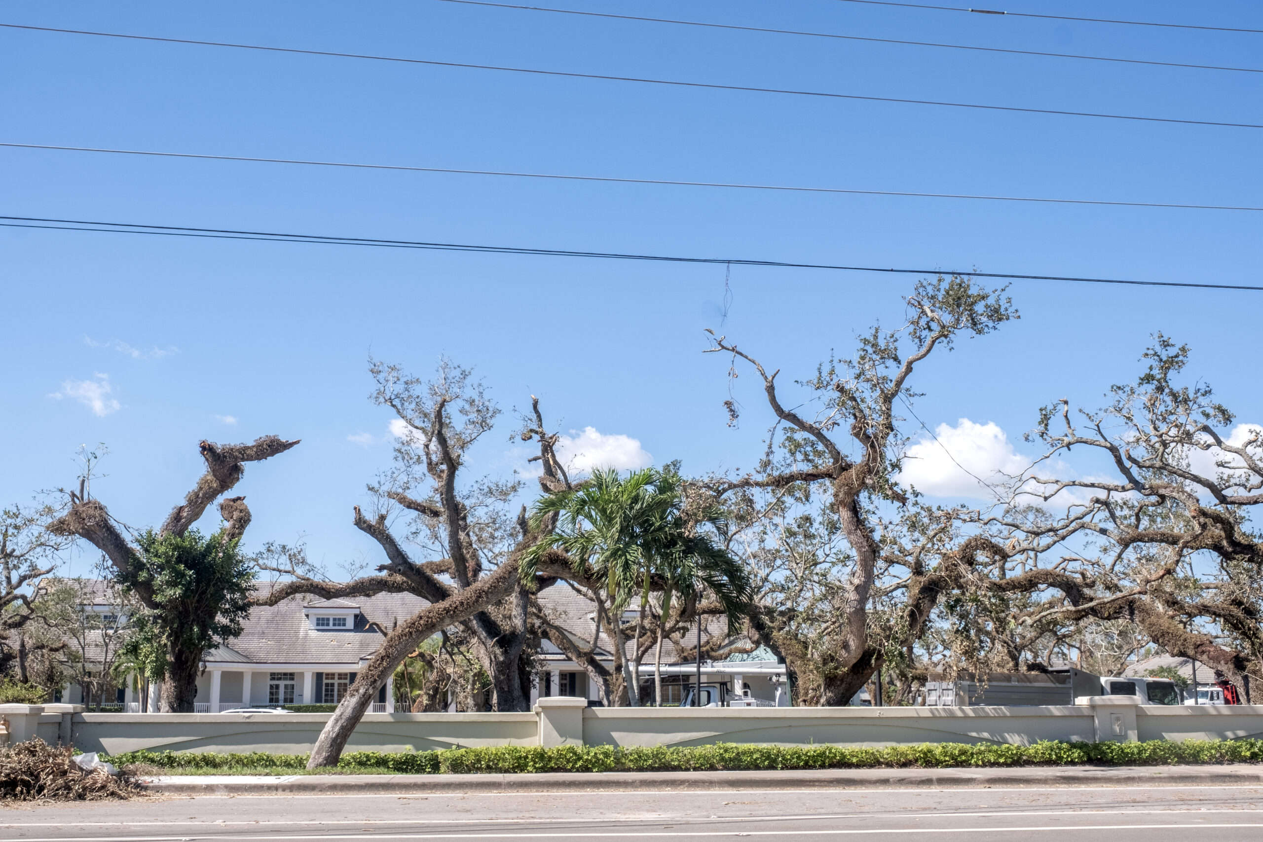
They were also frustrating – because so much of the damage to Central Beach homes and neighborhoods, as well as to the scenic canopy of oak trees that add to the community’s charm, wasn’t inflicted by Hurricane Milton.
Not by the usual culprits, anyway.
Most of the hurricane damage done here in the past had been caused by catastrophic winds, torrential rains and storm surge. Twenty years ago, Category 2 Hurricane Frances and Category 3 Hurricane Jeanne tag-teamed Florida’s Treasure Coast, leaving behind lengthy power outages, areas of flooding and a sea of roofless homes covered with blue tarps.
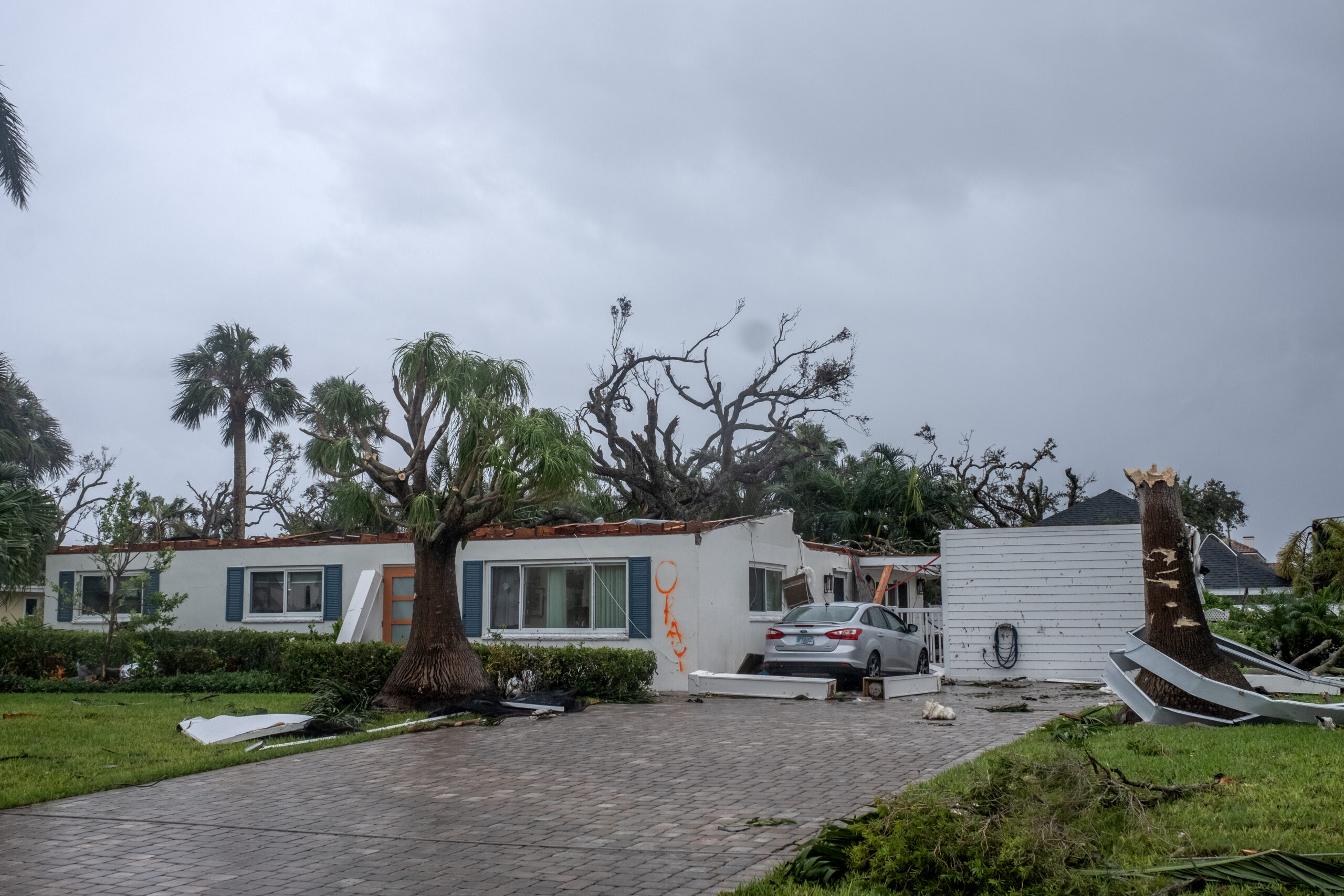
“I’ve lived in Vero Beach for over 30 years, and the damage done by the worst hurricanes we’ve had didn’t compare to the devastation I’ve seen from these tornadoes,” said Alain Mignolet, whose Live Oak Road home was hit hard by the twister, which tore up a new roof he had installed in June.
“I’ve never seen anything like it.”
By the time the hurricane itself brushed past Vero Beach, however, it had been reduced to a mostly toothless tropical storm, significantly weakened by its trek across the heart of the Florida peninsula. It was a shell of the Category 3 hurricane that came ashore in Siesta Key.
It was, for the most part, a non-event here.
“If we didn’t have the tornadoes,” Vero Beach City Manager Monte Falls said late Friday afternoon, “everything would’ve been back to normal by today.”
But we did have tornadoes.
The weather service confirmed that two of them touched down on the mainland, including an area near the city’s downtown, but, as of Monday morning, the agency hadn’t yet determined their strength.
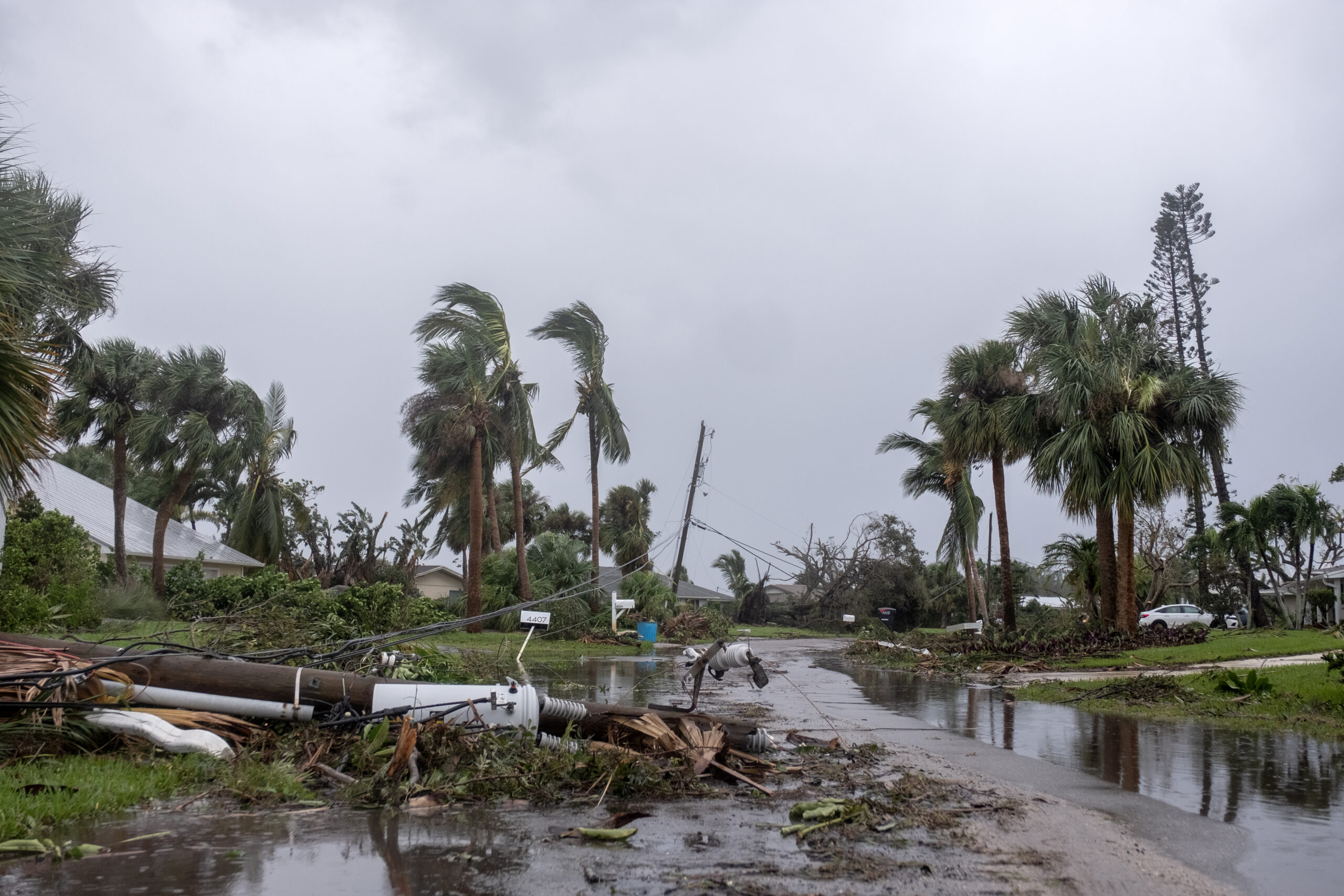
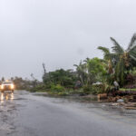
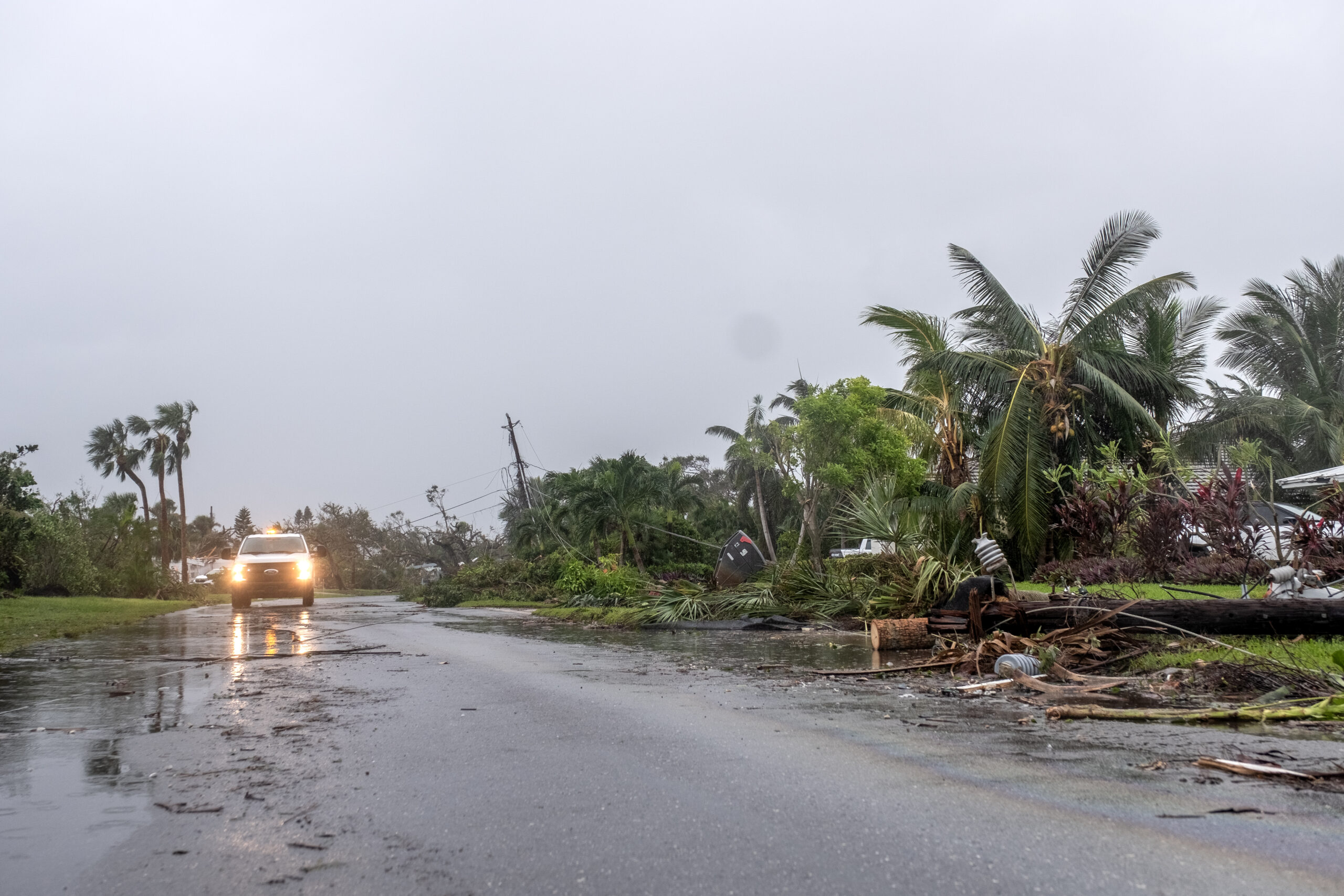
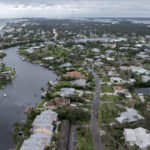
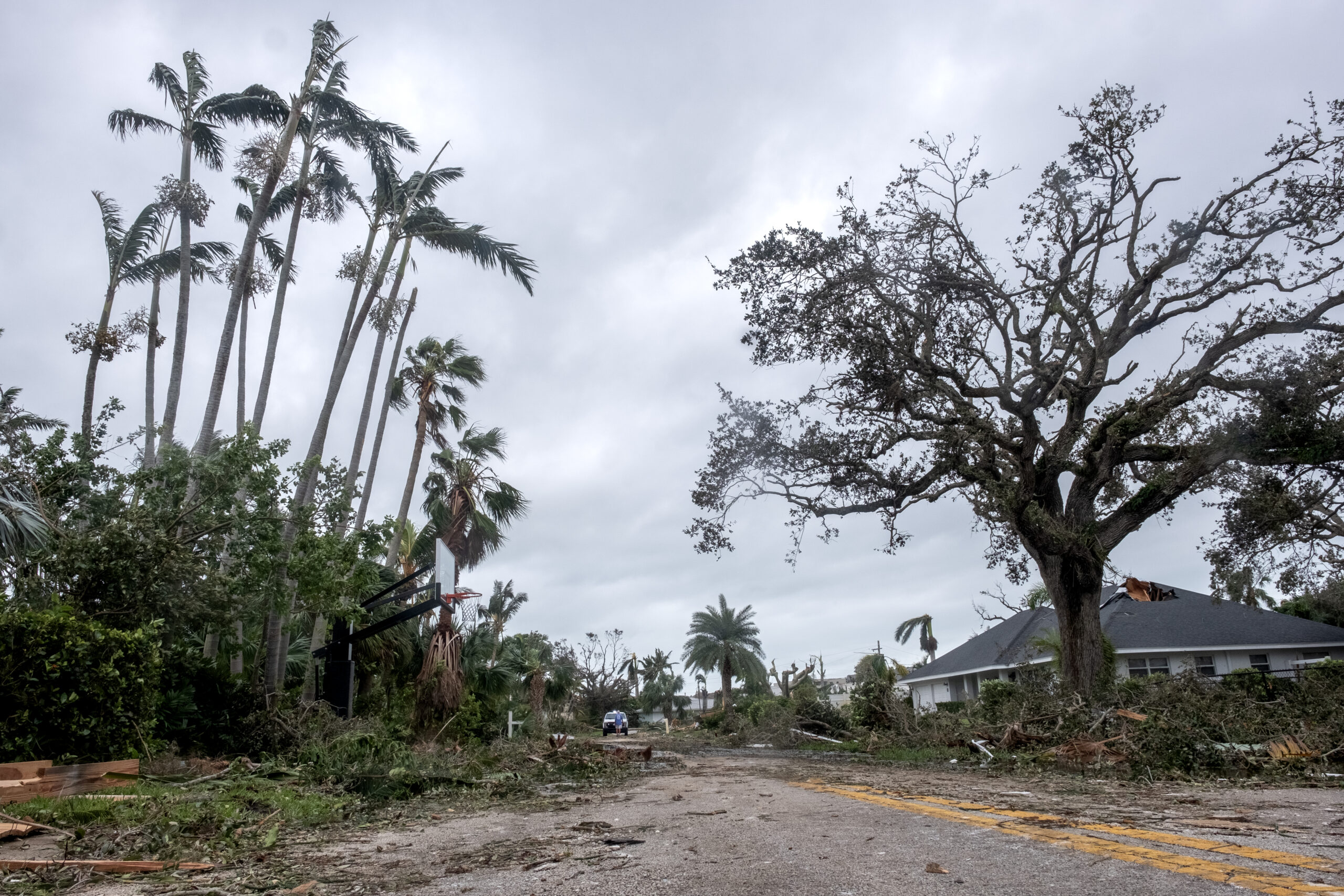
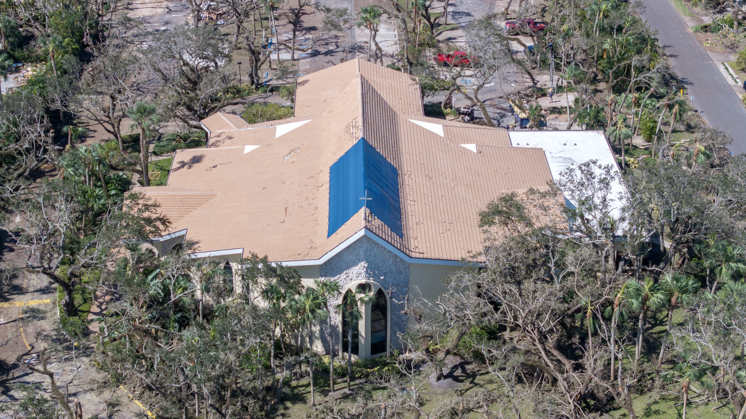
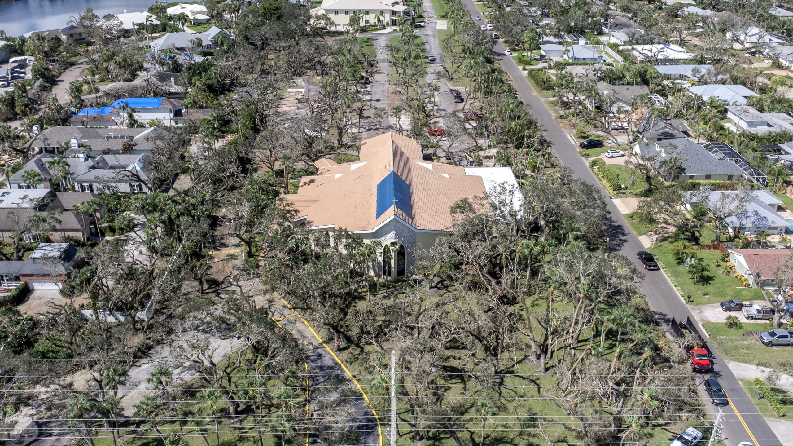
The tornado that tore through the Central Beach community last Wednesday afternoon (Oct. 9) first touched ground in St. Lucie County, west of I-95 and south of Midway Road, and traveled north and northeast more than 20 miles – through the Spanish Lakes community, into our county, across the Indian River Lagoon and onto the barrier island.
The seemingly relentless tornado then began its island assault, coming ashore on River Drive in Riomar, moving north past Quail Valley to trash the neighborhoods between Riverside Park and A1A, crossing Beachland where it stripped the block of many of its trees, and continuing northward through the Bethel Creek/Cache Cay neighborhood. It passed Pelican Plaza and the Village Beach Market, crossed A1A and exited the island just south of Indian River Shores, toppling and snapping trees as it tore through a wooded area on its way to the sea.
In its wake, the Quail Valley River Club sustained enough damage that management sent an email asking members to “refrain from visiting” the property until this past Monday, and sections of the roofs at the adjacent Bayou Condominiums were torn off and thrown into a nearby tree line.
The tornado’s entire, two-county journey took just over 30 minutes to complete, beginning at 4:59 p.m. and ending at 5:31 p.m.
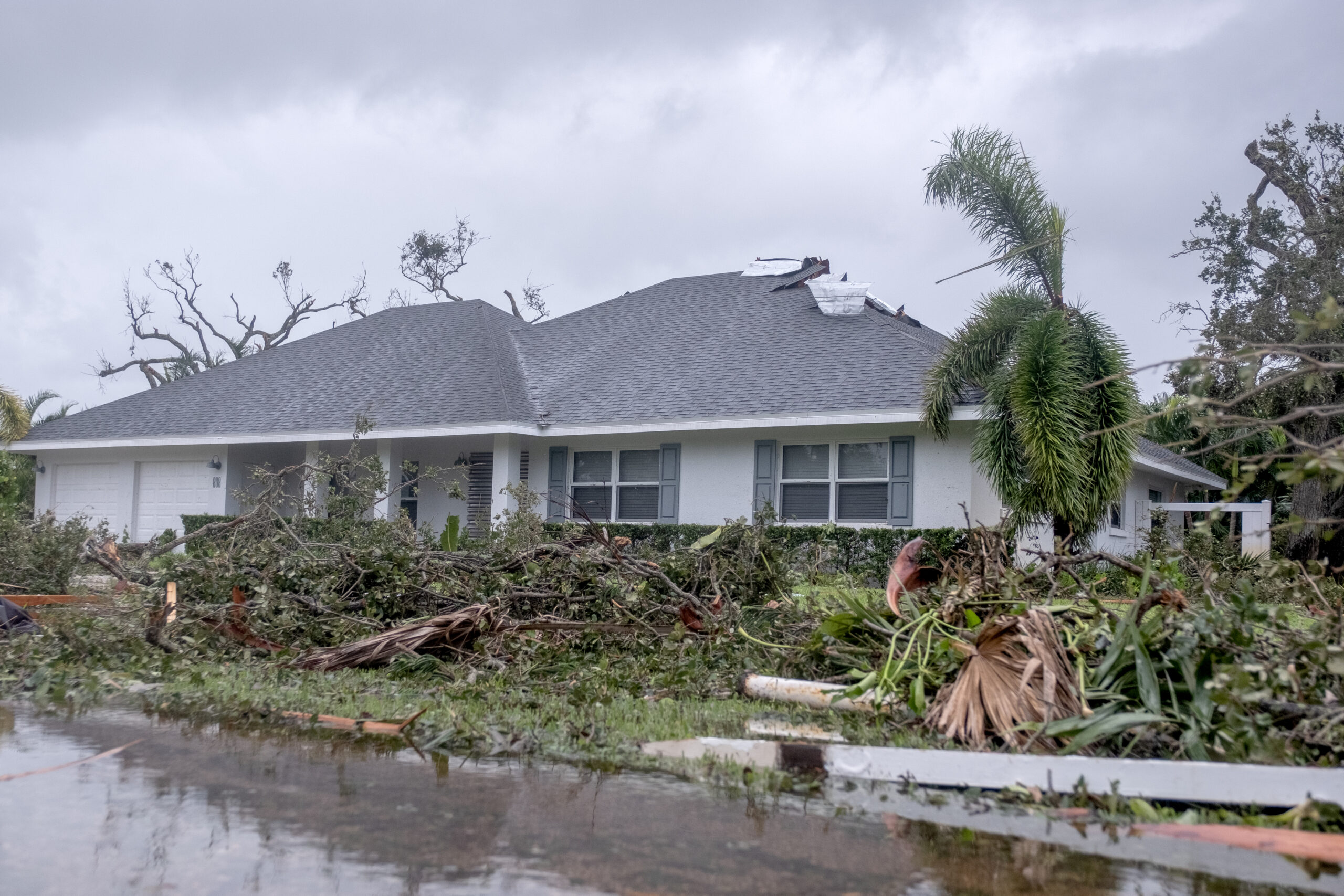
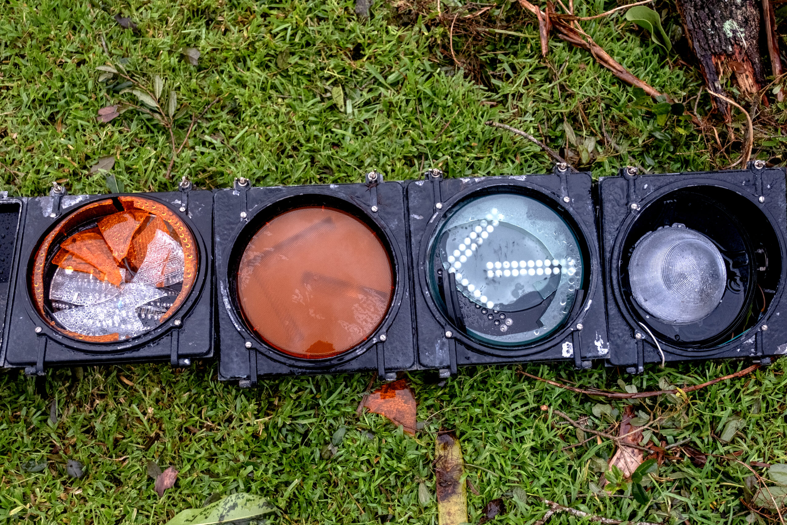
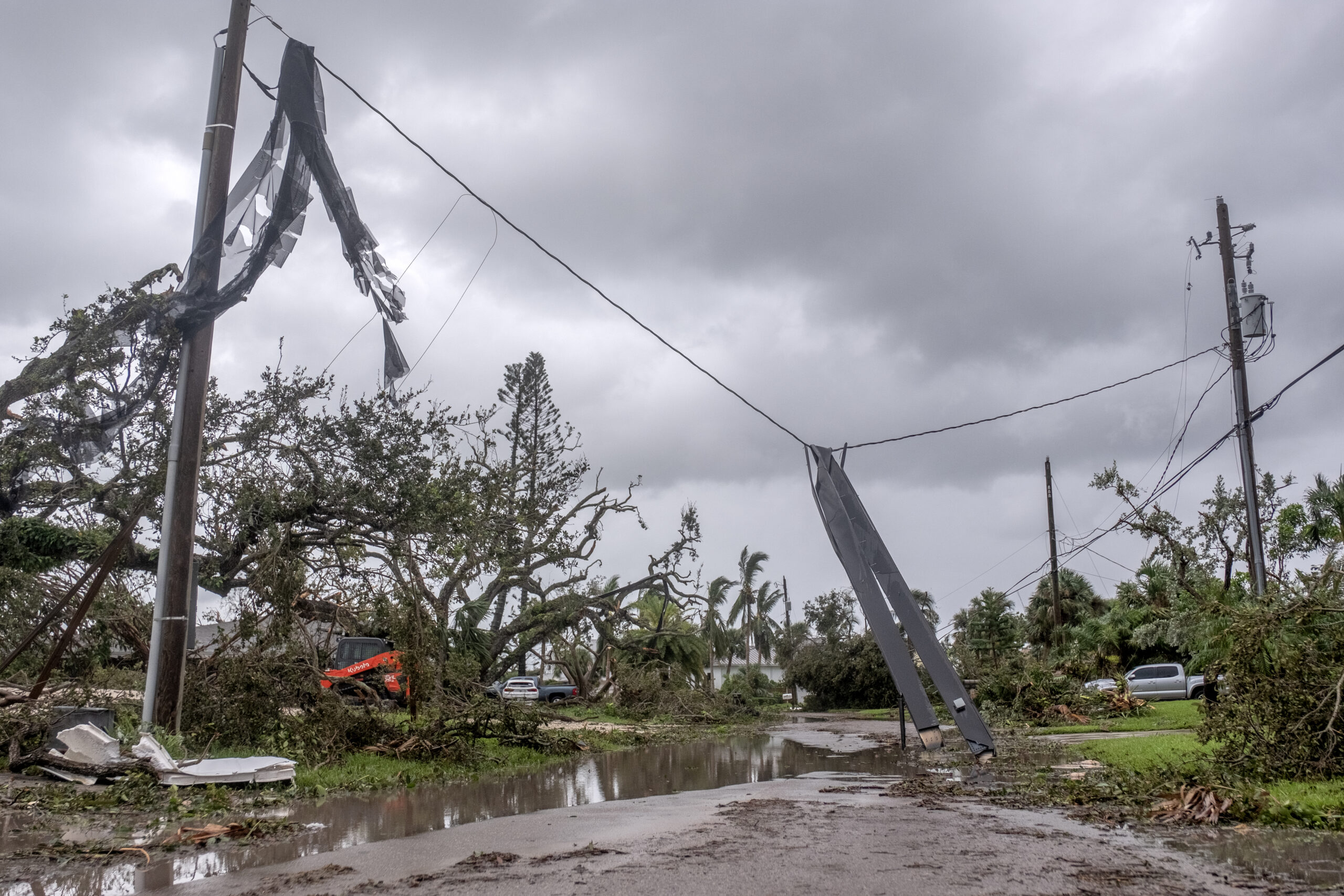
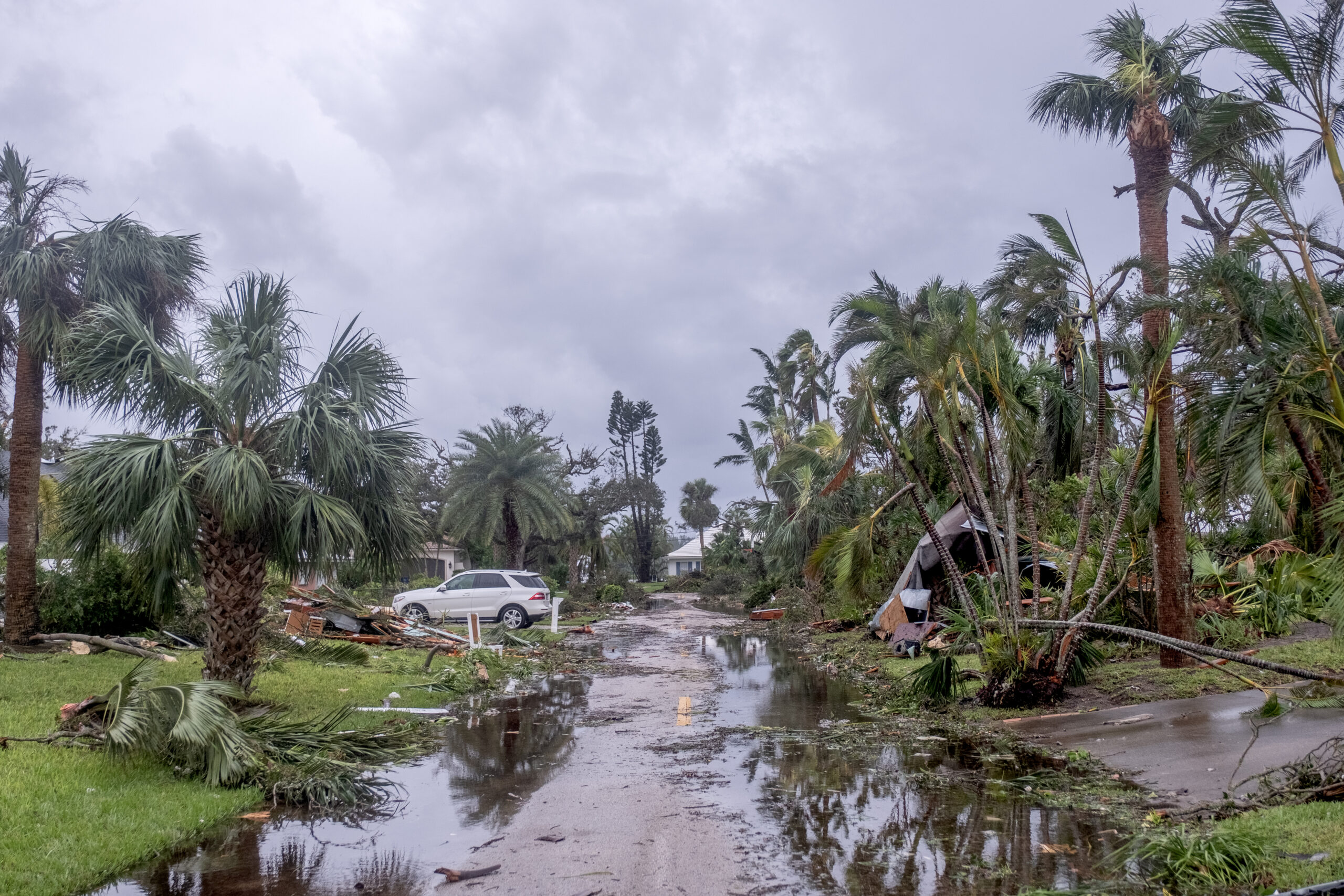
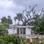
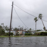
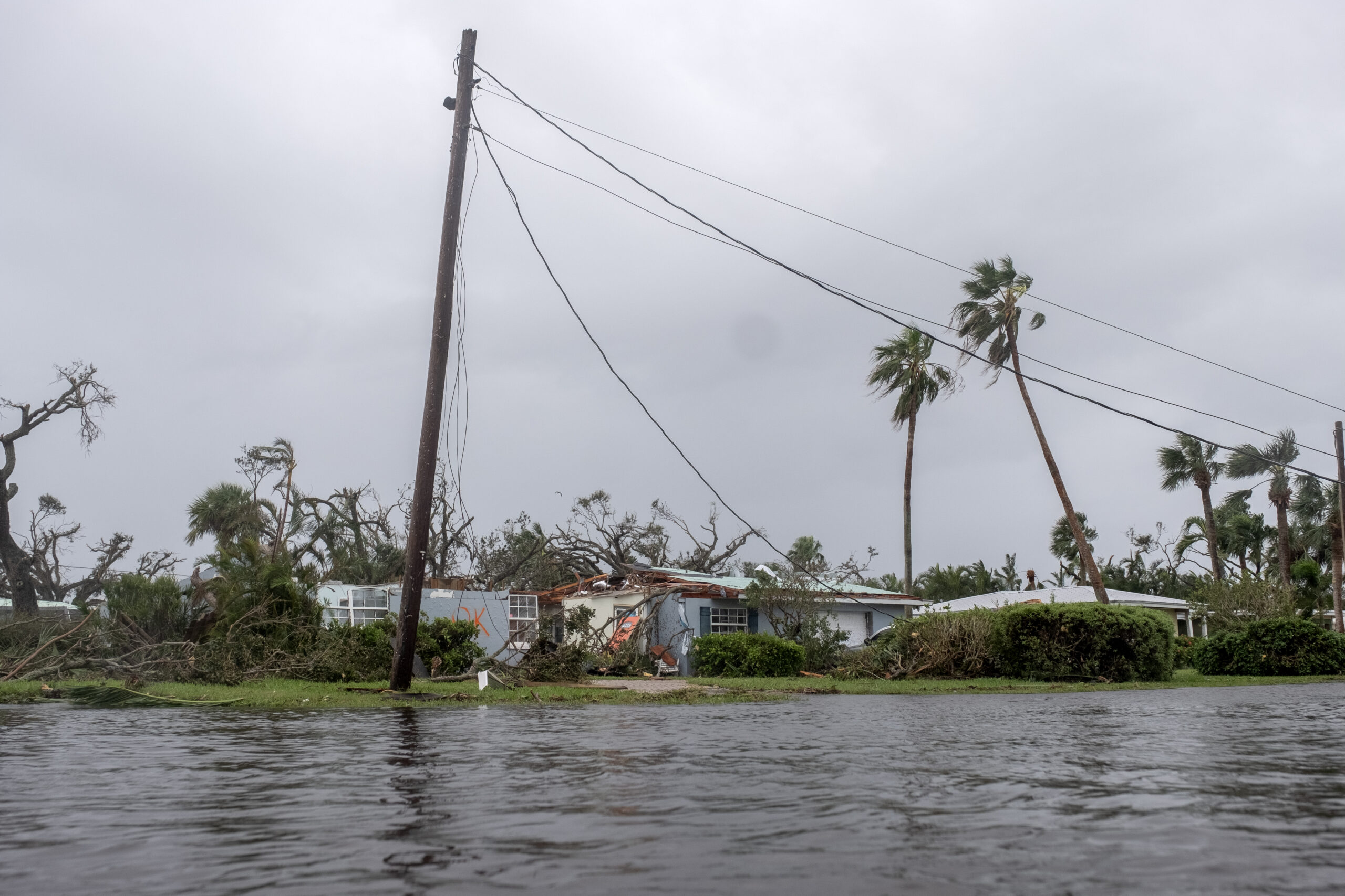
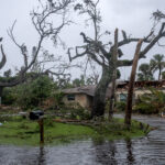
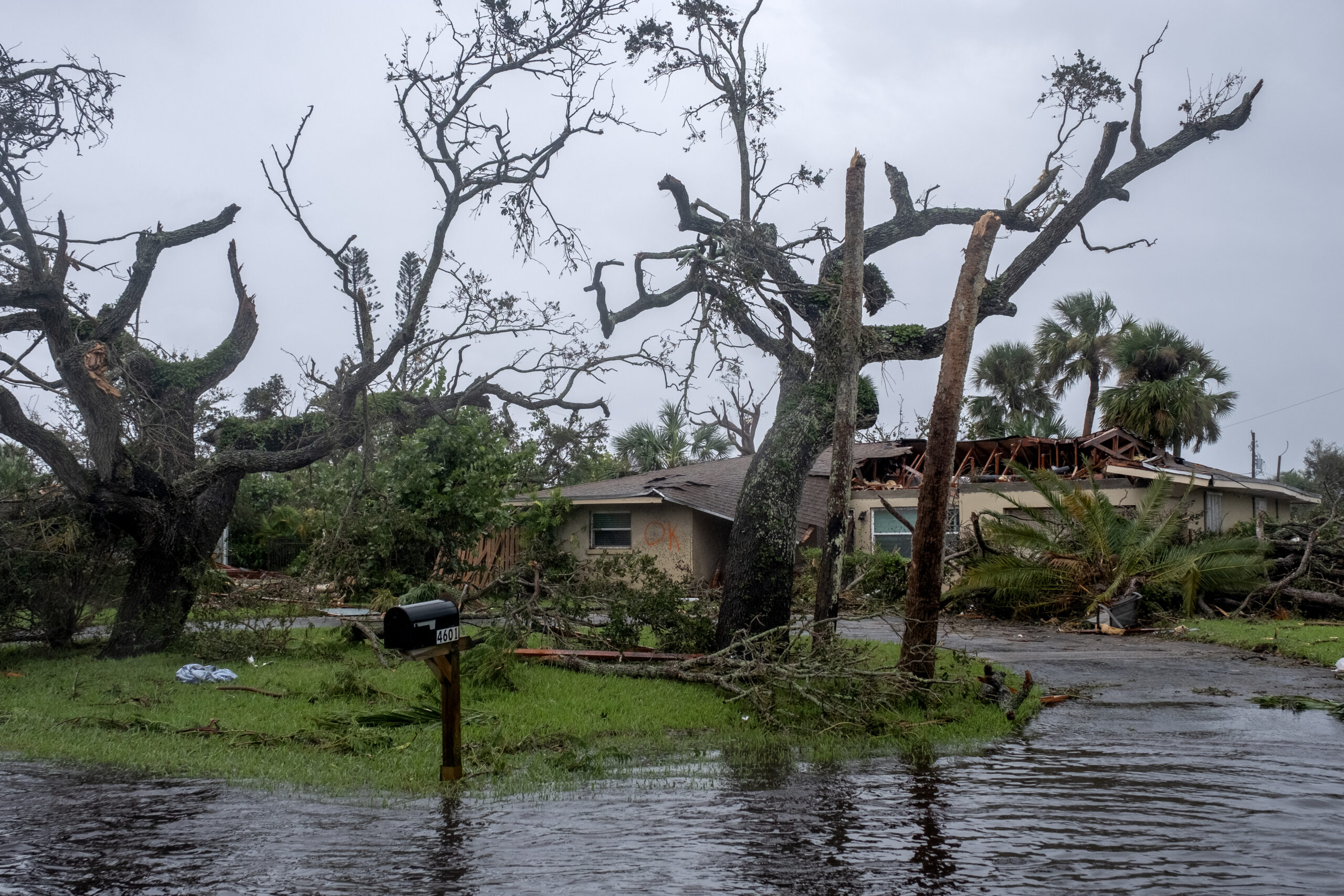
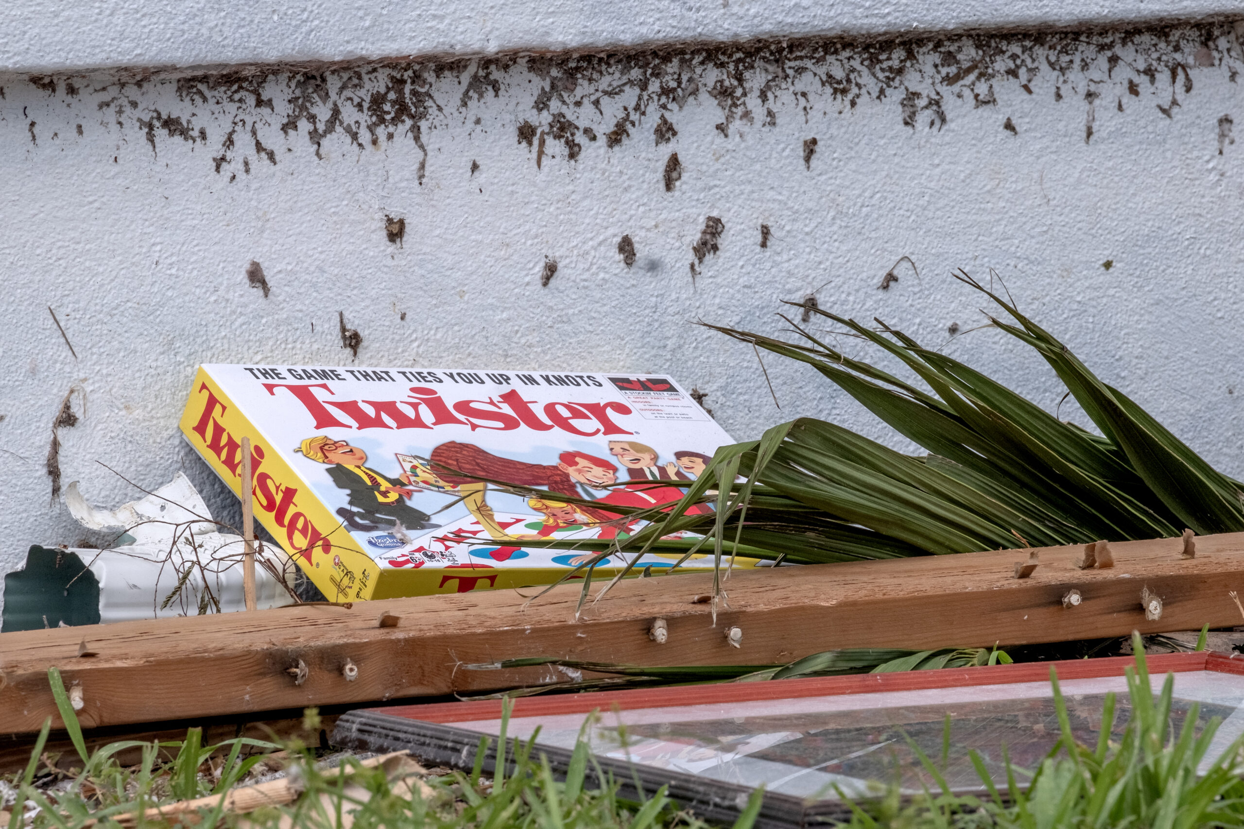
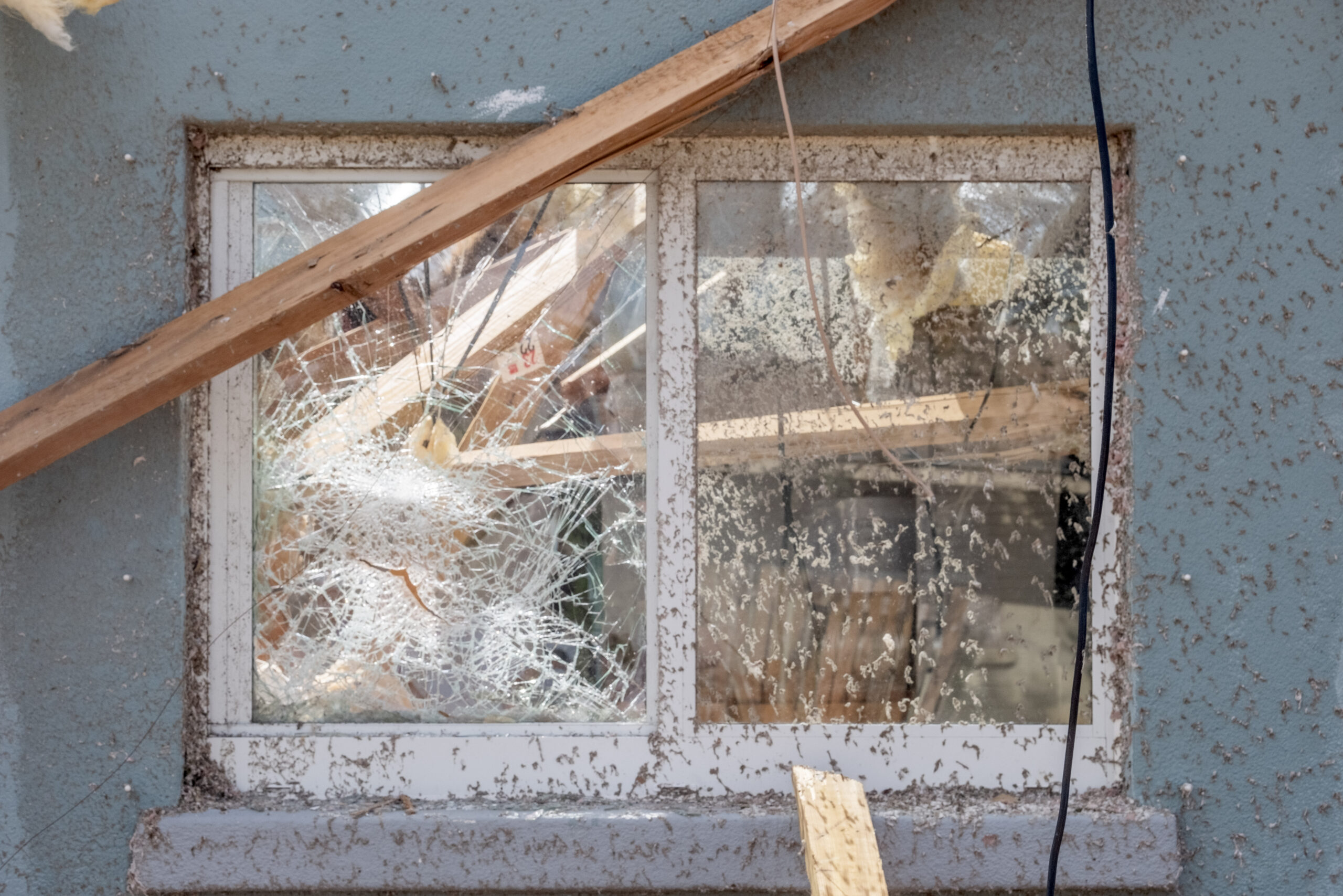
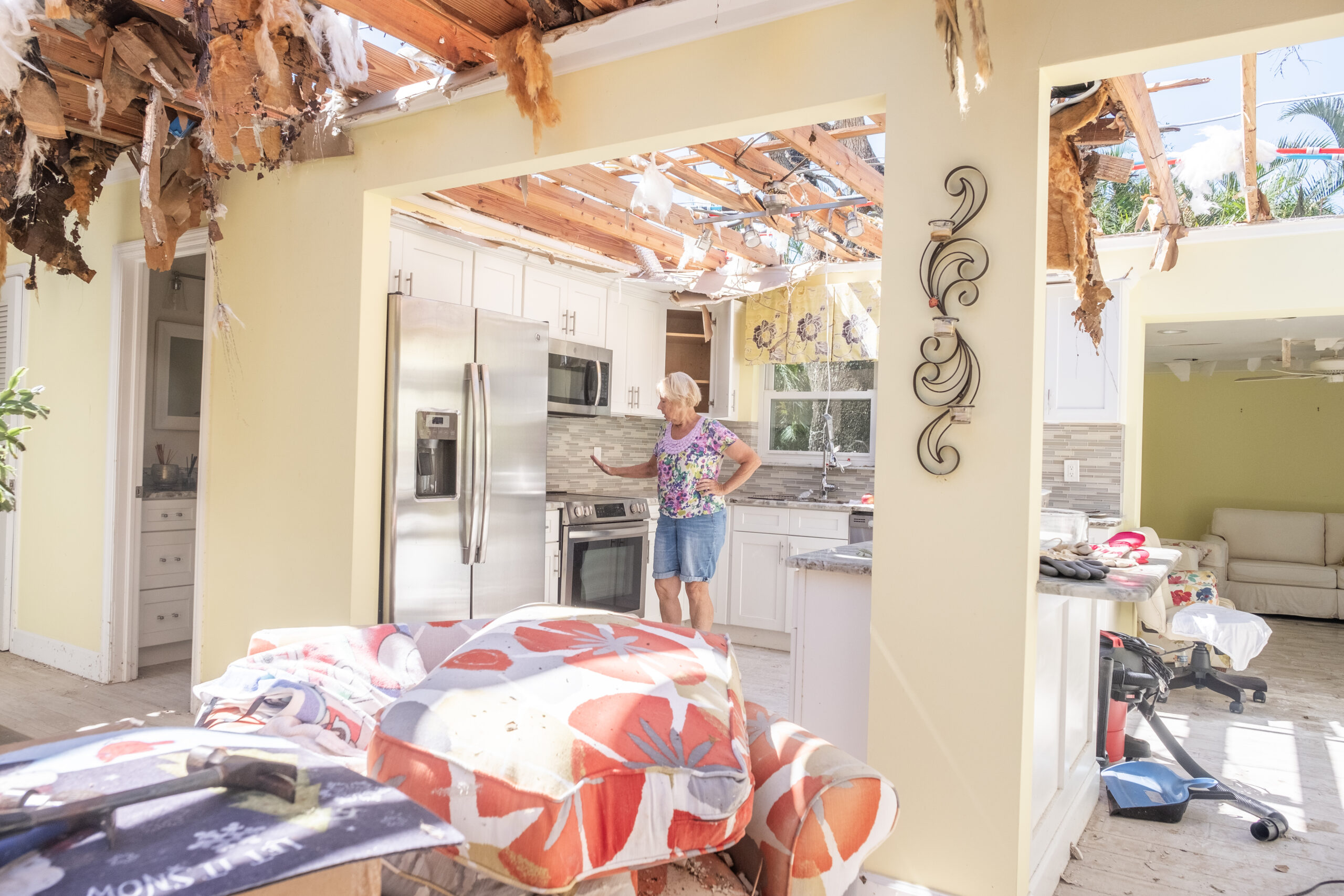
The carnage left behind in the Central Beach area included: torn-off roofs, segments of which landed in roadways and neighbors’ yards; shattered windows; damaged vehicles; uprooted trees, signs and light poles; downed power lines; and blocked streets.
It’s a miracle, really, that no deaths or serious injuries were reported to local authorities.
A weather service report described the whirling invader as an “unusually strong, long-tracked tornado” with widespread EF1 to EF2 damage levels, though there were periods where it increased to EF3.
Those designations refer to the Enhanced Fujita Scale meteorologists use to assign tornadoes a rating based on estimated wind speeds and related damage. The scale’s designated speeds in miles-per-hour are: EF0 (65 to 85); EF1 (86 to 110); EF2 (111 to 135); EF 3 (136 to 165); EF4 (166 to 200); and EF5 (over 200).
Heil, who was part of the weather service team that surveyed the damage along the Treasure Coast last weekend, said the tornado that ripped through Central Beach was rated at EF2.
“Generally speaking, the tornadoes we see with hurricanes are usually EF0 or EF1,” Heil said.
“The tornadoes here were noticeably stronger.”
The reason?
Among the circumstances Heil cited were the increasingly warm waters in the Gulf Stream, an expanding upper-level wind field, and the interaction of those winds with the jet stream over South Florida.
Combined, Heil said, those conditions and others created a “very favorable” environment for the formation of tornadoes, which isn’t uncommon during hurricanes, particularly storms as strong as Milton, which at one point reached Category 5 status as it moved across the Gulf of Mexico.
Usually, though, hurricane-generated tornadoes aren’t as large, potent or resilient as those that rolled through our area last week, he added.
Not that we could’ve prepared for them, anyway – despite the alarming string of five tornado-warning alerts issued via cellphone in the Vero Beach area between 2:45 p.m. and 5:42 p.m.
While Florida experiences more tornadoes per square mile than any other state, the impacts are not as severe as those that strike the Midwest and Great Plains, where many homes are equipped with storm cellars.
Few homes in Florida have such facilities, but at least one TV-issued emergency alert seemed to get people’s attention when it advised viewers in the Vero Beach area that they were in a “life-threatening situation” and need to “seek shelter now.”
“For the first time since 1985, I went to a safe room, which was nothing more than a small closet, just big enough for me, my wife and our dog,” Falls said. “I had never even contemplated that before, but there were so many alerts.”
It’s somewhat ironic, if not troubling, that these alerts were being issued – and tornadoes were touching down here – when the eye of the storm was still out in the Gulf of Mexico more than 100 miles away.
Vero Beach’s bridges were still open. The island was not under any mandatory evacuation. The weather folks told us to expect sustained winds of 35-to-50 mph with gusts up to 70 mph, torrential rains and potential power outages.
Yes, there were the obligatory warnings that a tornado could pop up, but they were mostly ignored – because, until last week, hurricane-related tornadoes really hadn’t been anything to worry about here.
And for good reason: No one here, including longtime Vero residents, could recall witnessing anything even remotely similar to the torrent of tornadoes unleashed by Milton’s outer band, which also dumped more than seven inches of rain between 2:30 p.m. and 5 p.m.
We went with what we knew, did what we always do when hurricanes or tropical storms are headed our way.
We bought bottled water and other supplies we might need to survive a power outage. We walked around our houses and picked up loose items that could become projectiles in strong winds.
Some of us shuttered our windows.
Then we waited for a nothing-special storm to pass, so we could wake up Thursday morning and go about our business, expecting little damage and perfectly willing to deal with whatever minor inconveniences we might need to confront.
Nobody knew what was coming.
How could we?
But we know now, having learned the hard way that we no longer can shrug off those favorable-for-tornado-development warnings that previously fell on deaf ears.
Does that change our thinking?
Do we respond differently the next time we find ourselves in this situation, confronting the approach of a hurricane bearing a threat level similar to what we were told to expect from Milton, which was supposed to bring us weather that teetered between a tropical storm and Category 1 hurricane?
Or do we treat last week’s nightmare as an anomaly – as a once-in-100-years perfect storm rather than a new normal?
Remember: Heil said the 20-plus, more-damaging-than-usual tornadoes that touched down in Florida prior to Milton making landfall on the Gulf Coast were the result of an extraordinary convergence of conditions.
But, he was quick to add, it’s possible that such conditions, as unusual as they were, could reoccur.
So the question is: Do tornadoes now become part of the evacuate-or-not equation?
It’s unlikely anyone here will soon forget the images of the tornado-caused devastation to the Central Beach area. And when the next hurricane threatens us, you can be sure the TV weather folks will provide a constant reminder of the potential dangers.
But will it make a difference?
Probably not – unless what happened last week happens again.
Photos by Joshua Kodis
-
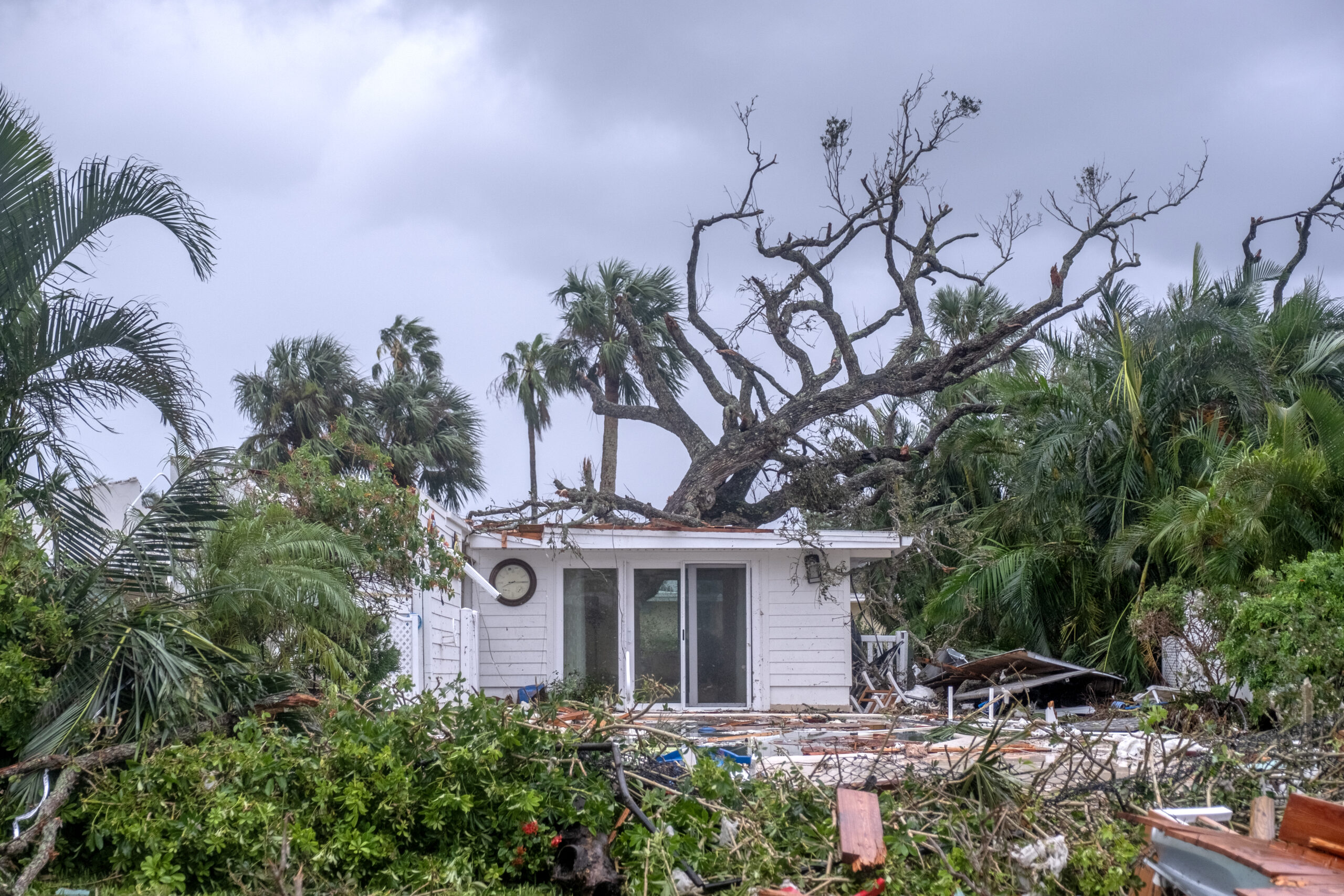
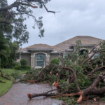
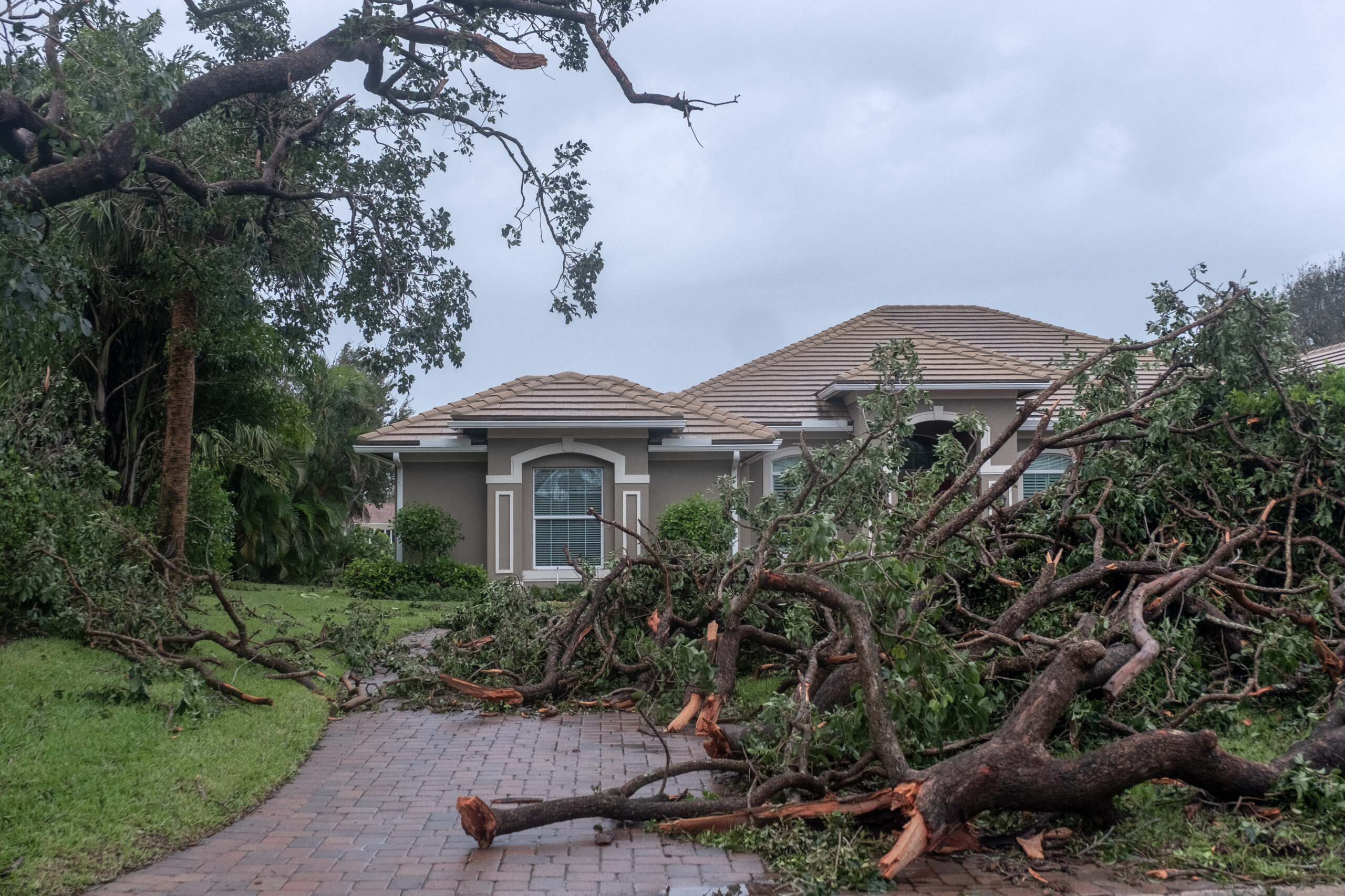
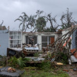
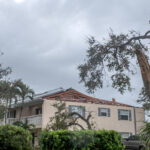
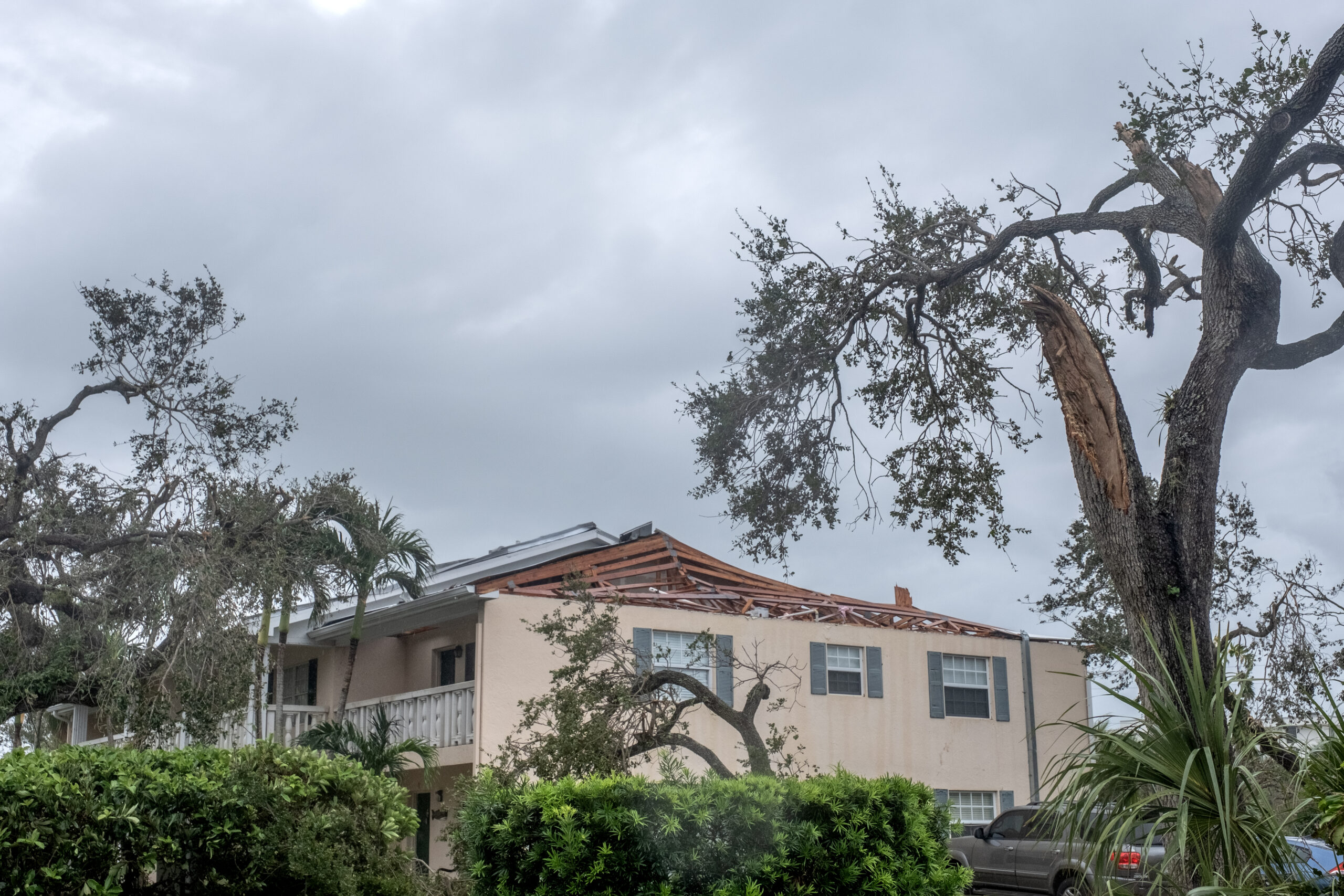
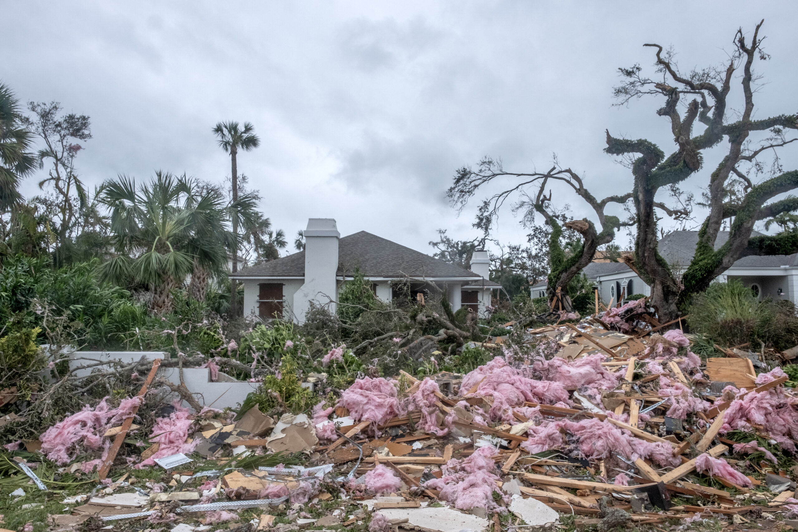
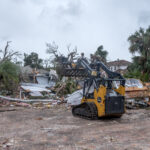
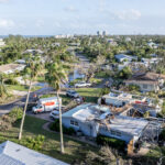
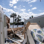
- A damaged home along Bethel Creek Drive.
-
- A damaged home along Bethel Creek area.
-
- The damage looking down Sunset Drive.
-
- A tree is ripped up in the yard of a home in the Bethel Creek area.
-

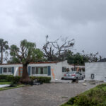
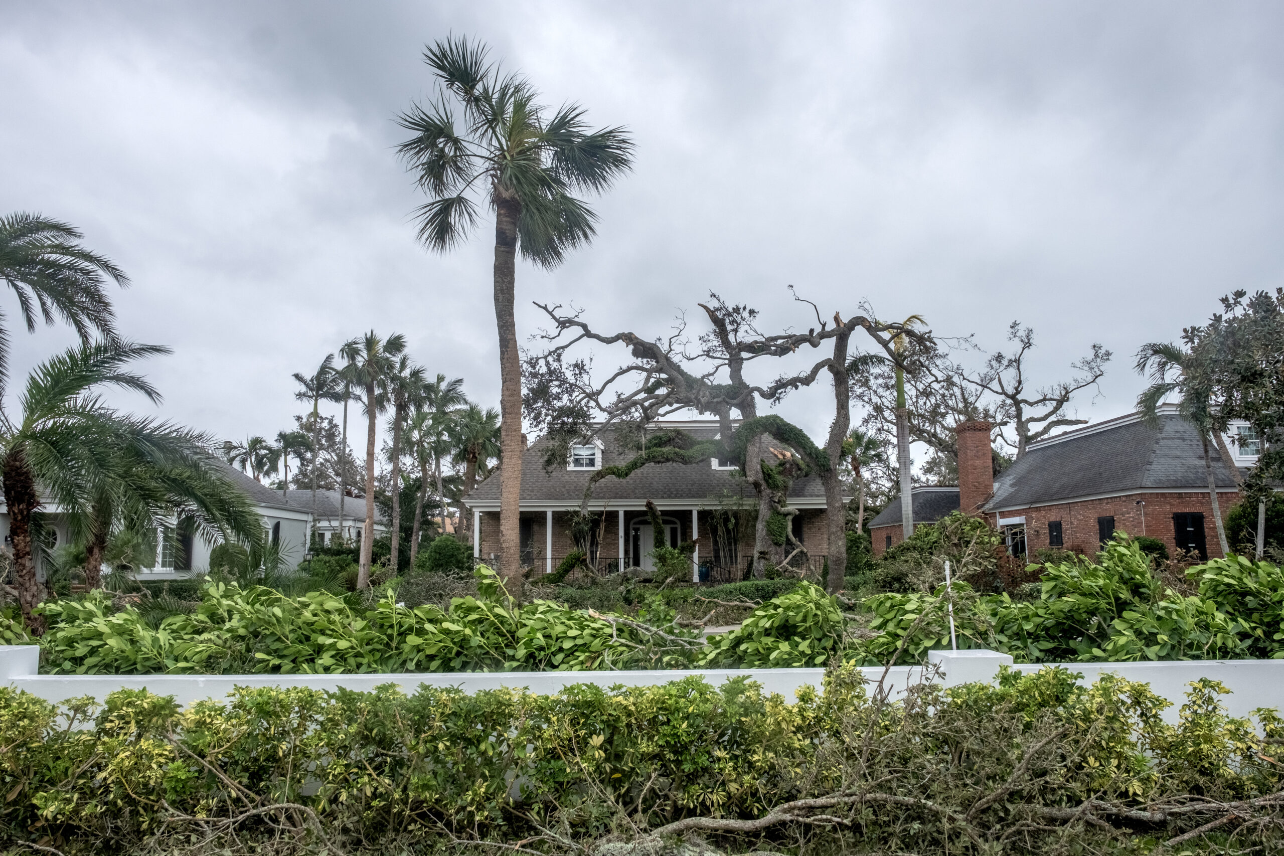
- A home in the Bethel Creek area.
-
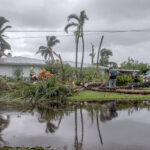
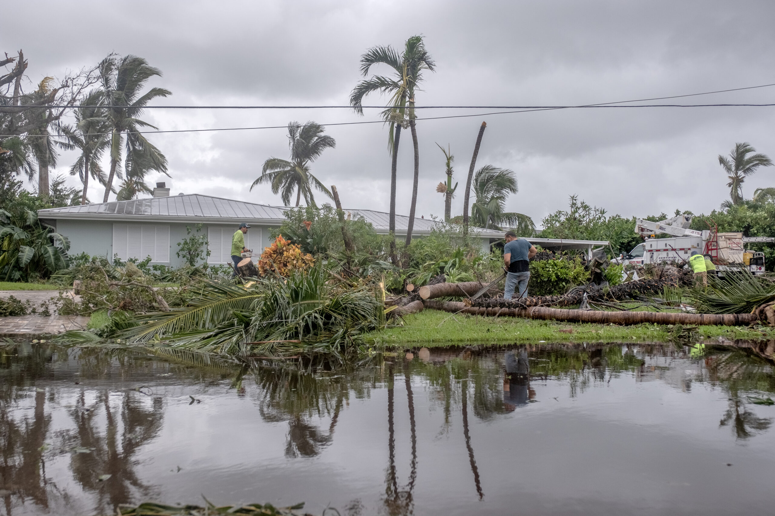
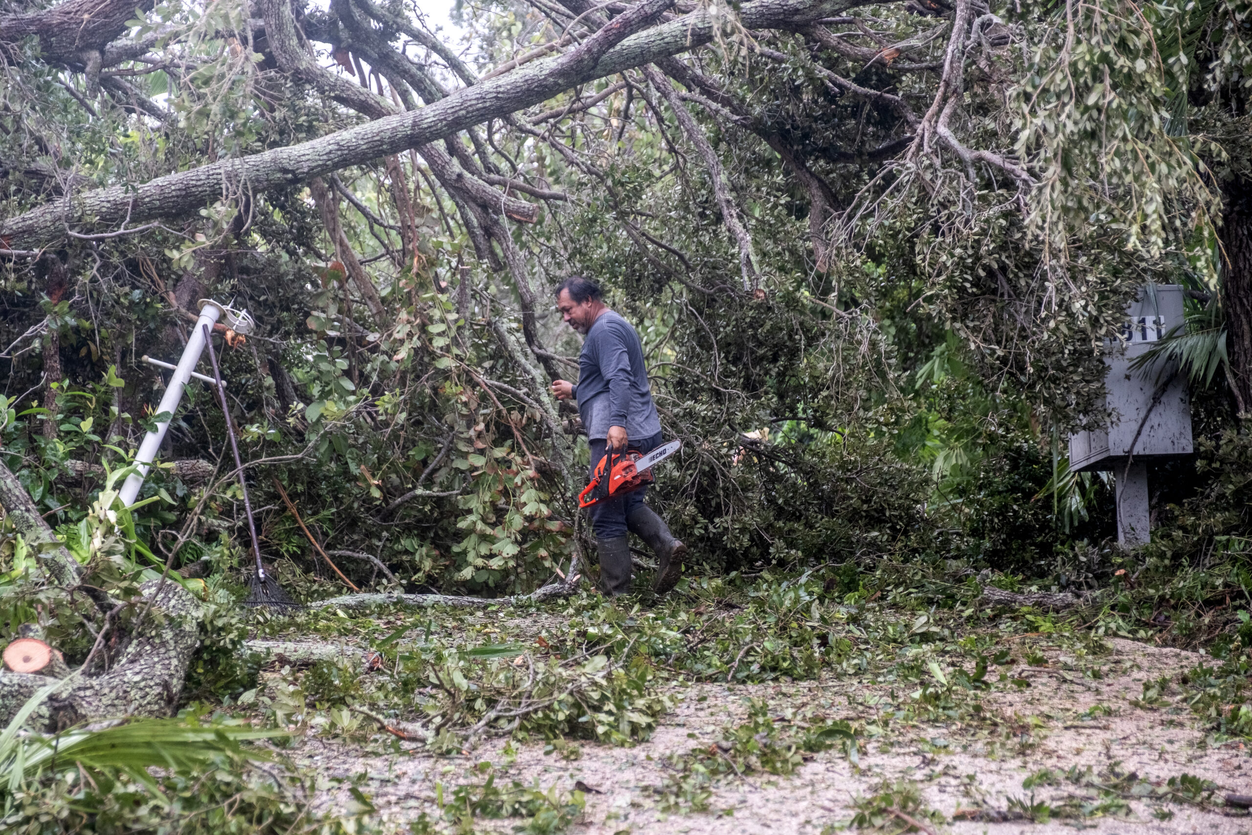
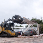
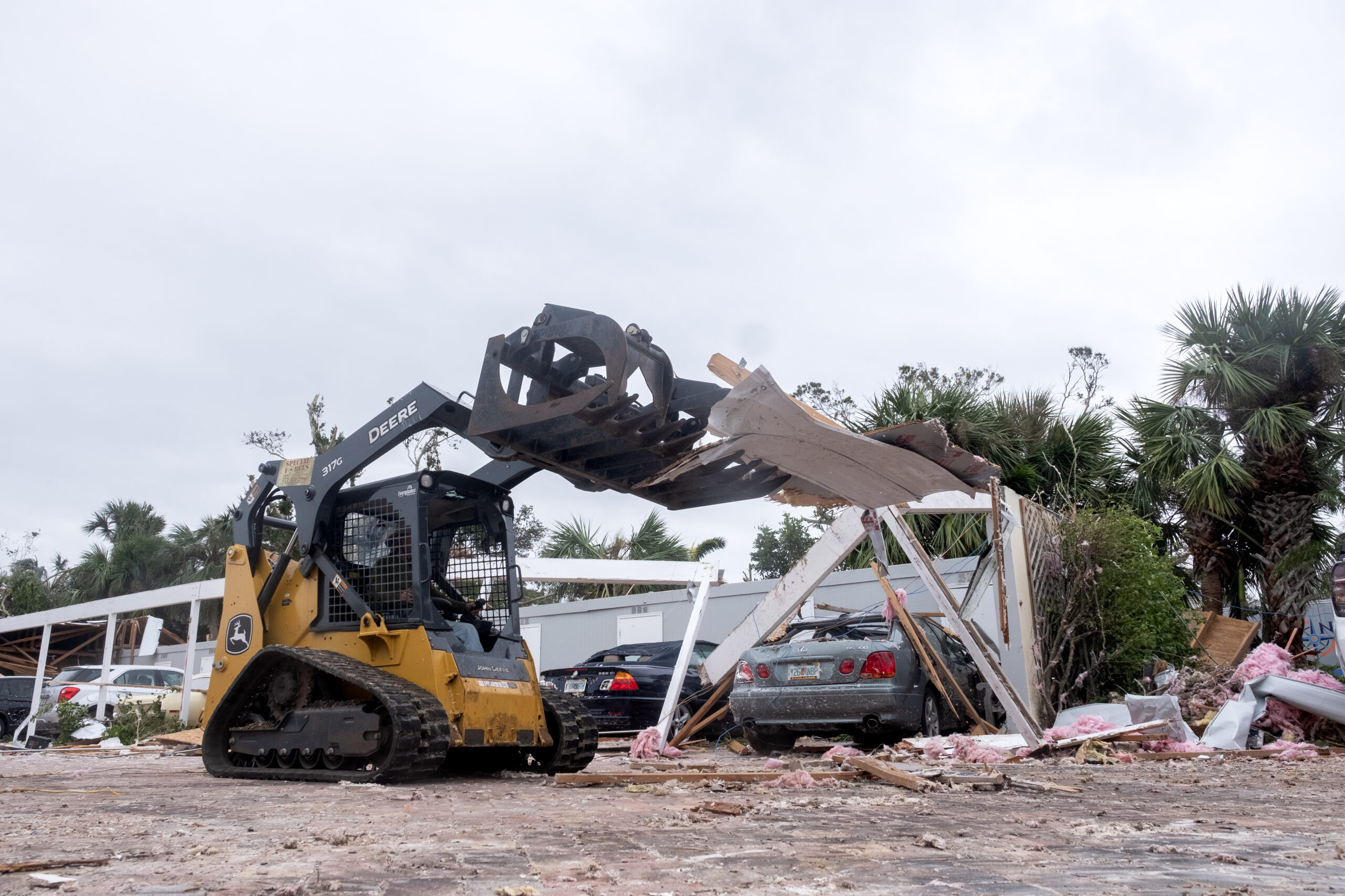
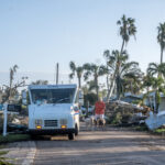
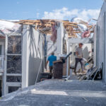
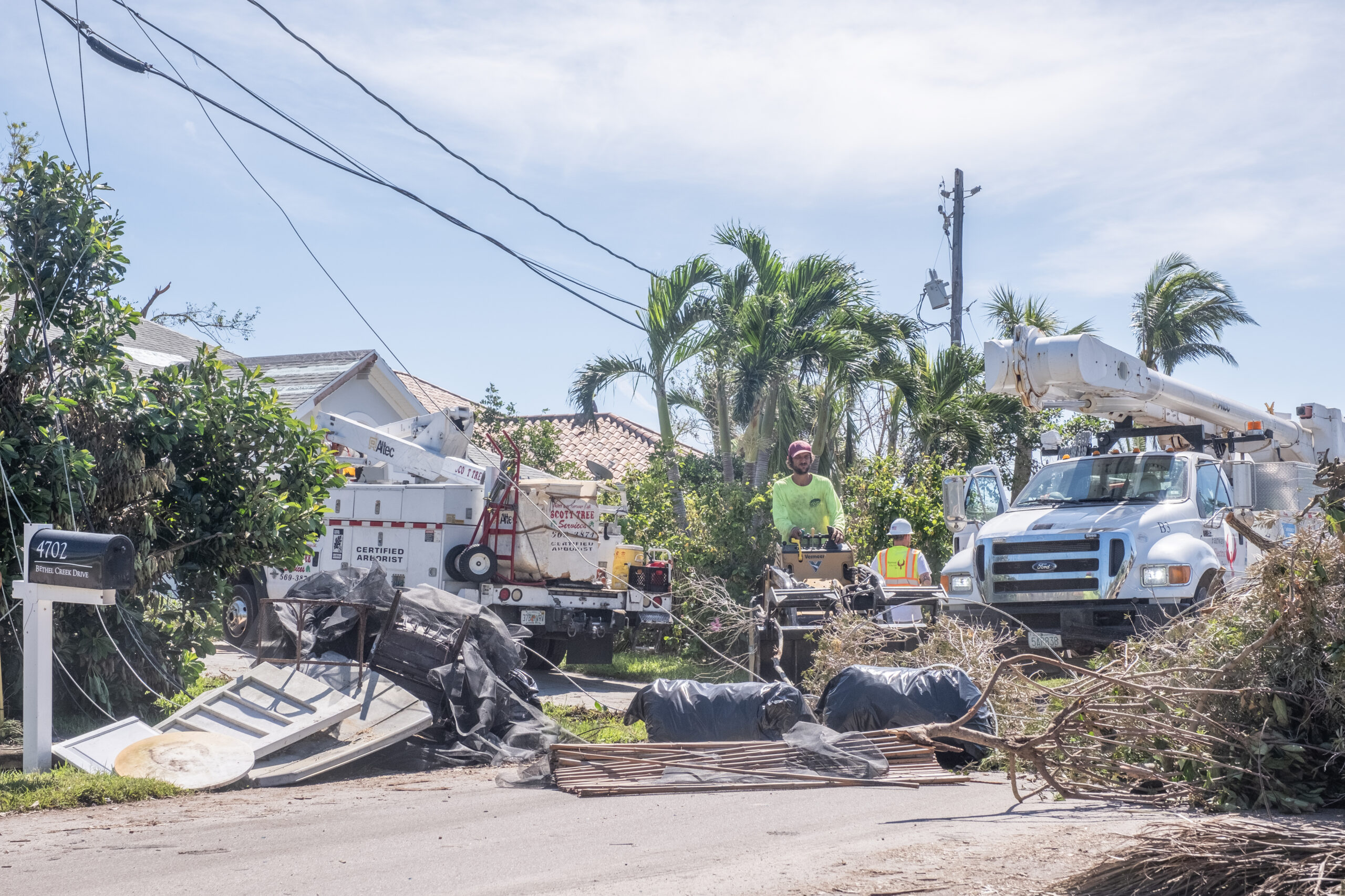
- Workers clear debris from a home along Bethel Creek Drive.
-
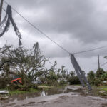
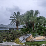
- Downed power lines and debris covered the streets of the Bethel Creek area.
-
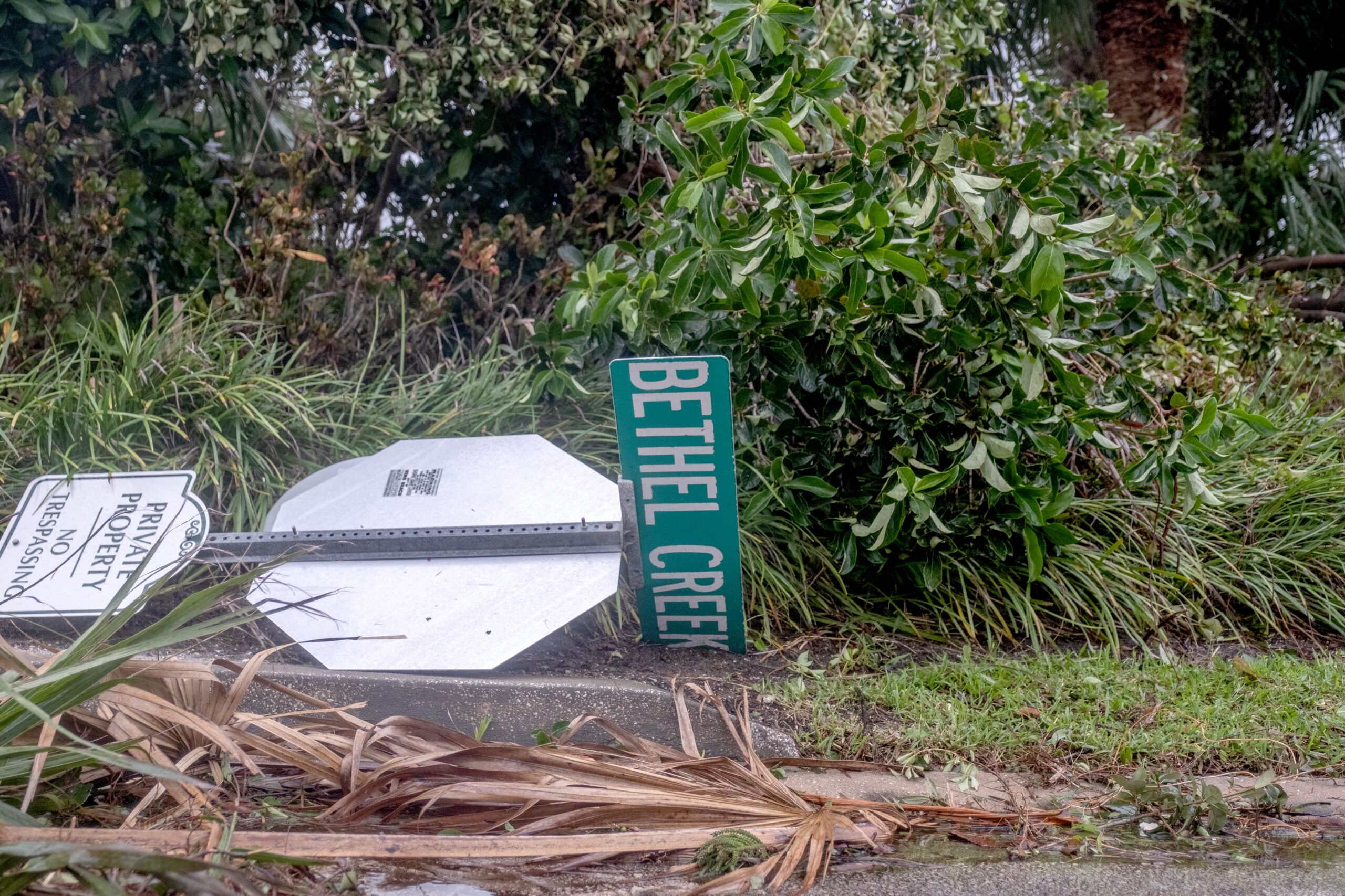
- El Perdido Street in the Bethel Creek area.
-
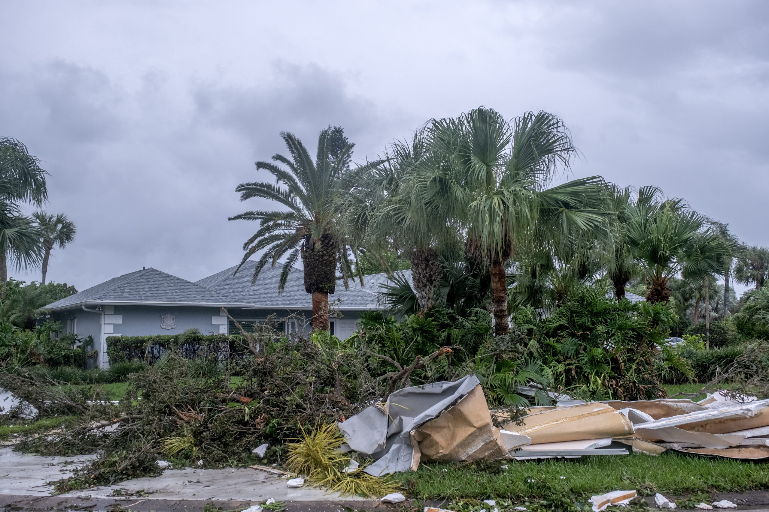
- A damaged home in the Bethel Creek area.
-
- A home in the Bethel Creek area.
-

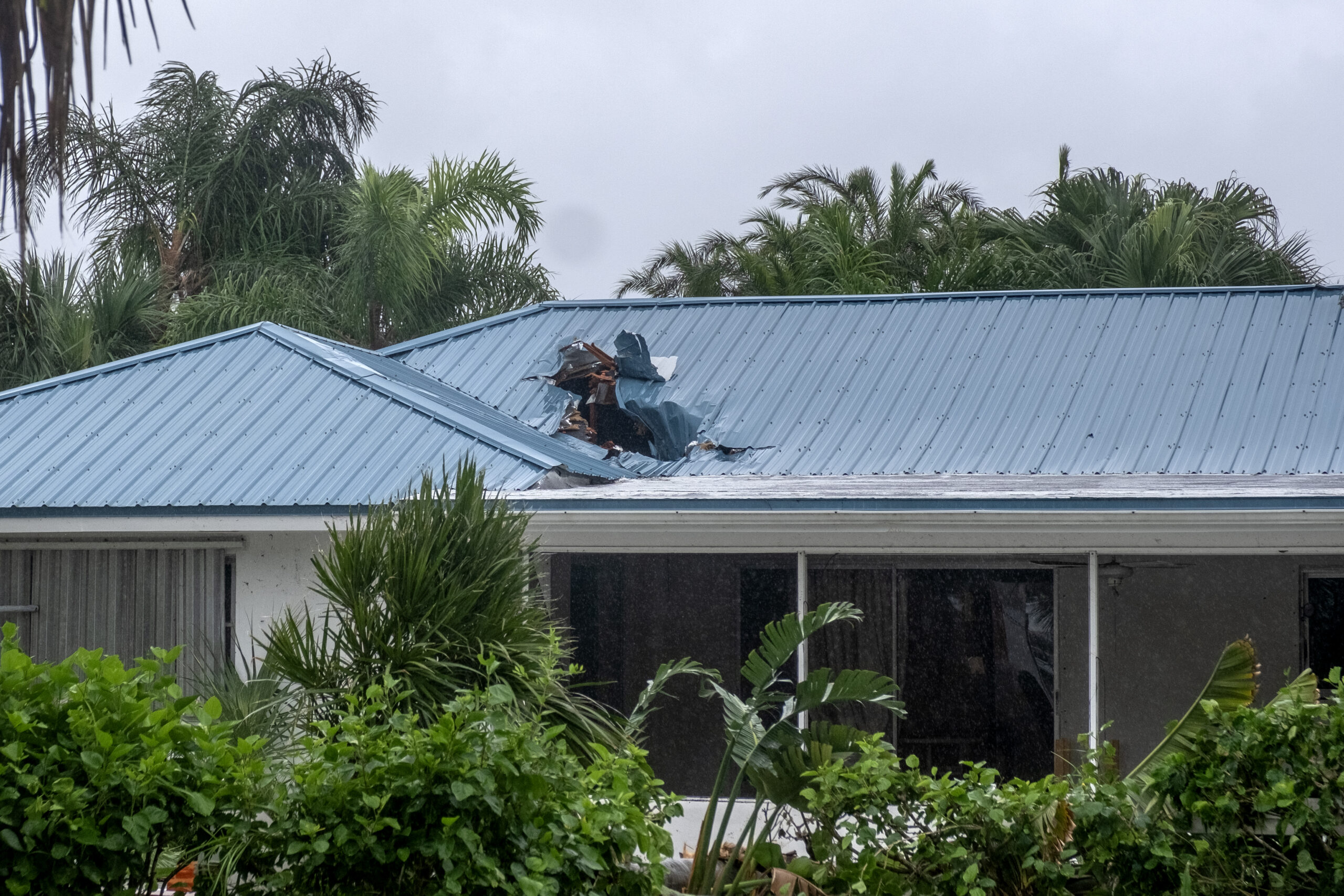
- Damaged roof of a home in the Bethel Creek area.
-
- Bethel Creek Drive
-
- A home in the Bethel Creek area.
-
- A home in the Bethel Creek area.
-
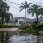
- Parts of Bethel Creek Drive remain flooded after the storm.
-
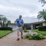
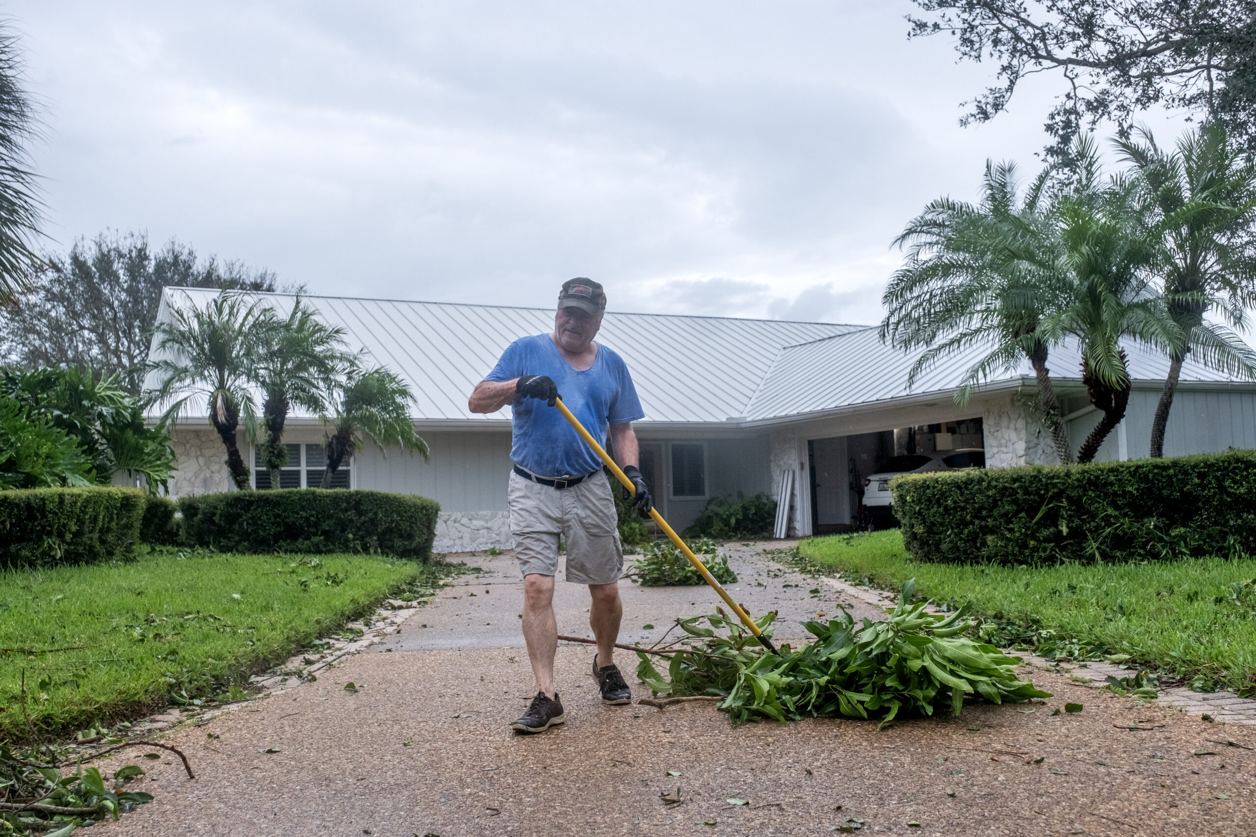
- Mike DiAntonio clears debris from his home in the Bethel Creek area.
-
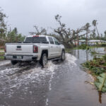
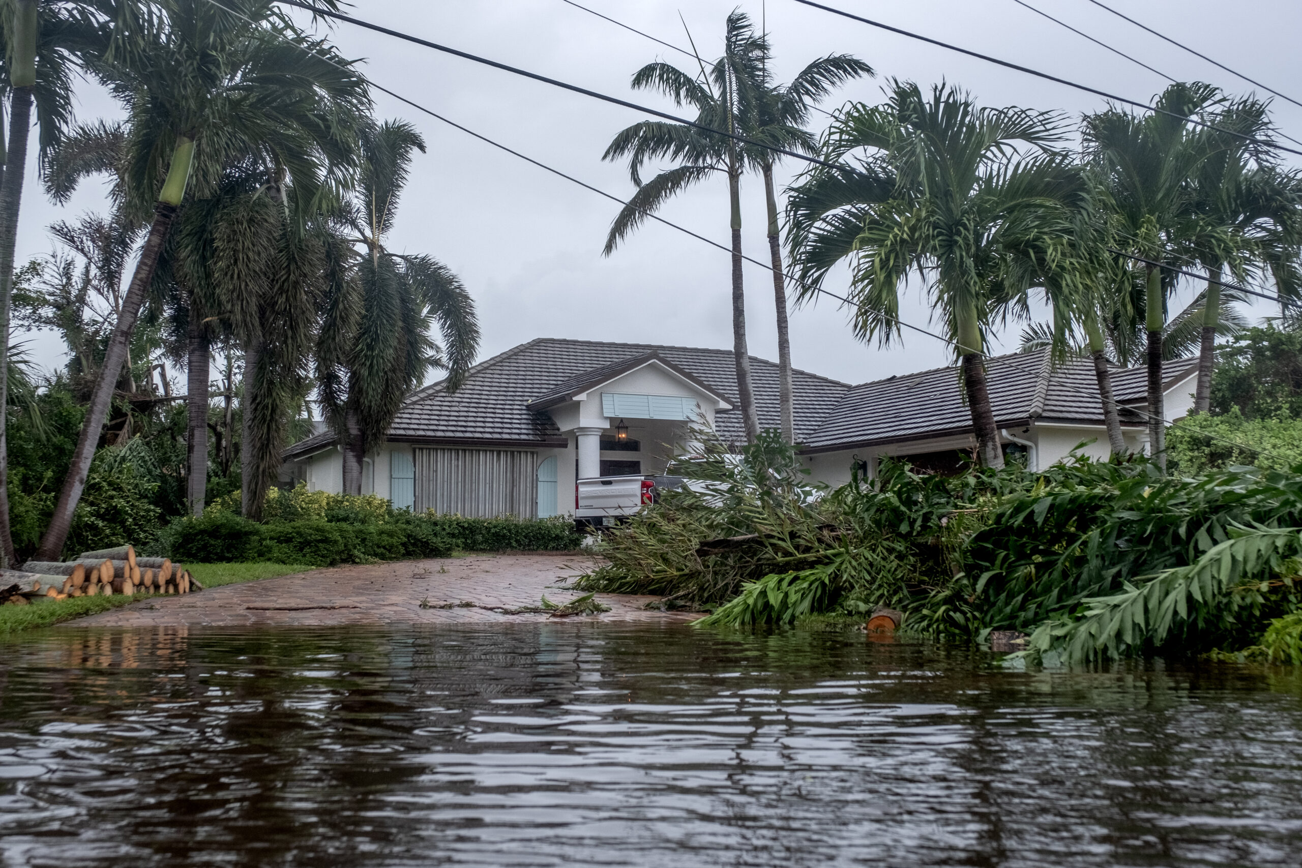
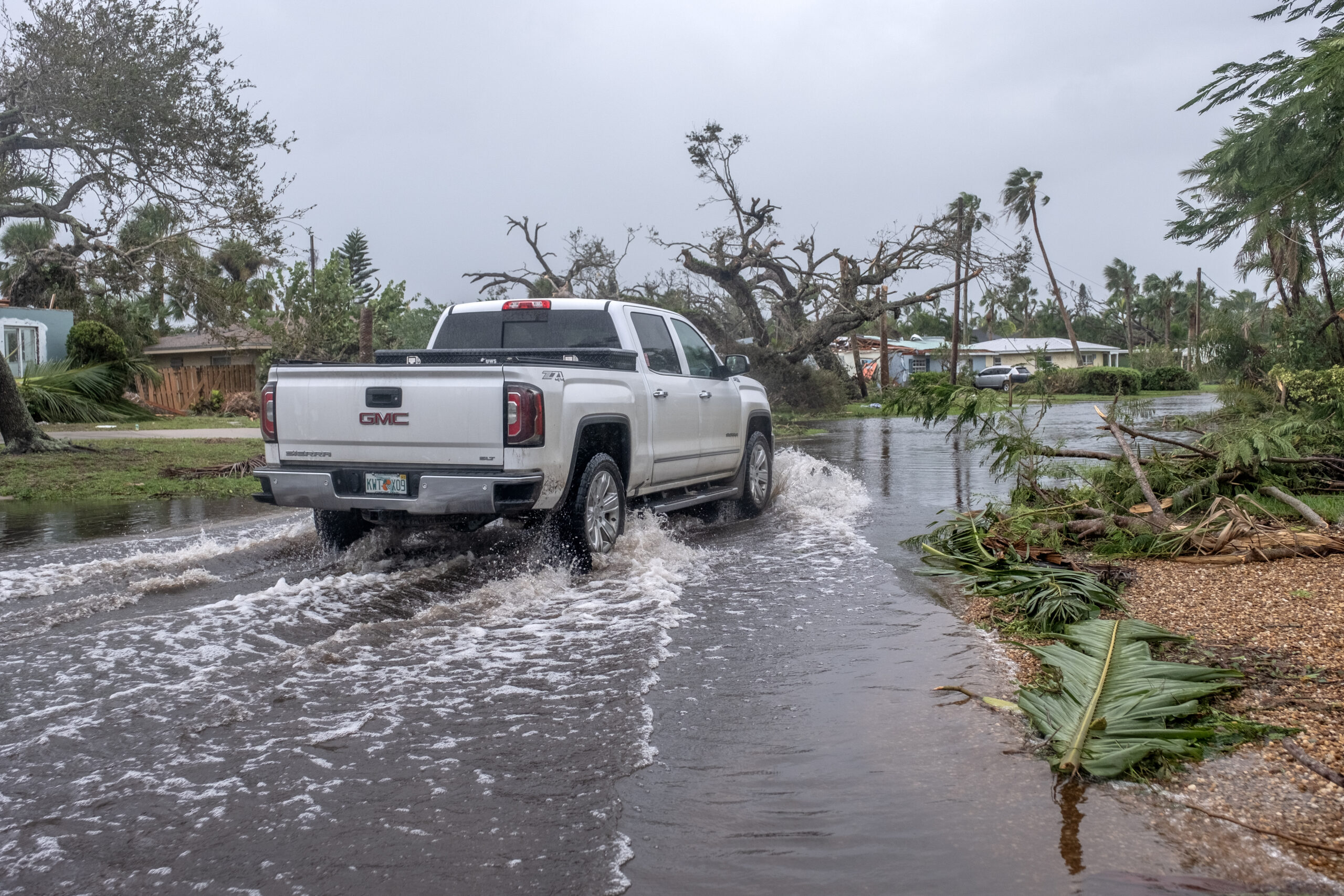
- A truck drives through a flooded portion of Bethel Creek Drive.
-
- A damaged home along Bethel Creek Drive.
-
- A damaged home along Bethel Creek Drive.
-
- A damaged home along Bethel Creek Drive.
-
- A damaged home along Bethel Creek Drive.
-
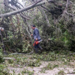
- A worker clears debris from the driveway of a home along Bethel Creek Drive.
-
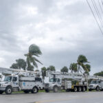
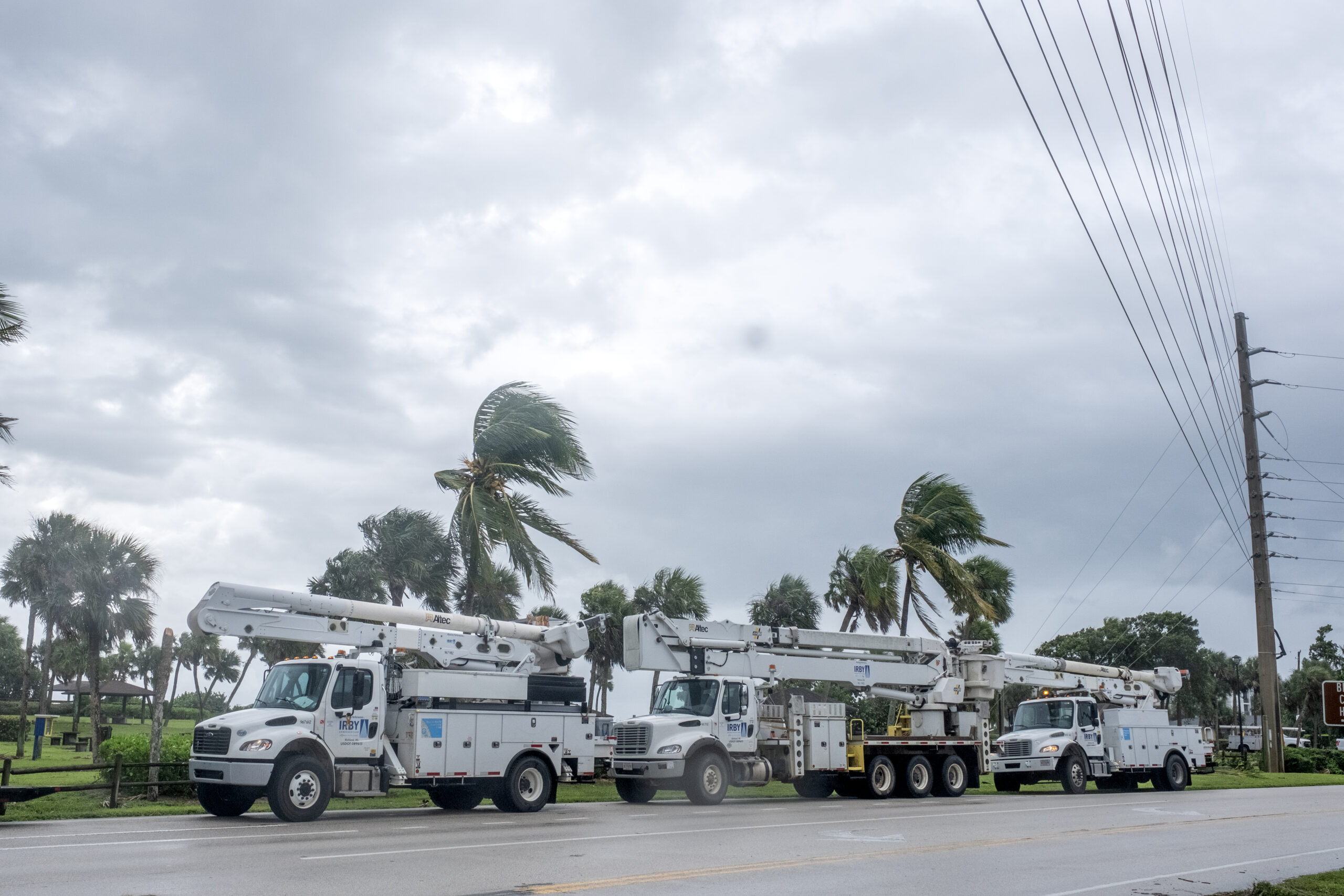
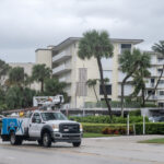
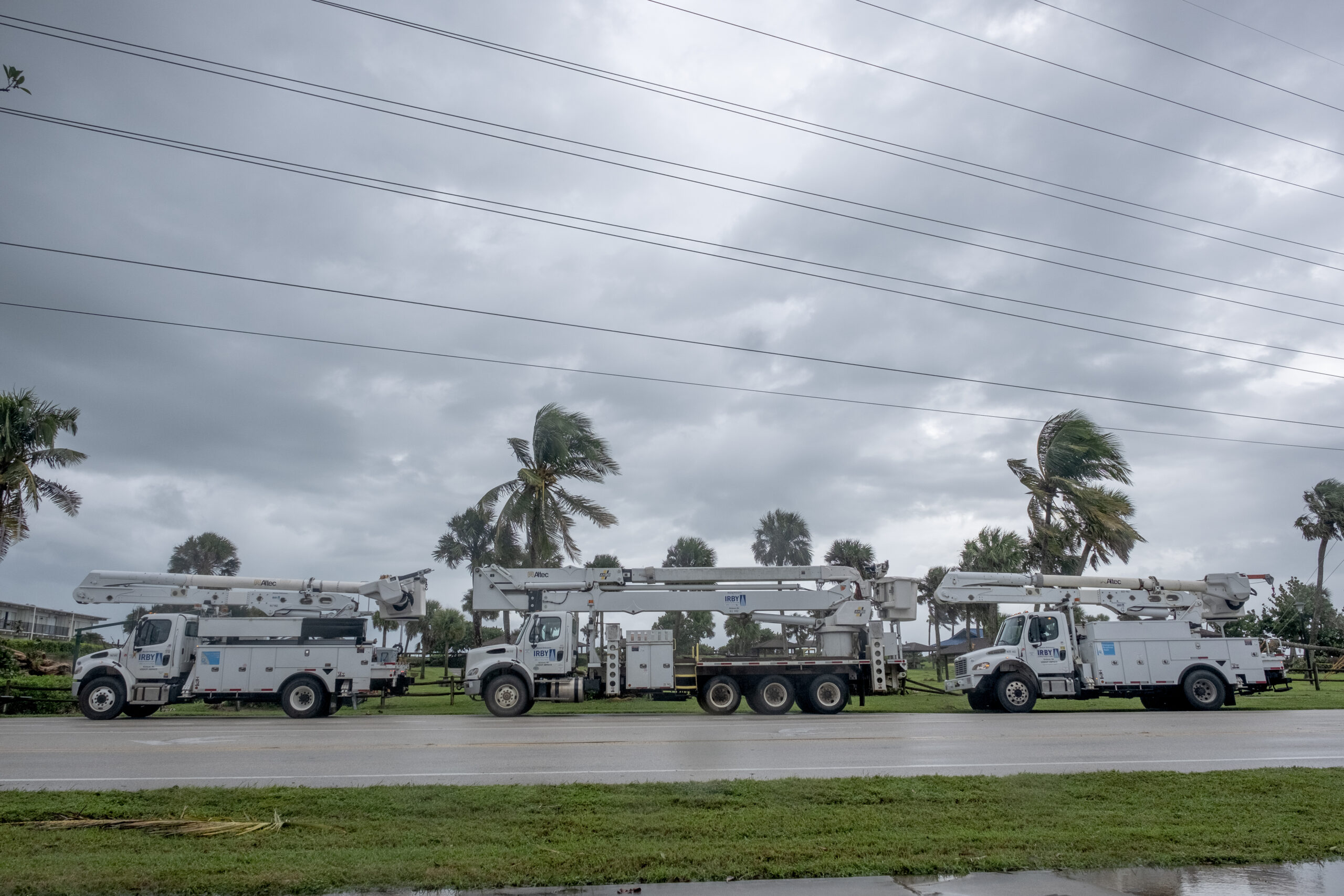
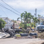
- Service vehicles working to repair power along A1A.
-
- A damaged roof of condos along Bahia Mar Road in the Bethel Creek area.
-
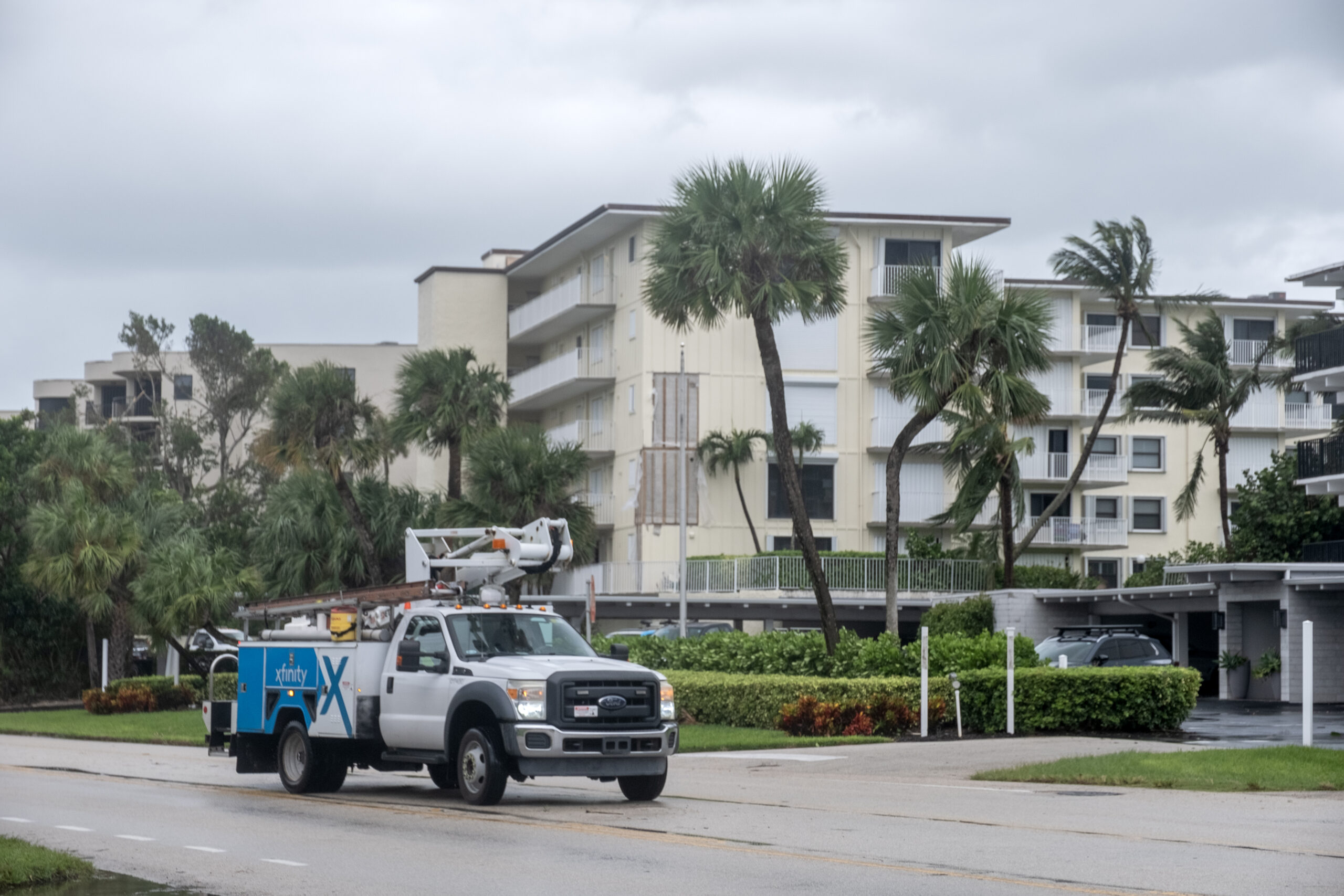
- An Xfinity repair truck drives down A1A.
-

- Service vehicles working to repair power along A1A.
-
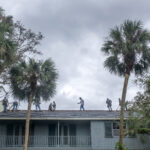
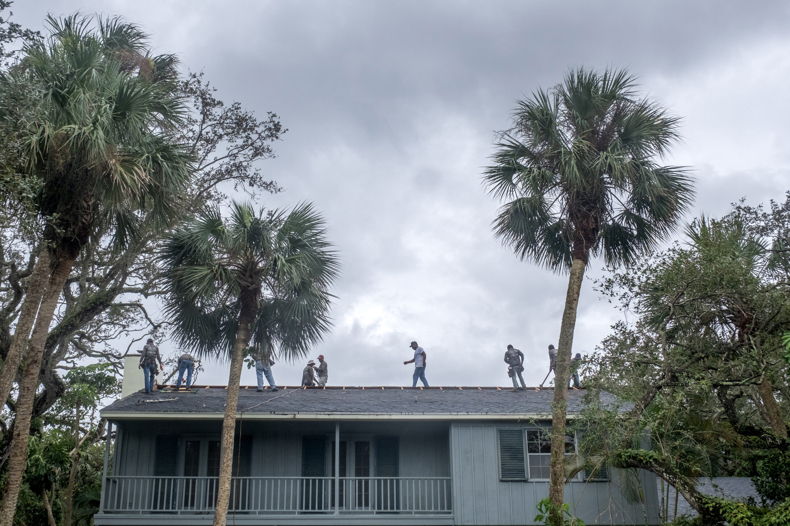
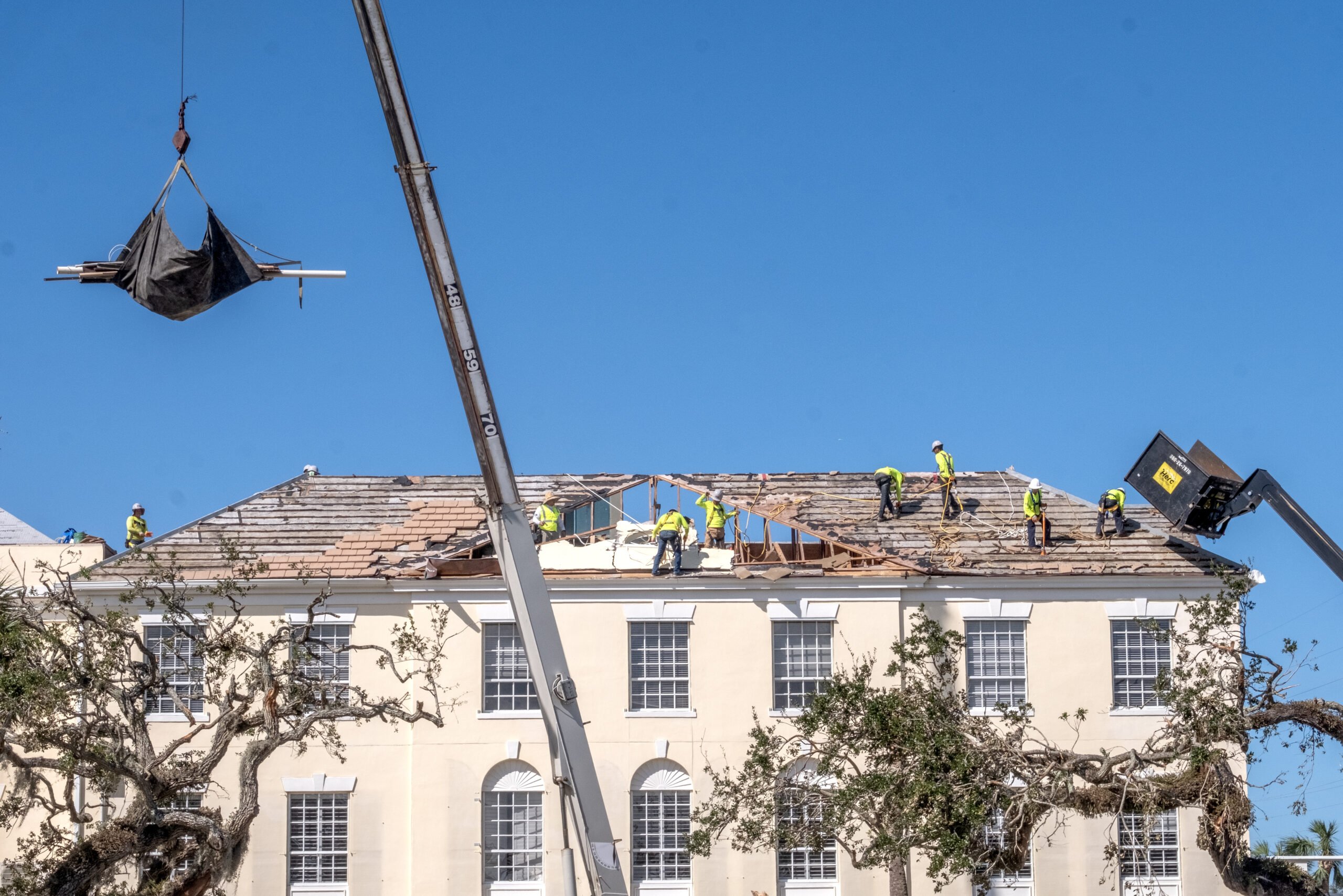
- A crew of workers make repairs to a roof along Live Oak Road in the Central Beach area.
-
- A home covered in debris along Sabal Palm Drive.
-
- default
-

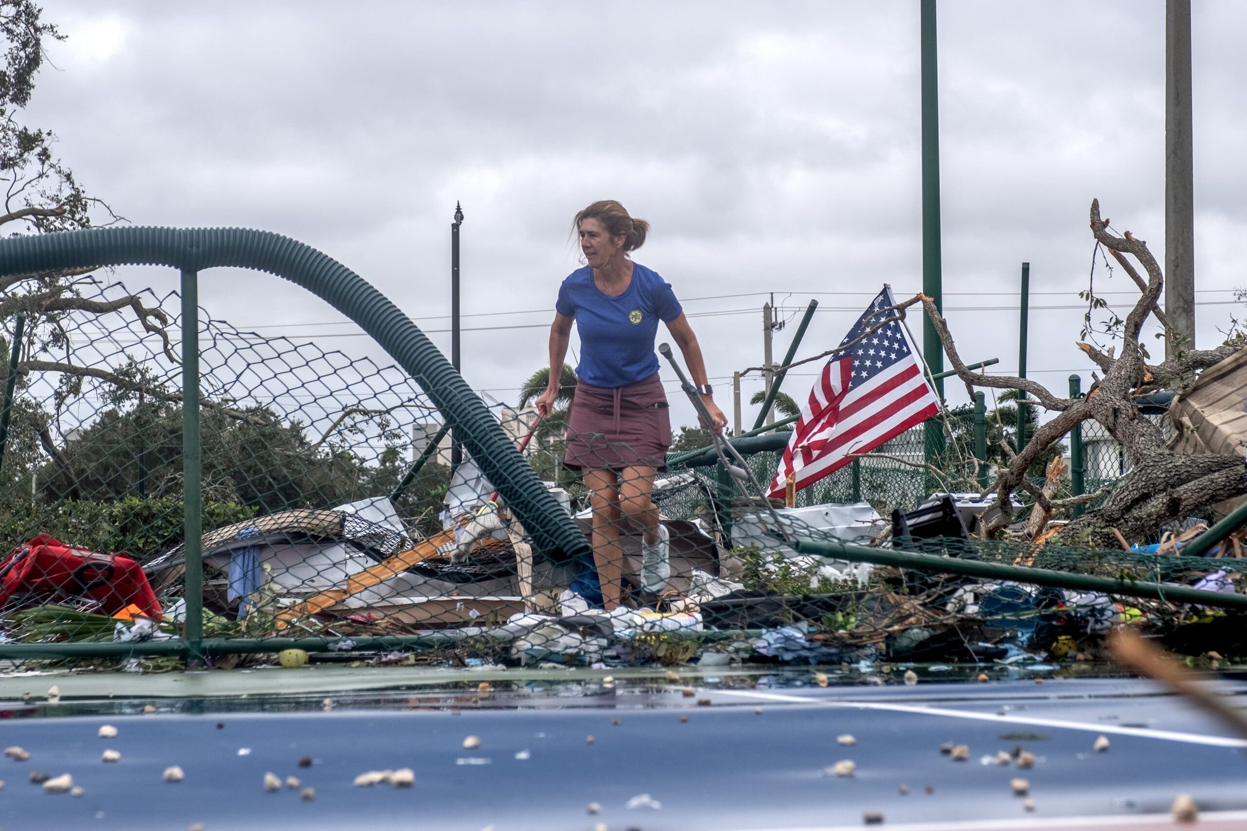
- Claire Miller walks through the remains of the pickleball courts at Pocahontas Park.
-

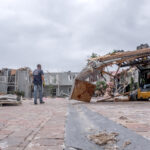
- A mail truck flipped onto its side at the Post Office on 13th Ave.

-
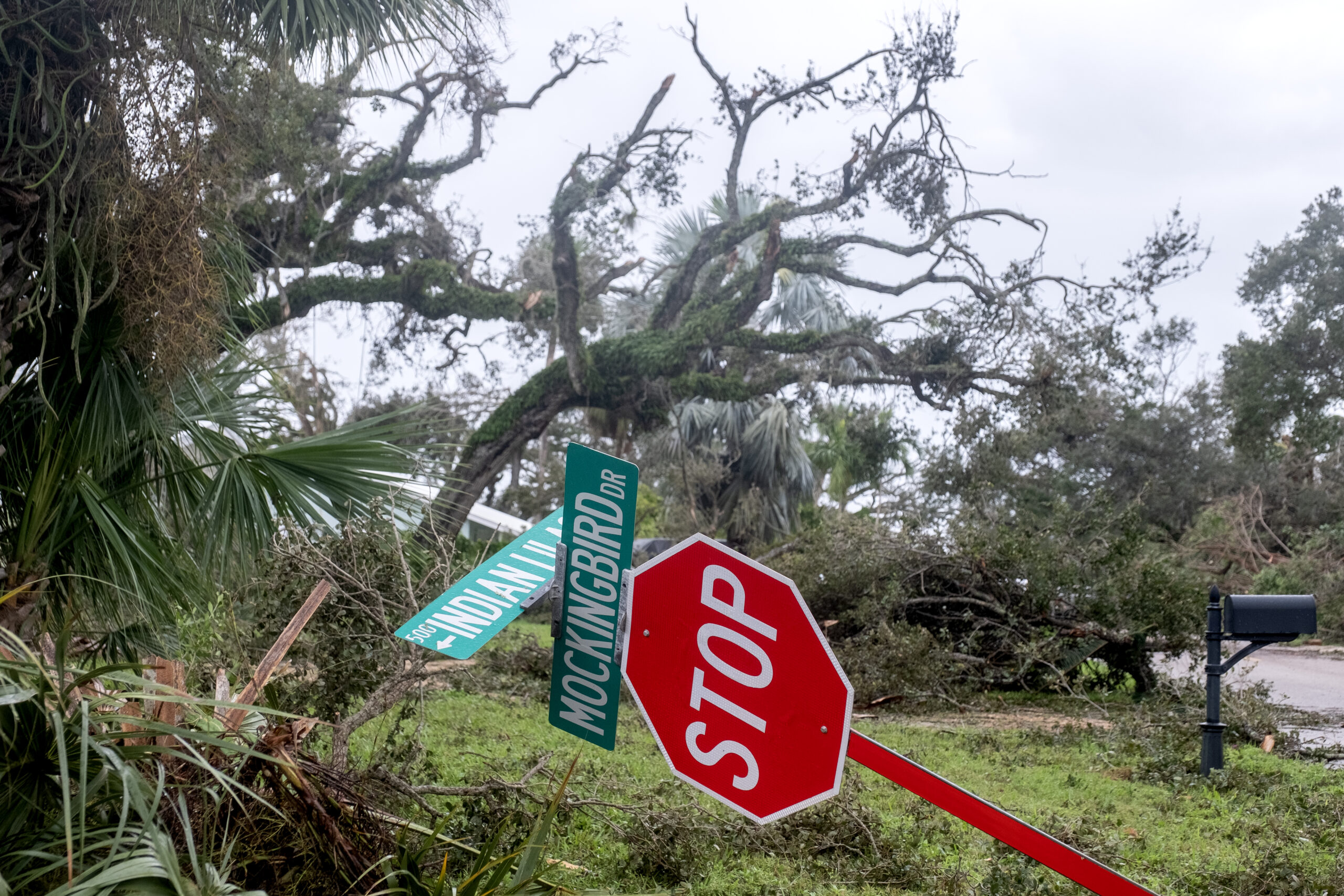
- El Perdido Street in the Bethel Creek area.
-
- A damaged home along Riomar Drive.
-
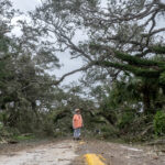
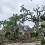
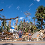
- A woman pauses to take in the scene of distruction along a road in Indian River Shores.
-
- A damaged home along Riomar Drive.
-
- A damaged home along Riomar Drive.
-
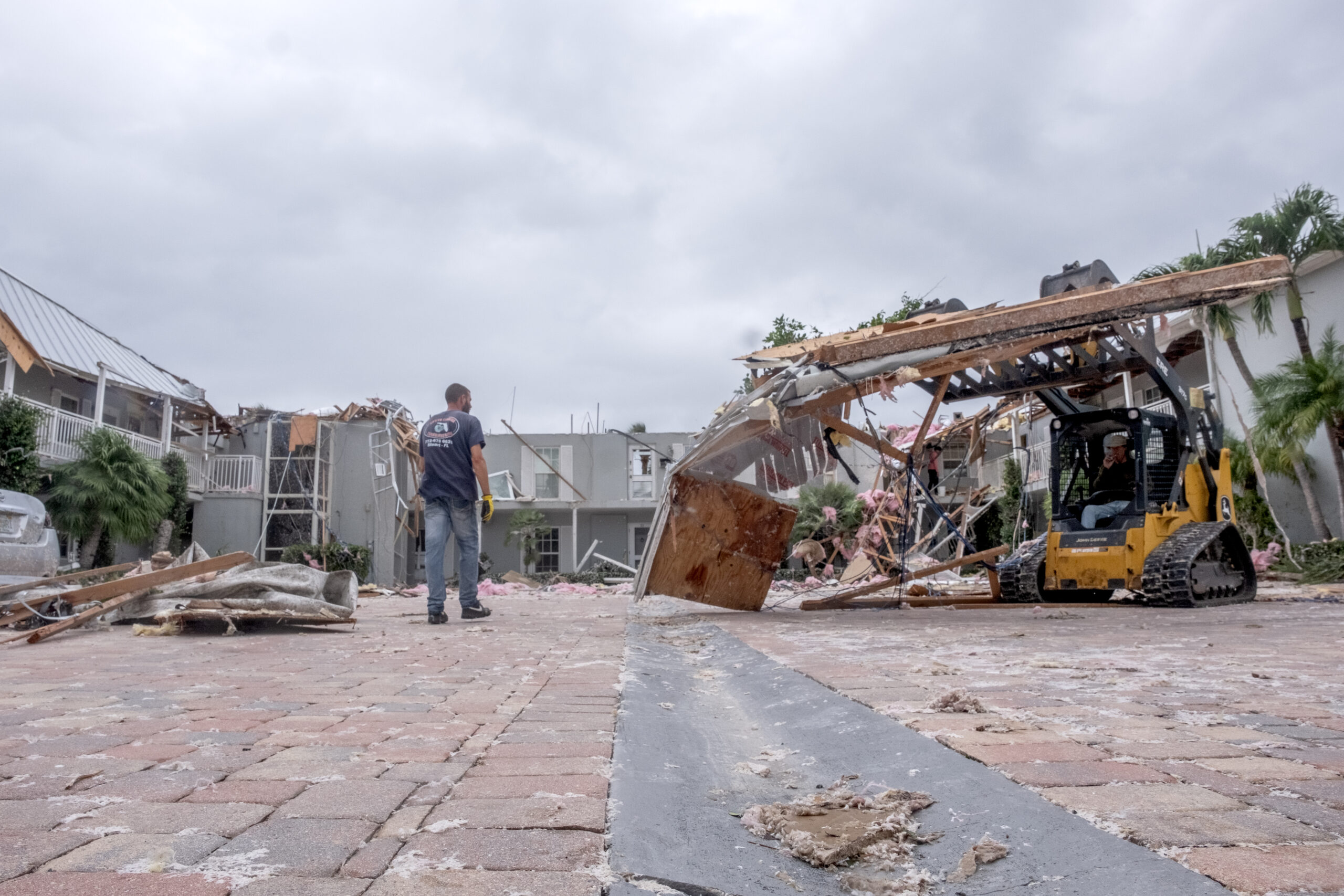
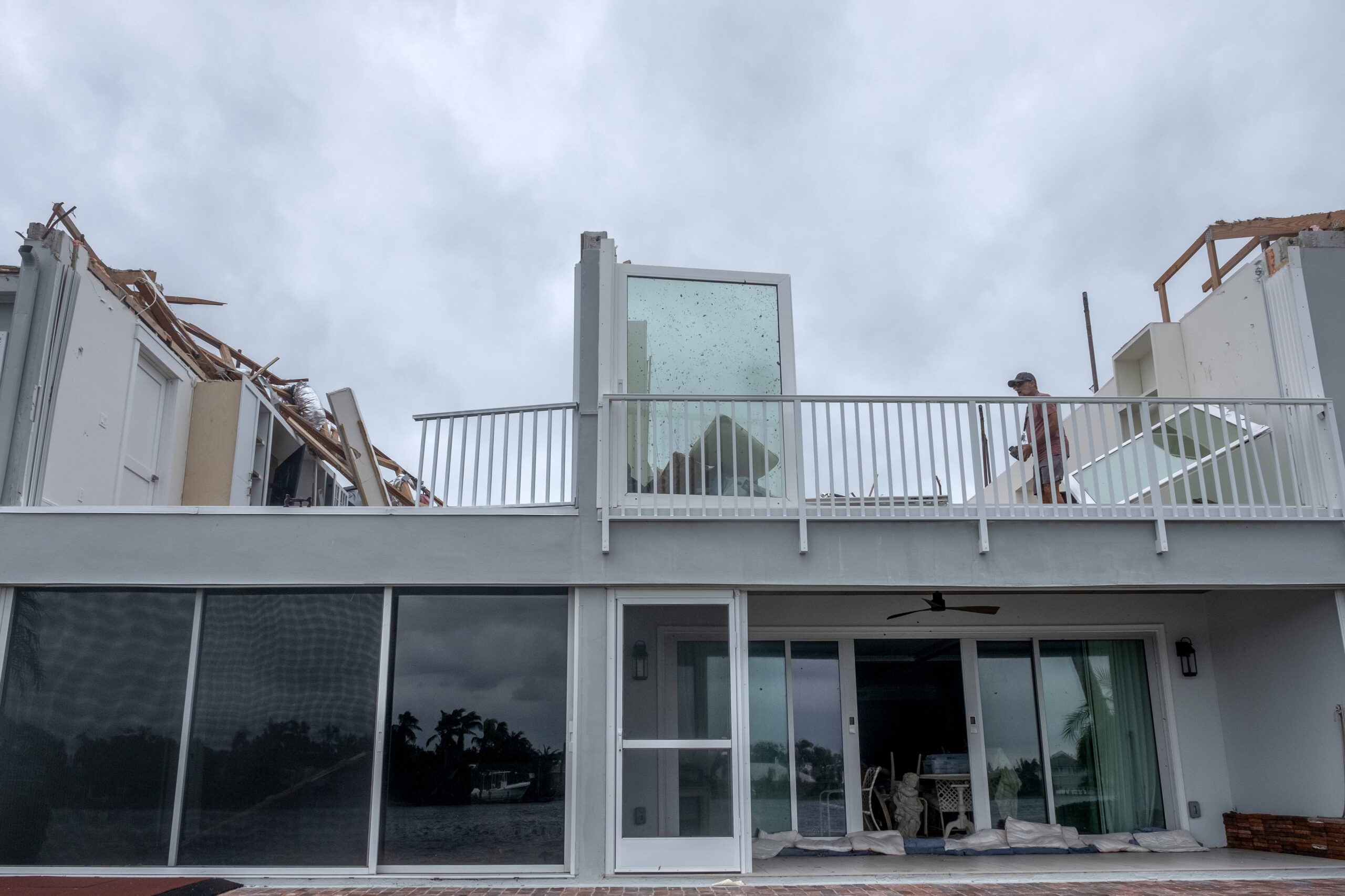
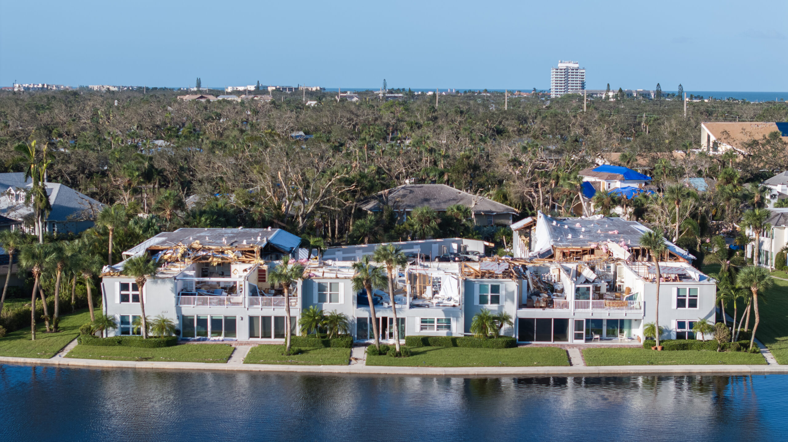
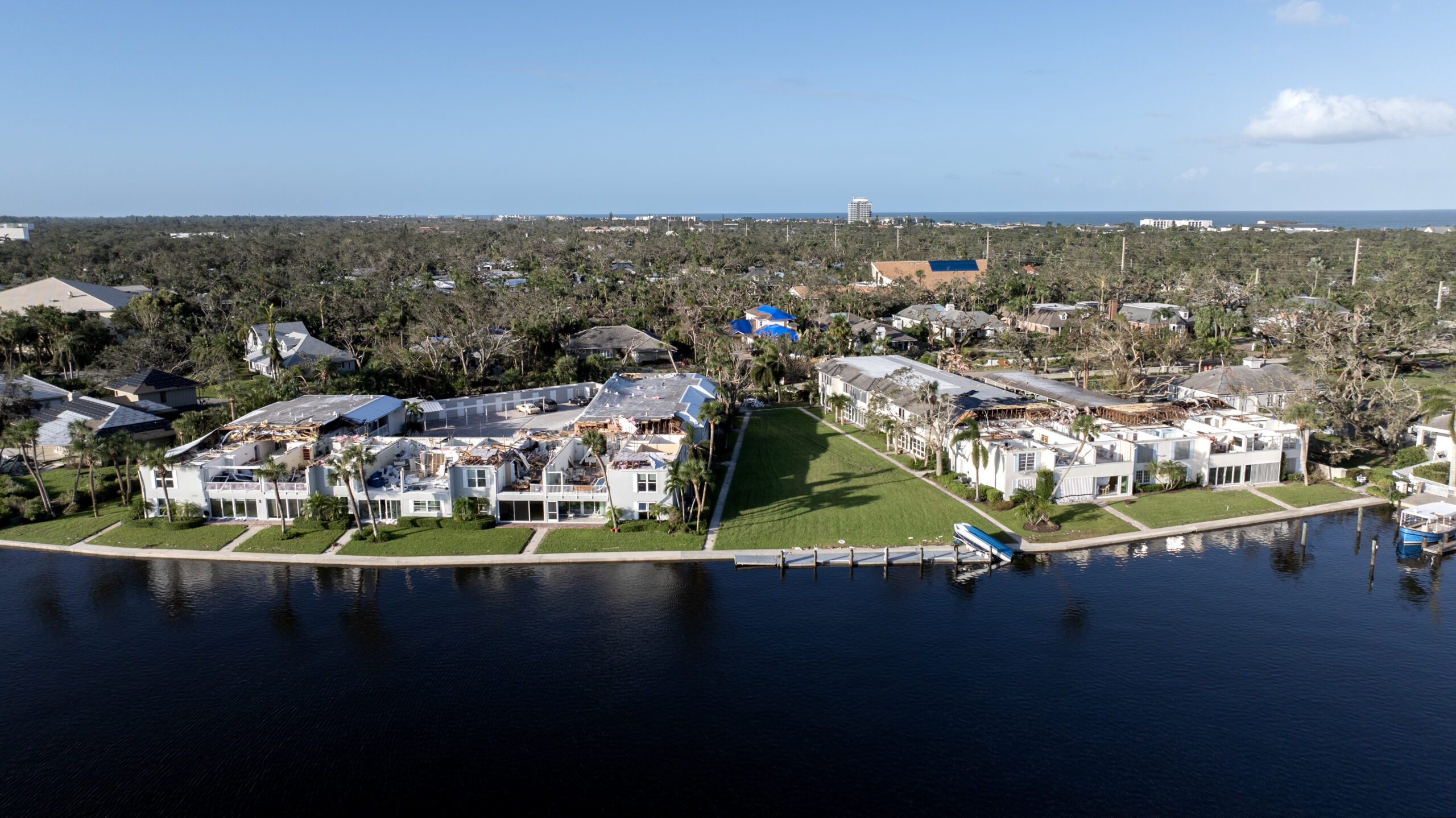
- Workers clear debris from the wreckage of condos along Riomar Drive.
-
- Workers clear debris after a tornado ripped the roof off of condos along Riomar Drive.
-

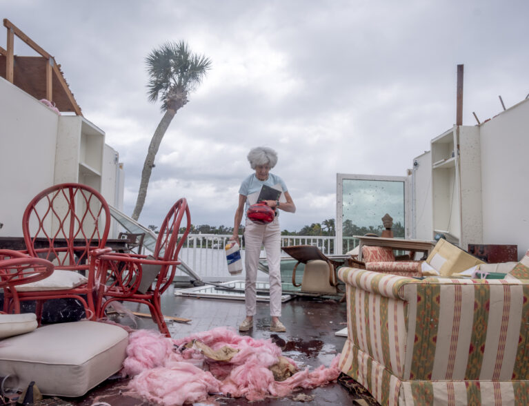
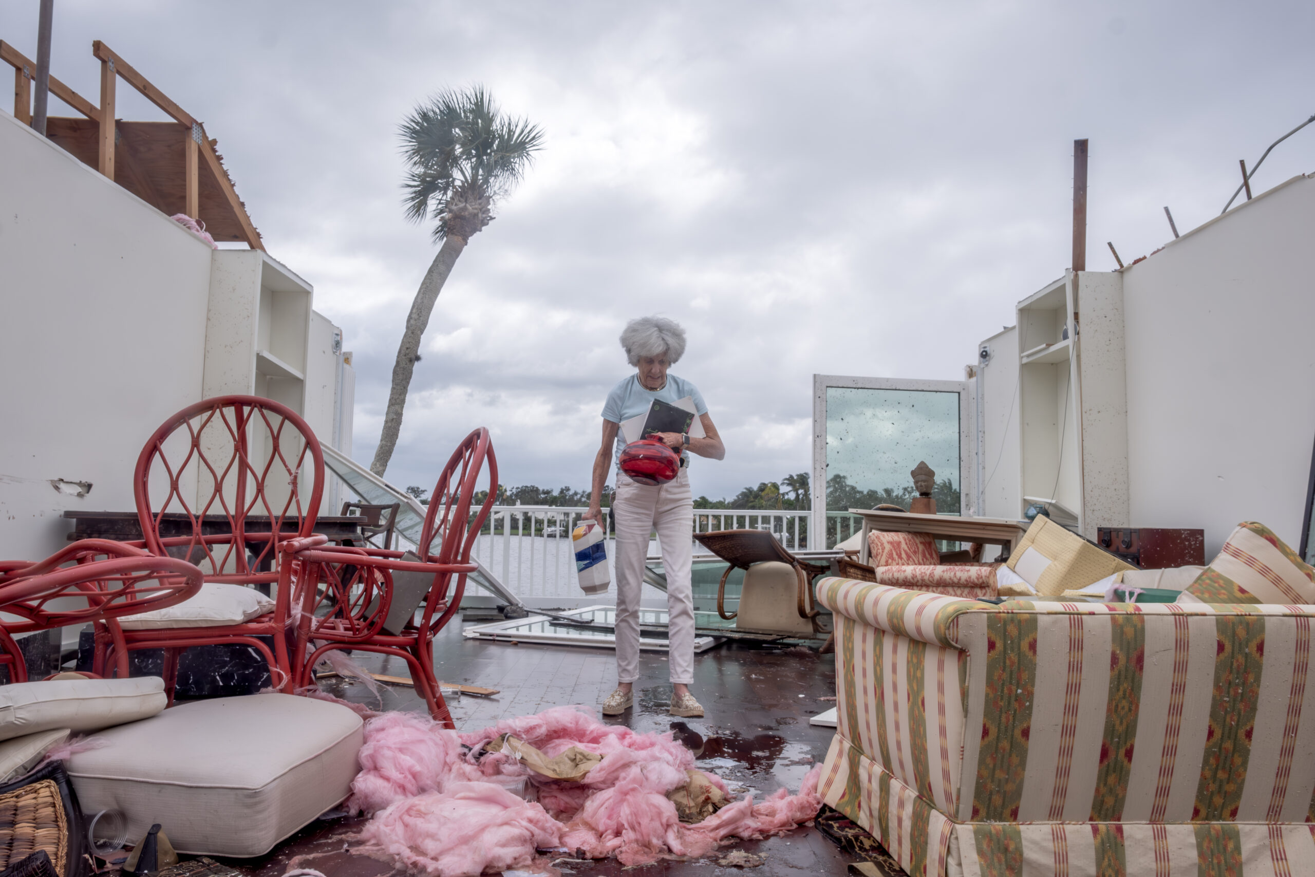
- Mary Singer salvages some of her belongings from her condo she’s lived at for six years at Quail River Valley after a tornado ripped the roof off.
-
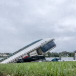
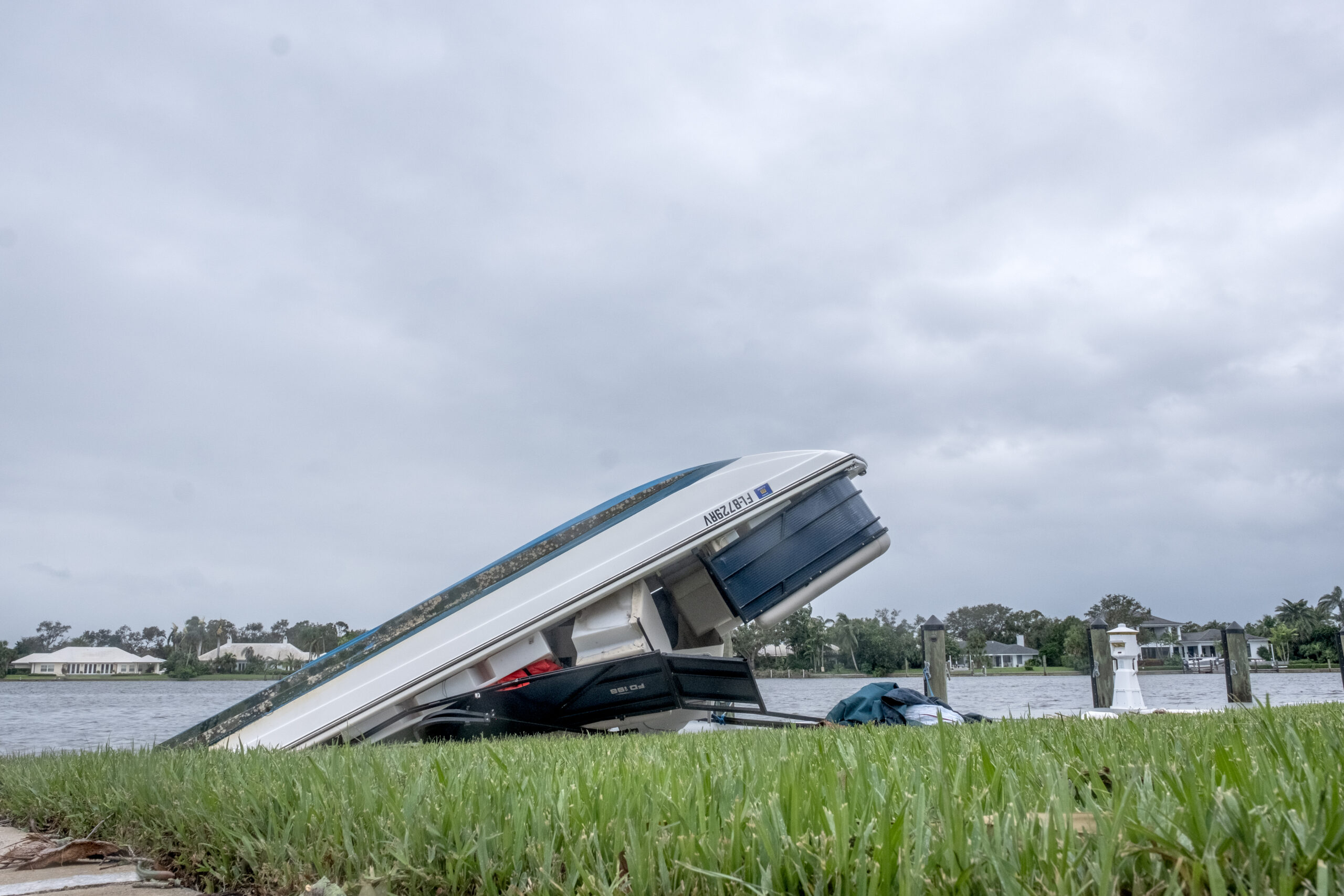
- A boat flipped over in the lagoon near the Quail Valley River Club.
-

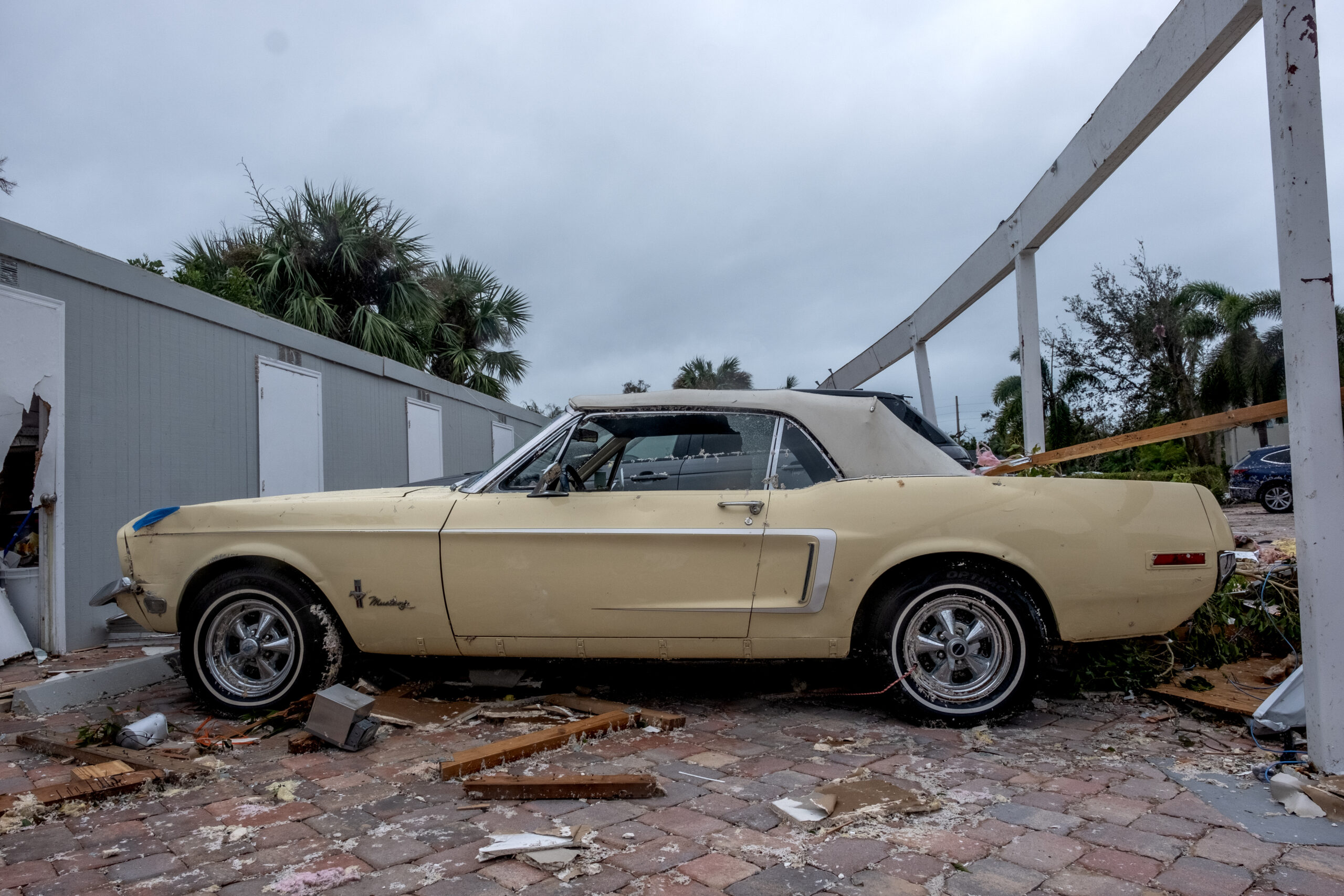
- An old Ford Mustang damaged from a tornado that hit Riomar Drive.
-
- Workers clear debris after a tornado ripped the roof off of condos along Riomar Drive.
-
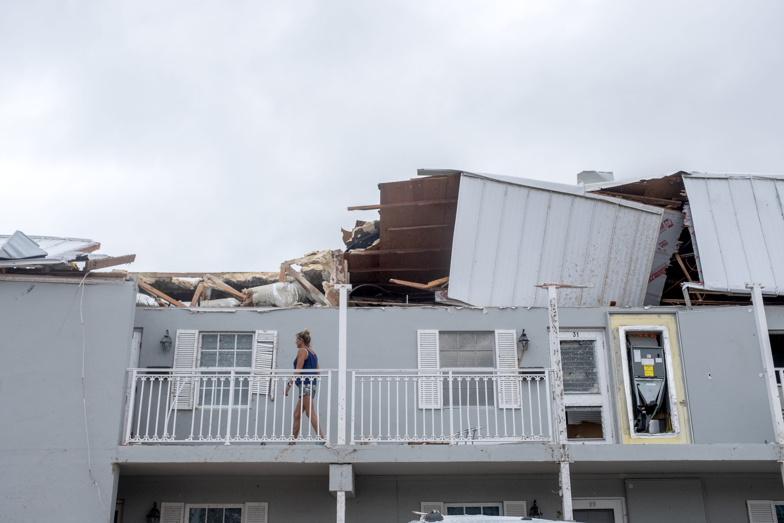
- The roof blown off of a Quail Valley Condo.
-
- The roof completely blown off of a Quail Valley Condo.
-

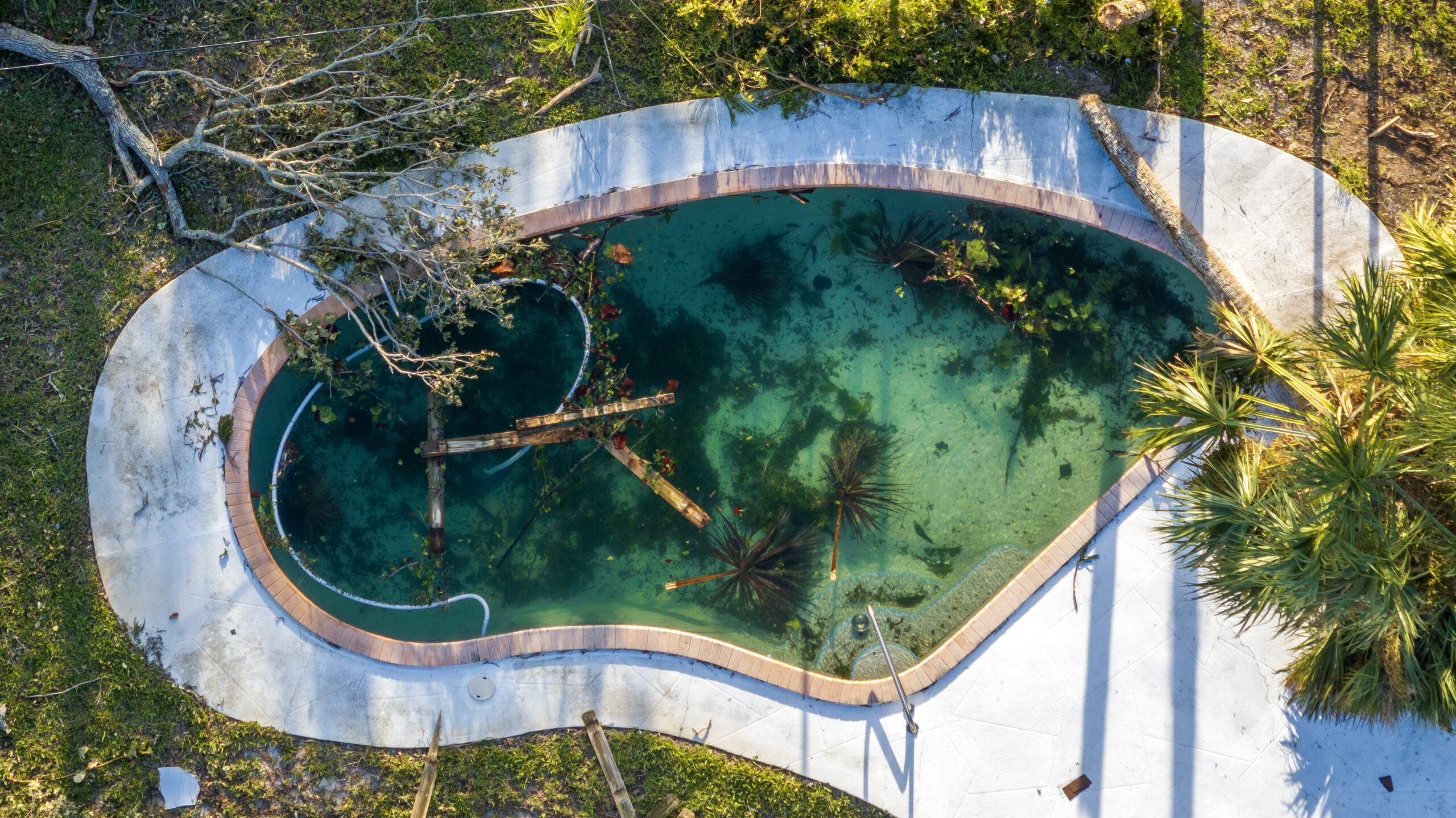
- A pool full of debris along Bethel Creek Drive.
-
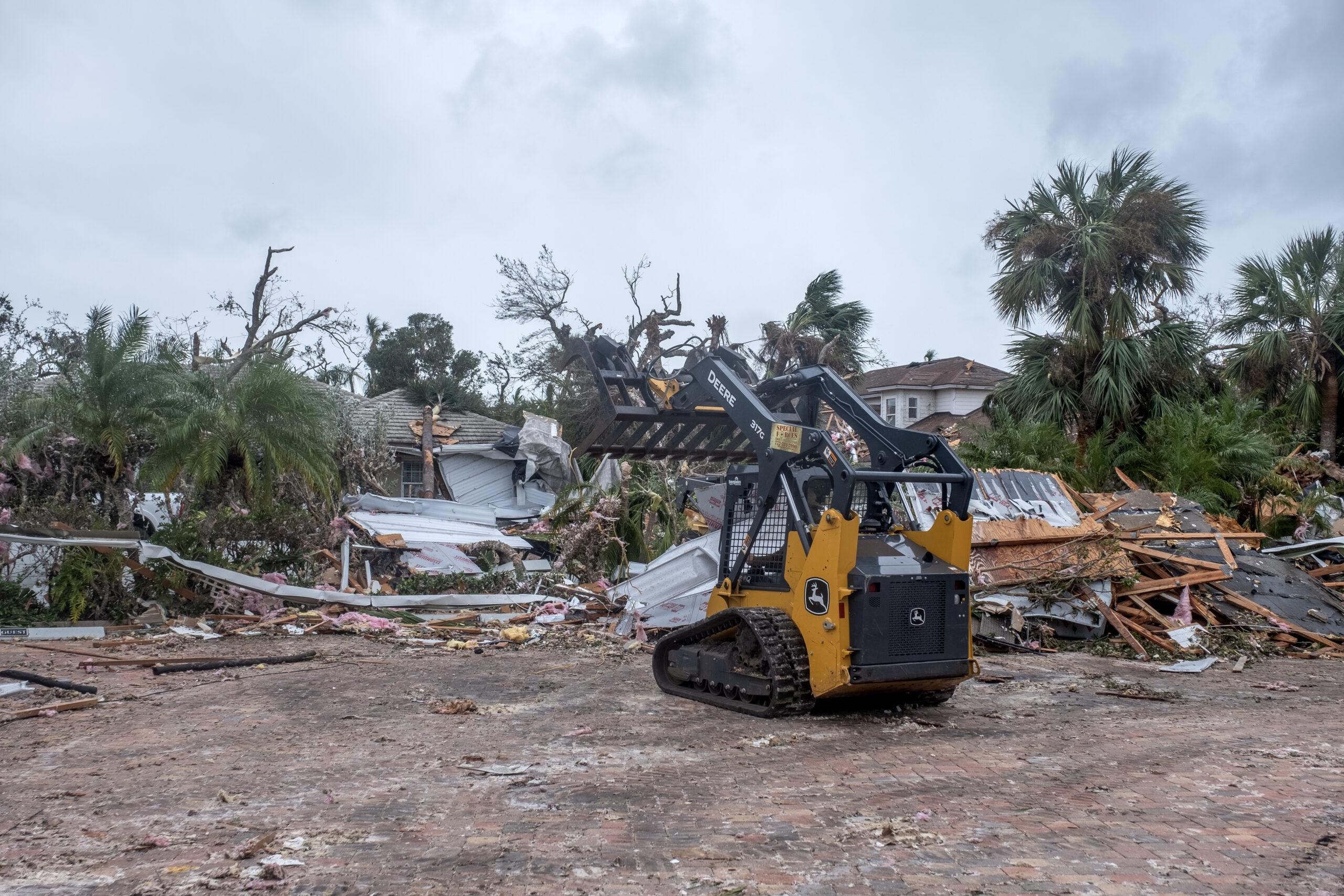
- While some homes were untouched, others lay in ruin from the tornado’s path of destruction through the Bethel Creek area. PHOTO BY JOSHUA KODIS
-
- While some homes were untouched, others lay in ruin from the tornado’s path of distruction through the Bethel Creek area.
-
- A destroyed home on Bethel Creek Drive.
-
- Homes destroyed on Bethel Creek Drive.
-
- Despite some homes being completely destroyed, mail was still being delivered where possible.
-
- Stacey Clark looks through the window into the room where she took shelter from the tornado that destroyed her home on Bethel Creek Drive.
-

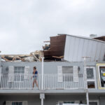
- Damage done to condos of Riomar Drive.
-

- Damage done to condos of Riomar Drive.
-

- Chase Bank

-
- default
-
- default
-

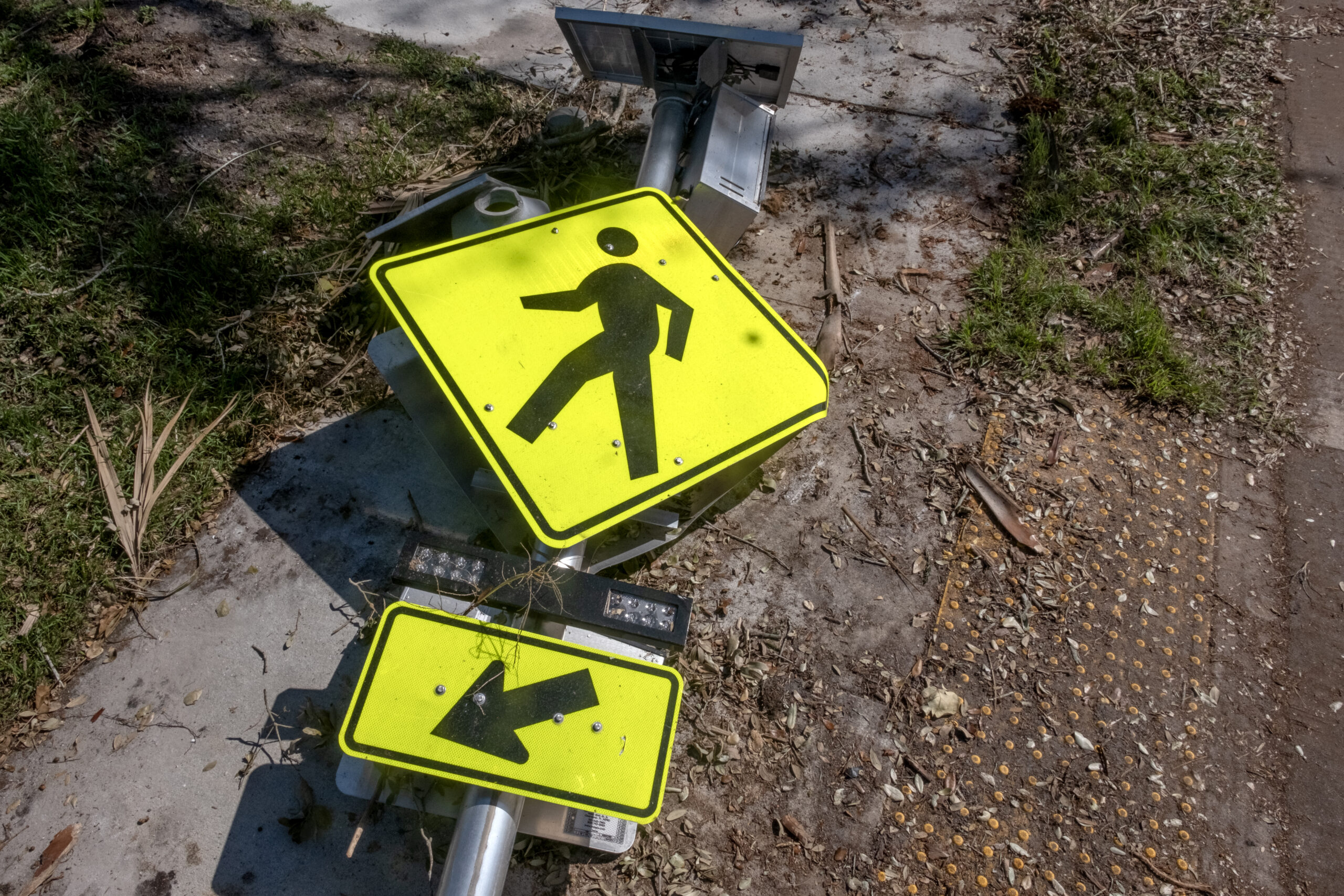
- Fallen crosswalk sign on A1A.
-
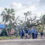
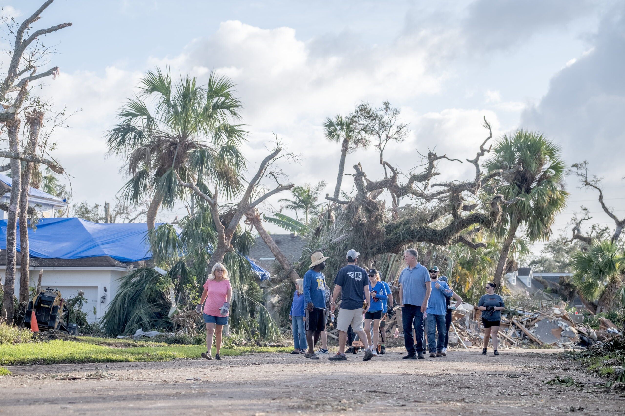
- Volenteers gather to helo cleanup debris on Riomar Drive.

-
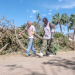
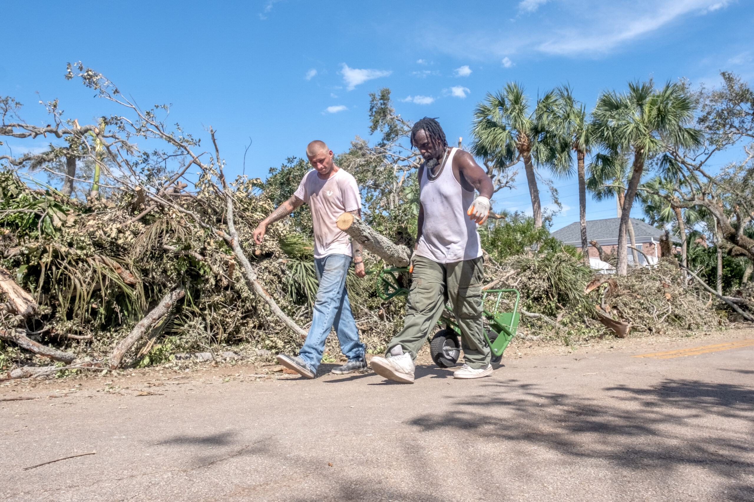
- Workers haul debris away from a home on Riomar Drive.
-
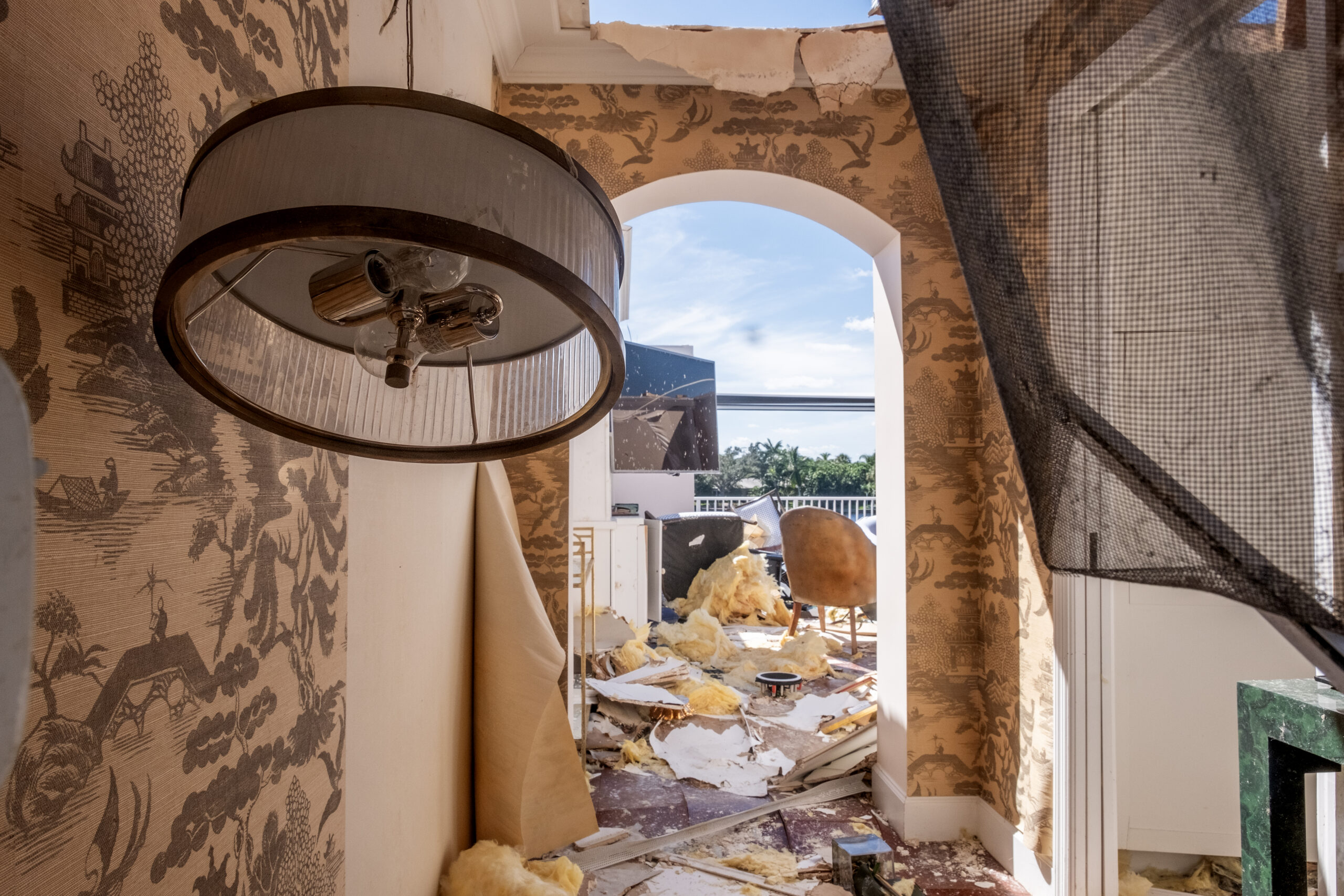
- The view from a damaged condo on Riomar Drive.
-
- Residents and helpers continue to salvage what they can from the damaged condos on Riomar Drive.
-
- Volenteers take a moment to view the amount of debris piled up on Riomar Drive.
-

- Penny Eshleman stands where she was in her home on Bethel Creek the moment a tornado hit while she was cooking dinner.
-
- Cleanup efforts on Bethel Creek Dr.
-
- Quail Valley River Club
-

- Lisa Vanvoorem salavges what she can from her condo on Riomar Drive.

-

- Inside a condo on Riomar Drive.