*This story will be continuously updated for Hurricane Milton coverage
Update 10 a.m. Wednesday, Oct. 9, 2024
Meteorologists issued a tornado watch Wednesday morning for Indian River County as the window of time closes to prepare for Hurricane Milton, which experts called a “historic hurricane.” A tornado watch means there’s a chance that tornadoes could form in the area within 48 hours.
“Hurricane preparations should be done today. People should shelter in place,” said Derrick Weitlich, a meteorologist with the National Weather Service in Melbourne. “The greatest wind impacts will be tonight and tomorrow. People should take this storm very seriously.”
The tornado watch will last until 9 p.m. Wednesday, according to the National Weather Service in Melbourne. Weitlich said weather conditions will continue to deteriorate Wednesday.
A hurricane warning remains in effect for Indian River County until further notice. A hurricane warning means hurricane-force winds are expected for the area within 36 hours.
A flood watch for Indian River County remains in effect until 8 p.m. Thursday.
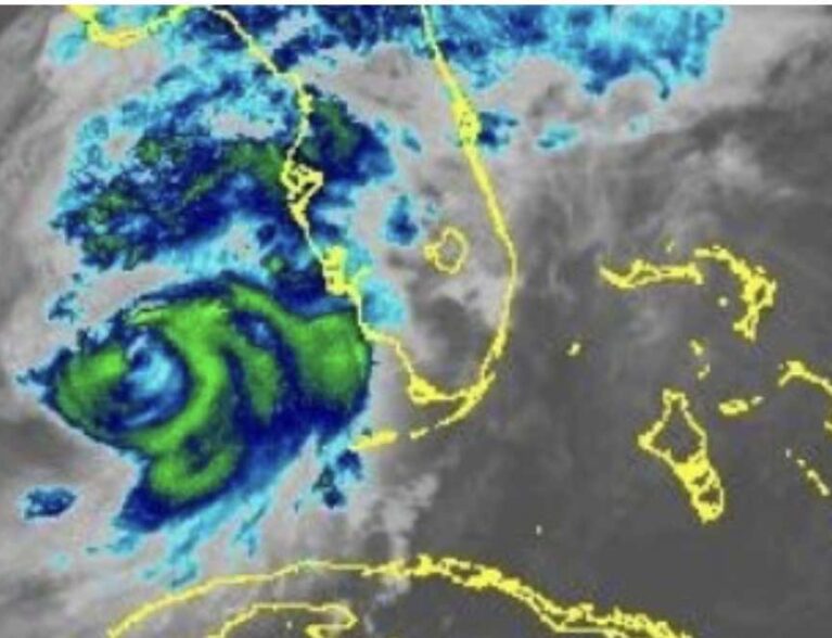
Milton remained a powerful Category 4 hurricane Wednesday with 155-mph maximum sustained winds. The storm, barreling northeast at 9 mph, was expected to hit Florida’s Gulf Coast sometime Wednesday night and continue pushing eastbound.
The forecast tracks the center of the storm hovering over Brevard County, but the track could still shift, meteorologists said.
“People all across central Florida should expect significant impacts. Hurricane conditions are what people need to be prepared for.”
Weitlich said Milton will make its exit off Florida’s east coast, but residents should still remain vigilant.
“That doesn’t mean the storm will be over. The back winds will also be damaging,” Weitlich said. “There will be flooding impacts north of the center.”
Hurricane Milton will bring damaging winds between 74 and 110 mph, along with gusts up to 60 mph, to Indian River County, weather officials said. Meteorologists said the hurricane will produce up to 2 feet of storm surge and between 2-to-4 inches of rainfall, causing flooding in some areas.
Milton will also bring moderate beach erosion and strong rip currents.
Weitlich said residents should be on the lookout for when weather warnings and advisories are finally dropped. Those with questions about Hurricane Milton should call the storm hotline at 772-226-4000.
Update 8 a.m. Tuesday, Oct. 8, 2024
Weather officials issued a hurricane warning Tuesday morning for Indian River County ahead of Hurricane Milton, churning in the warm waters of the Gulf of Mexico and barreling east toward Florida. A hurricane warning means hurricane-force winds are expected within 36 hours.
“Urgently complete efforts to protect life and property,” emergency service officials said in an alert. “Have food, water, cash, fuel and medications.”
Hurricane Milton was expected to slam Florida’s Gulf Coast as a Category 3 hurricane on Wednesday night and continue traveling toward the state’s eastern seaboard. The storm will bring damaging winds between 74 and 110 mph, along with gusts up to 60 mph, to Indian River County, weather officials said.
Meteorologists said the hurricane will bring up to 2 feet of storm surge and between 2-to-4 inches of rainfall, causing flooding in some areas. Milton will also bring moderate beach erosion, strong rip currents and a chance of tornadoes.
A flood watch remains in effect until Thursday for Indian River County, meteorologists said. A high surf advisory will last from Wednesday night through Thursday.
Milton, with 145-mph maximum sustained winds, was traveling east northeast at 12 mph, according to a Tuesday morning update from the National Hurricane Center. The storm was downgraded to a Category 4 hurricane by 2 a.m. Tuesday, one day after reaching a peak of Category 5.
Earlier story:
INDIAN RIVER COUNTY — Weather officials issued a Hurricane watch for the county Monday afternoon as Milton remained a major Category 5 hurricane churning in the Gulf of Mexico. A hurricane watch means hurricane-force winds are possible in the area within the next 48 hours.
The hurricane watch will remain in effect until further notice.
Meteorologists said Hurricane Milton will weaken to a Category 3 storm before it slams Florida’s Gulf Coast on Wednesday evening. The hurricane will bring 25-to-35 mph winds, with gusts up to 55 mph to Indian River County, officials said.
The storm could possibly produce up to 2 feet of storm surge, snap trees, damage roofing and siding materials, destroy mobile homes, and cause up to 6 inches of rainfall. A flood watch for Indian River County remains in effect until Wednesday evening.
Tornadoes could also possibly form, emergency service officials said. Residents should make preparations – which include having food and water for seven days in case of power outages – before the hurricane-force winds arrive.