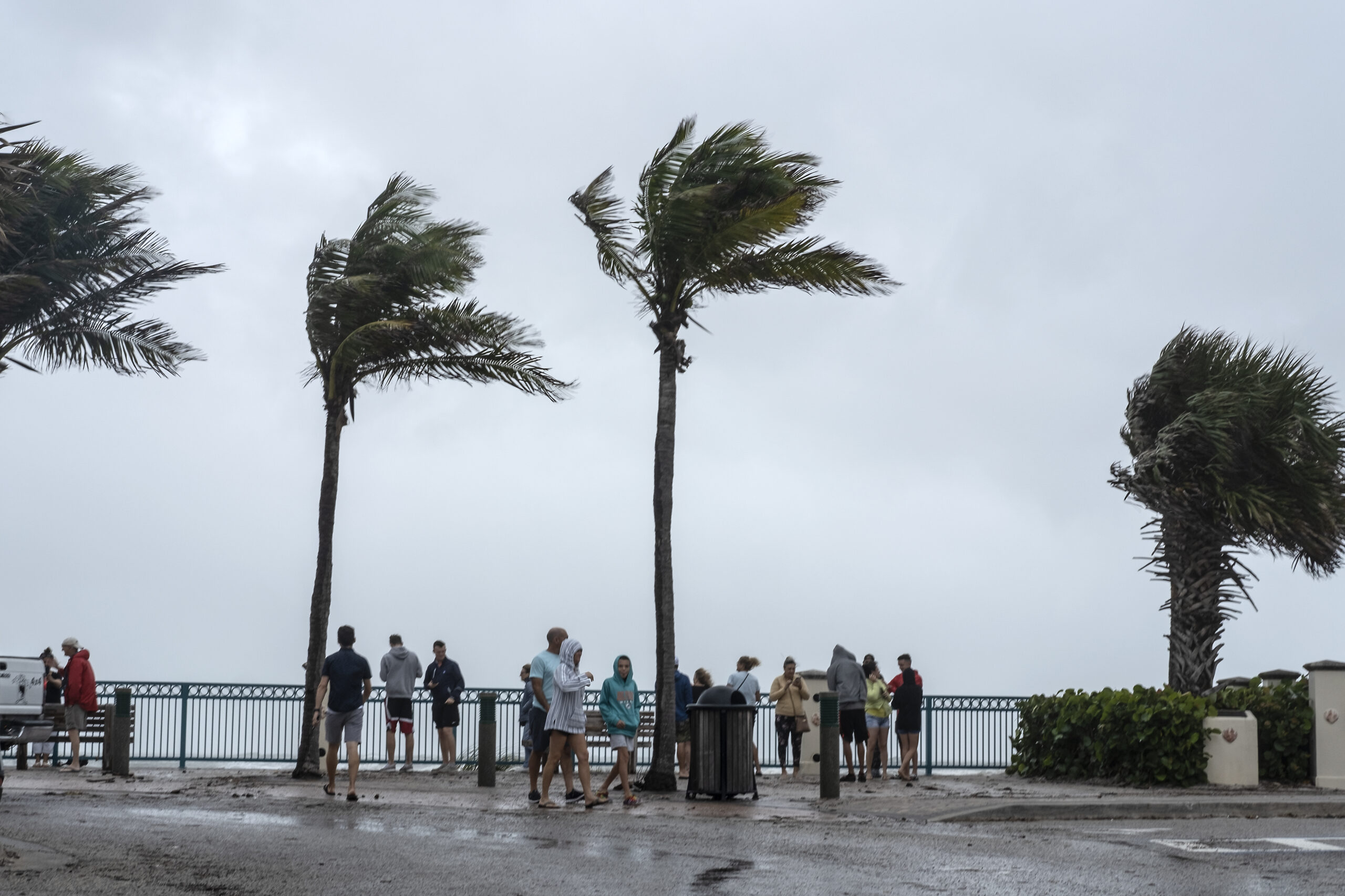
Strong storm gusts up to 35 mph swept through Indian River County Wednesday as Florida braces for Hurricane Nicole’s arrival later tonight, meteorologists said. Nicole was expected to make landfall on the Treasure Coast as a Category 1 hurricane sometime between midnight and 2 a.m., according to National Weather Service in Melbourne Meteorologist Zachery Law.
“We are getting gusts,” Law said about 4 p.m. Wednesday. “Over the next couple of hours, we’ll be getting sustained tropical storm force winds.”
Indian River County government officials issued voluntary evacuations Wednesday for areas east of U.S. 1 including the Barrier Islands, low-lying flood prone areas, residents with mobile homes or vulnerable housing and people with special medical needs.
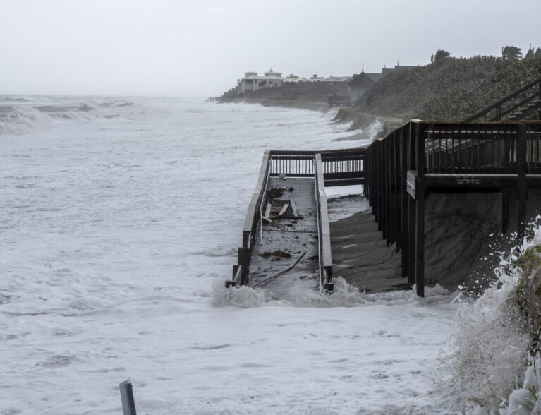
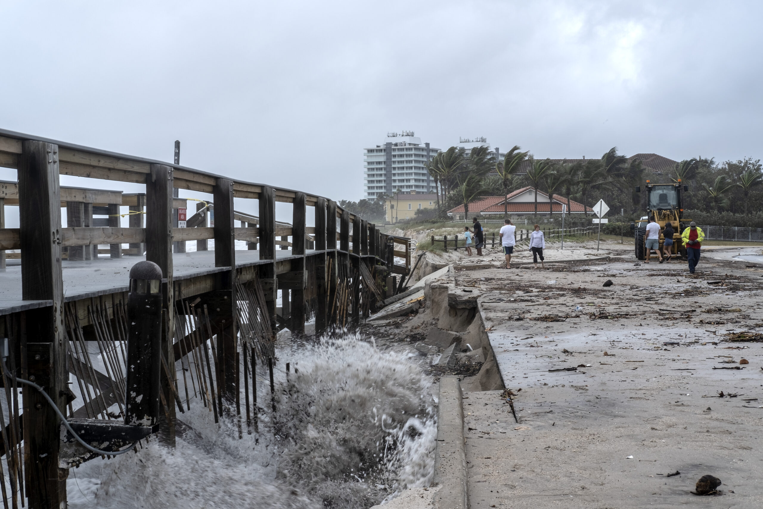
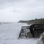
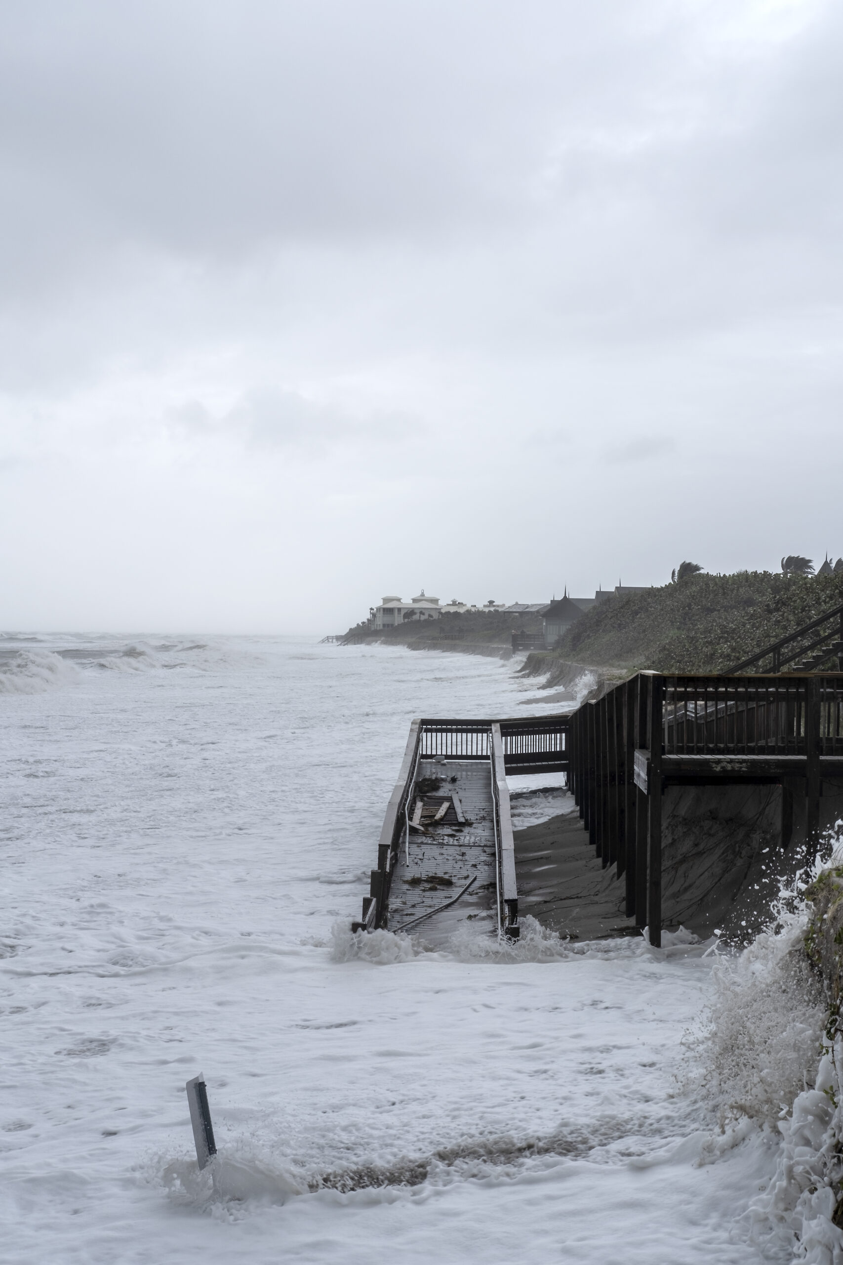
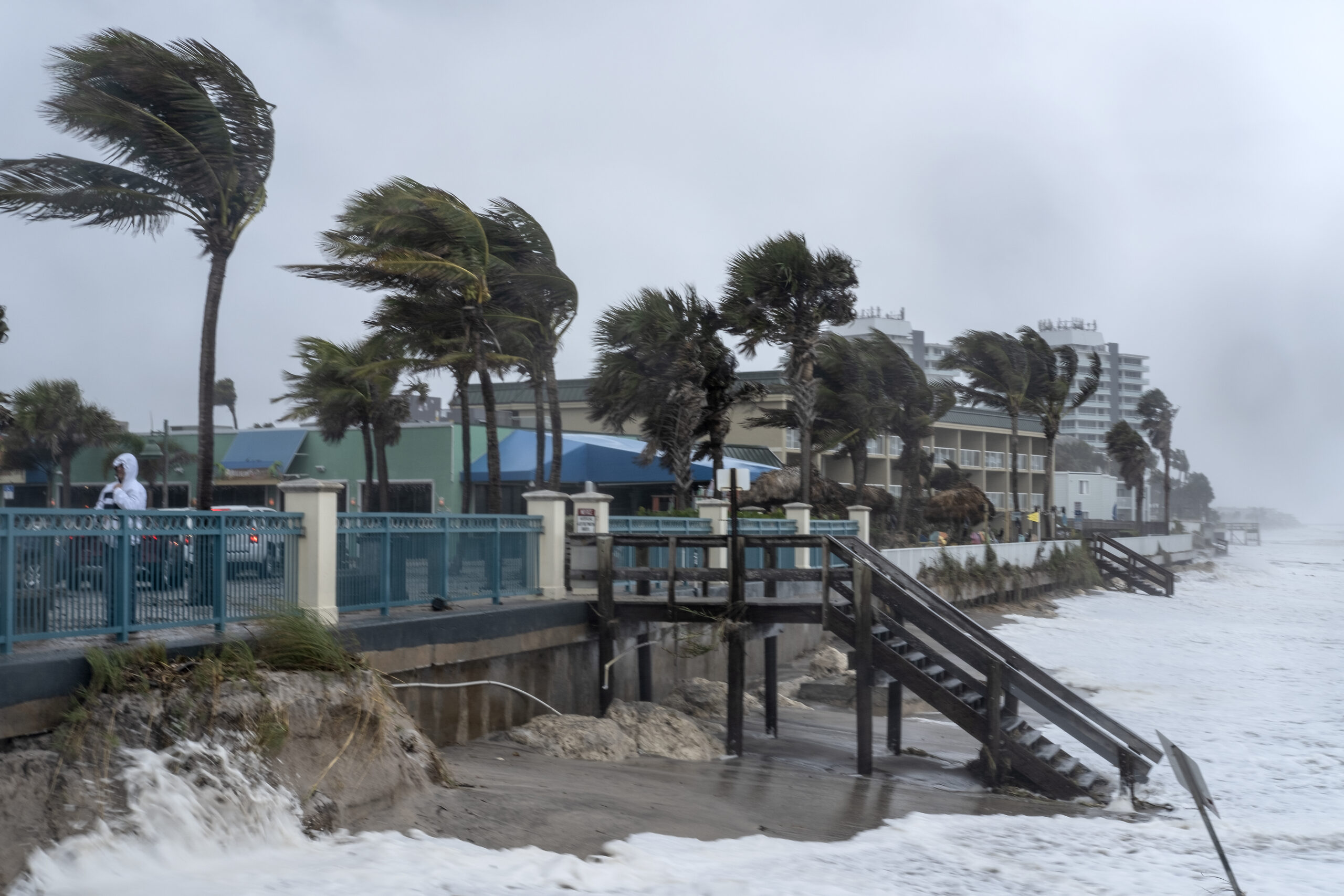
Strong winds have pushed water from the Atlantic Ocean to the bottom of the stairway areas at some local county beaches. The beaches were already eroded from strong winds caused by Hurricane Ian in September.
Photos by Joshua Kodis
-
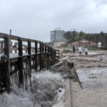
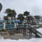
- Storm surge destroys stairs and a portion of the boardwalk at Jaycee Beach Wednesday as Tropical Storm Nicole moves closer to Vero Beach.
-
- Access to Wabasso Beach is hit by storm surge from Tropical Storm Nicole.
-
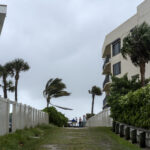
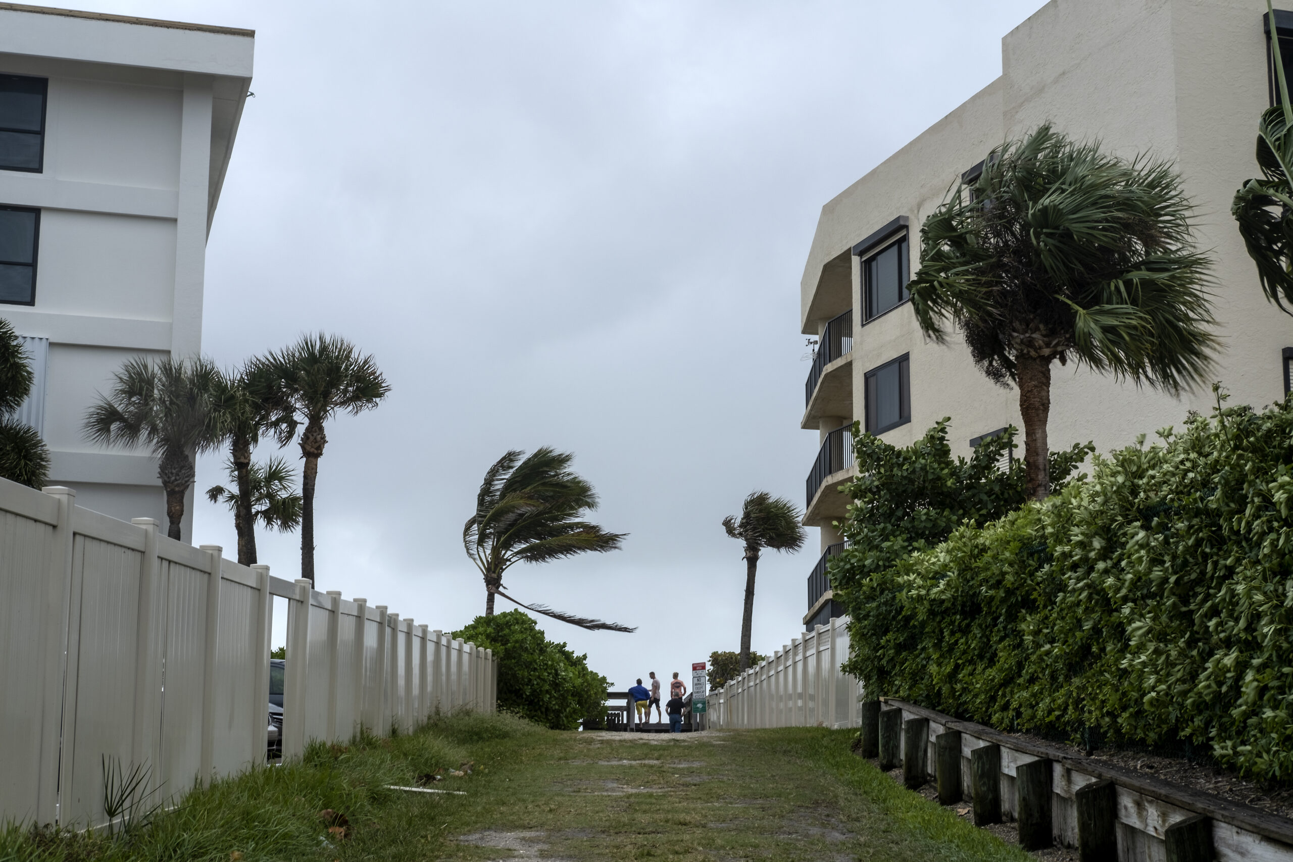
- People gather along the coast of Indian River Shores Wednesday to witness the waves and storm surge damage from incoming Tropical Storm Nicole.
-
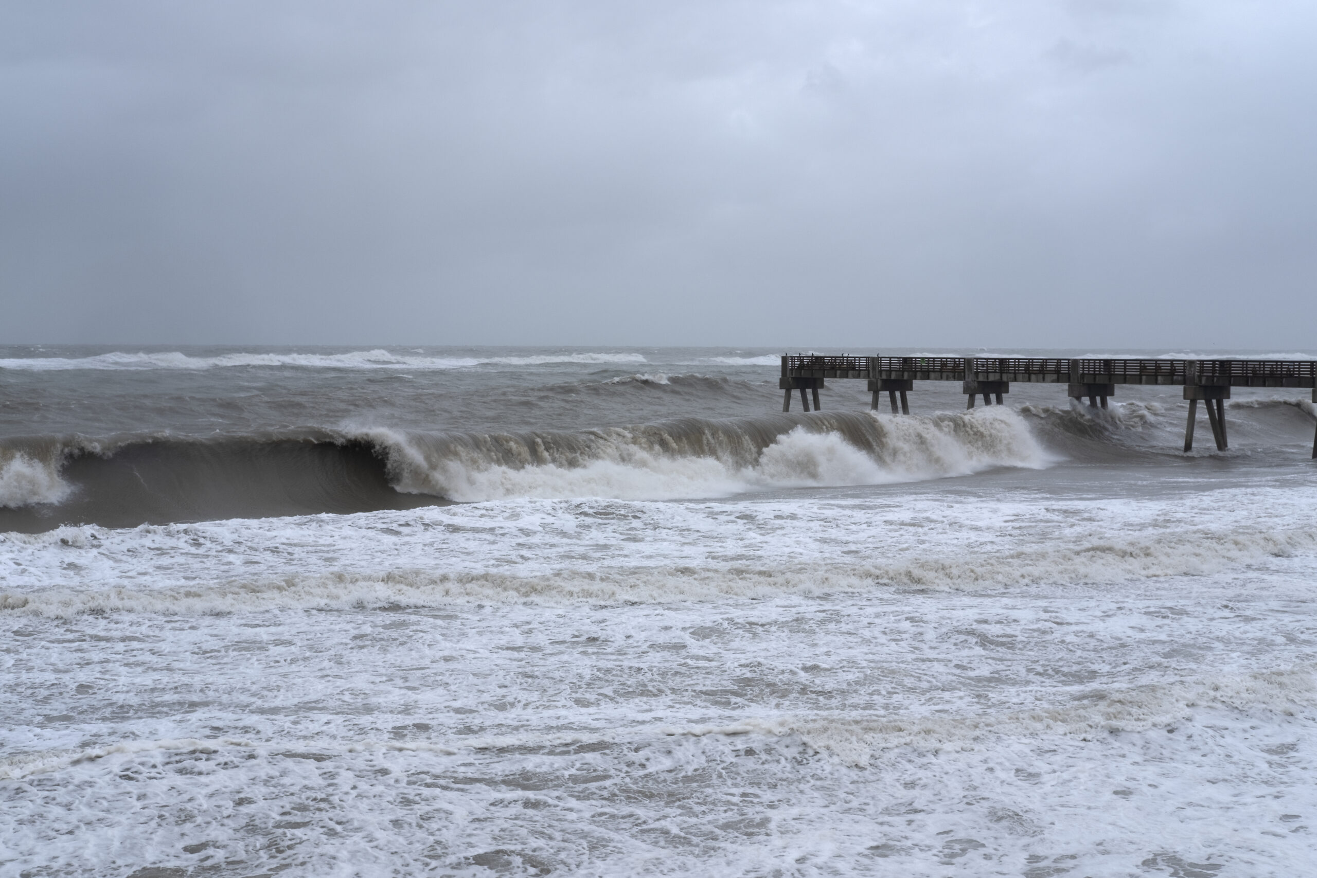
- Heavy waves crash along Jaycee Beach Wednesday as Tropical Storm Nicole approaches.
-
- Rising storm surge consumes the beach at Sexton Plaza as Tropical Storm Nicole makes its way closer to landfall.
-
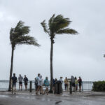
- People gather at the Sexton Plaza Beach Wednesday to witness the waves and storm surge damage from incoming Tropical Storm Nicole.