
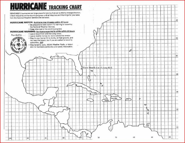
For the latest storm location, check out the National Hurricane Center, which will have the latest longitude and latitude locations issued.
Hurricane center positions are given by latitude (for example: 13.5 degrees North) and longitude (for example: 55.0 degrees West).
When the storm moves within range of radars, center positions may also be given as statute miles and compass direction from a specified point.
Step 1:When you receive a tropical disturbance advisory, note the advisory number, center position, intensity and forecast direction of movement.
Step 2: Then mark the center position on the tracking chart.
Step 3: Because hurricanes change directions very quickly, you should listen more carefully to where the storm will go, rather than where it has been.
The coordinates for the Vero Beach area are: 27.3E North/80.2E West.


