
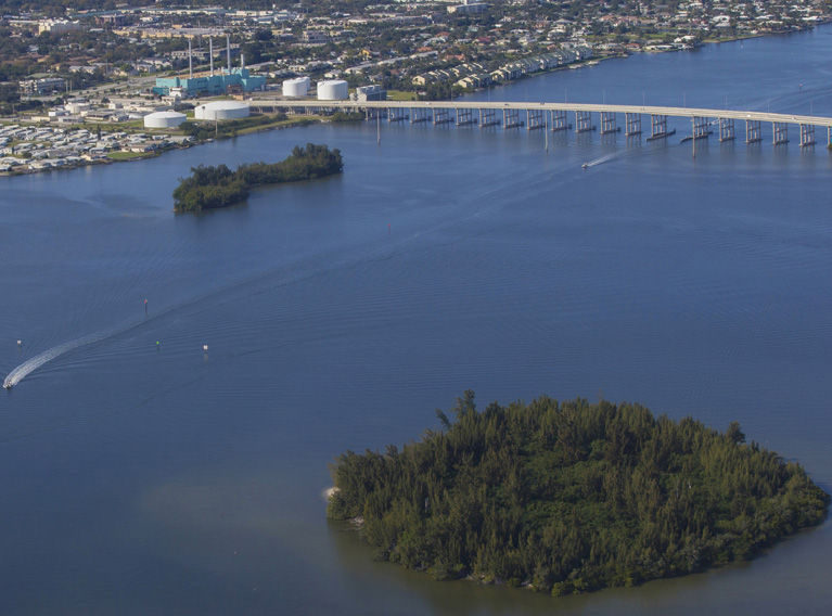
INDIAN RIVER COUNTY — Ecosystem-killing nitrogen has spiked to levels that are off the chart in the Indian River Lagoon south of the 17th Street bridge, according to new testing by Ocean Research and Conservation Association.
ORCA scientists and students from St. Edward’s took 68 sediment and water samples in the area during October, November and December and just released a color-coded map that shows nearly the entire mile south of the bridge bright red – indicating the highest levels of nitrogen measured on the scale.
ORCA founder and chief scientist Eddie Widder says the findings are deeply disturbing and somewhat mysterious.
The unexpected results are disturbing because high levels of nitrogen feed destructive algae blooms that cloud the water, killing seagrass beds that need light to survive and smothering other forms of sea life.
It was a series of severe algae blooms in 2011 and 2012 that destroyed more than half the seagrass in the central and northern lagoon and created an environmental crisis that is still ongoing.
High nitrogen levels in the aquifer and toxic algae blooms could also pose dangers to human health.
The findings are mysterious because testing done by ORCA in 2011 immediately to the north found relatively low levels of nitrogen in most of the area between Vero’s bridges. Those test results, also released in the form of a color-coded map, showed high nitrogen levels in the finger canals of Vero Isles and in other areas along both banks of the lagoon, but the bulk of the waterway was blue on the map, indicating low nitrogen levels.
Last week, ORCA took new sediment and water samples between the bridges to see if that area has become as heavily contaminated as the stretch to the south. Results of tests on those samples are not yet available, but Widder says she suspects they will show elevated nitrogen levels between the bridges because it is unlikely there would be a sharp demarcation in the free-flowing lagoon between an area saturated with nitrogen and one with much lower levels.
“I would be amazed if the area between the bridges is the same as in 2011,” she says.
If Widder is right and test results show the area between the bridges is “red,” that will put front and center the question what happened since 2011 to spike nitrogen poisoning in the lagoon.
In any case, ORCA staff will be analyzing weather data and land development patterns to try and figure out why the area south of the Causeway is saturated with nitrogen.
The problem of determining the causes of pollution in the lagoon is made more difficult because testing has been spotty due to limited funding.
ORCA’s 2011 map of the lagoon between the bridges with red areas along the shores is what sparked the push to clean up the lagoon in Indian River County.
It also drew the attention of Impact 100, a philanthropy that provided a $100,000 grant to fund additional testing in the stretch of the lagoon between the Barber Bridge and the Wabasso Causeway.
Those tests revealed varying levels of nitrogen and phosphorous pollution in the waterway, but nothing as severe as what ORCA found last fall south of 17th street.
ORCA has an ongoing Campaign for a Clean Indian River Lagoon that includes a fundraising effort. Money raised in the campaign paid for testing in the contaminated area, and the organization is seeking funds to extend testing further south and to eventually create a pollution map of the entire lagoon.
The Campaign for a Clean Indian River Lagoon also includes placing in the estuary 50 Kilroy water-monitoring devices that keep track of water conditions and movement, including levels of nitrogen and phosphorous pollution, in real time.
ORCA received $2 million in state funding for the Kilroy initiative last year and expects to have 35 Kilroys deployed by June, but Widder says testing the entire lagoon by taking water and sediment samples is critical to establishing a baseline against which pollution events can be charted so that pollution sources can be tracked.
Nitrogen pollution in coastal waters is a worldwide problem.
Ever since German chemist Fritz Haber discovered a process that extracts nitrogen from the atmosphere early in the 20th century, the chemical has become ever more abundant on the planet.
On the plus side, nitrogen in fertilizer, where it is mainly used, has enabled food production to keep up with earth’s exploding population.
But there is a big downside, too.
As untold millions of tons of fertilizer have been dumped on fields in watersheds worldwide, the chemical has begun to overwhelm the planetary ecosystem, throwing the delicate chemical balance of life out of order.
“Excess nitrogen is leading to dead zones in the ocean,” Widder says. “If we don’t act, the lagoon could become a dead zone.”
Several years ago, Widder warned of a possible impending tipping point in the lagoon environment.
That warning sounded extreme to some at the time, but the tipping point came with the catastrophic algae blooms in 2011 and 2012, which baffled scientists with their severity and longevity.
“One of the things that is really important for people to understand that is not widely appreciated, is just how critical the estuaries are to the health of the whole ocean,” Widder says. “So many open ocean species have to spend part of their life in an estuary.
“We live on an ocean world, where 71 percent of our planet is covered with water, but only two thousandth of one percent of the earth’s surface is taken up by estuaries and most estuaries are under the same kind of duress as the Indian River Lagoon because of the number people living around them and dumping into them, so this is where I am putting my focus.
“I am a deep-sea biologist working to save the ocean, but this is the place to do it.”


