
Tropical Depression 13 has been upgraded to Tropical Storm Lee in the northern Gulf of Mexico.
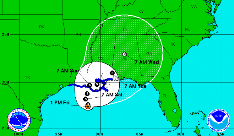
The storm sits south of the Louisiana coast and is producing heavy rain and strong winds in the area. Lee is expected to remain a tropical storm until it makes landfall in the next few days.
Tropical Storm Lee is drifting northwest at about 2 mph, bringing maximum sustained winds near 40 mph with higher gusts.
Much of the Gulf Coast, from the Florida panhandle to Texas, remains under Tropical Storm watches and warnings.
Tropical Storm force winds extend out from the center of the storm up to 200 miles.
Lee is expected to produce total rain accumulations between 10 and 15 inches over southern Louisiana, Mississippi and Alabama through Sunday.
The rains are expected to cause extensive flooding.
Tropical Storm Lee is also expected to cause a storm surge, raising water levels between 2 and 4 feet above ground level along the northern Gulf Coast in areas of onshore flow.
Isolated tornadoes are possible over portions of southern Louisiana tonight due to the bands of rain coming off Tropical Storm Lee.
While Tropical Storm Lee threatens the Gulf Coast, Hurricane Katia remains a Category 1 storm out in the Atlantic and is currently no threat to land. It remains on a path between Bermuda and the Bahamas.
Though tropical conditions remain “hostile,” the National Hurricane Center said, the storm could become a major – Category 3 or higher – hurricane by 8 a.m. Wednesday.
Models are inconclusive at this point whether Katia will impact Florida or stay out to sea.


