INDIAN RIVER COUNTY — The threat of too-high winds never realized and school buses were allowed out on Indian River County streets this morning to pick up students on their way to school.
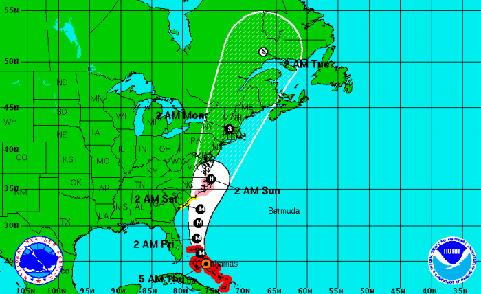
There had been concern that the Category 3 storm could bring sustained winds of 40 mph – a speed at which buses, by state law, are not allowed out on the road. The hurricane has moved so far east off the coast of Florida that it is expected to bring wind gusts and rain, but not the sustained wind speeds originally feared.
Those not in school but planning a trip to the beach are warned to not go into the surf.
“Large breakers can knock you down and make you susceptible to being caught in a rip current,” the National Weather Service said in a statement.
Forecasters expect wind speeds and seas to increase along Indian River County today as the storm moves over the northwest Bahamas, then continues north well offshore the Florida east coast tonight.
A wind advisory is in effect, which means that winds of 25 mph are expected. Winds this strong can make driving difficult, especially for high profile vehicles. Drivers are urged to take extra caution.
Outer rain bands associated with Irene moving over the northwest Bahamas early this morning will reach the Treasure Coast by late this morning.
Windy conditions will develop by late this morning, with northeast winds increasing to near 25 mph, occasionally gusting up to around 40 mph, especially in squalls.
A rough and pounding surf will make entering the ocean very dangerous, due to the large breaking waves building up to 8 to 12 feet, and a very high rip current danger. Small craft should remain in port.
Fast moving showers and isolated thunderstorms will move onshore today as major Hurricane Irene moves through the northern Bahamas. These showers and storms will produce brief torrential downpours as they move onshore and push inland. Stronger showers may produce wind gusts up to 40 mph. A few thunderstorms may produce dangerous cloud-to-ground lightning over the interior as well.
Isolated tornadoes and waterspouts will be possible within the outer rain bands that are expected to push onshore later today.

