
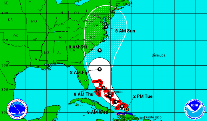
Update: Florida is no longer within the Cone of Error for Hurricane Irene’s eye. However, the east side of the state, including the Treasure Coast, could be effected by wind and rain from the storm.
Hurricane Irene has been upgraded to a Category 2 storm and is expected to grow stronger.
“Irene is forecast to become a larger than average hurricane,” the National Weather Service has advised.
Hurricane Irene could become a major hurricane – a Category 3 or stronger – within the next 24 hours once the storm clears the effects of Hispaniola. Forecasters expect the storm to maintain major hurricane status throughout the remainder of the 5-day forecast period.
Forecasters, however, are predicting the storm will move farther east than originally expected, removing nearly all of Florida from the cone of error.
Though the track for the storm’s eye appears unlikely to hit the state, the bands of rain and wind associated with the storm could affect land.
The consensus from forecasters is that Hurricane Irene will gradually turn northwestward over the next two or three days and then move northward through a developing break in the subtropical ridge over the southeastern United States.


