
Hurricane Irene, which has been downgraded to Category 1, could bring swells between 10 and 20 feet Thursday into Thursday night along Florida’s east coast, including Indian River County. The storm is expected to regain strength and reach Category 3 within the next 36 to 48 hours.
The hurricane’s swells could grow to 20 to 30 feet offshore on Friday. Large swells are expected to continue through Saturday before beginning to subside.
Forecasters predict that between tropical storm force wind gusts and large swells, moderate to severe beach erosion could occur. The chance of rip currents, too, will be high to extreme.
The surf along beaches could be as high as 8 to 10 feet, with the possibility of surf as high as 12 feet in some areas.
A Tropical Storm Watch is now in effect for Atlantic waters only – not land areas – from the Sebastian Inlet south and east and may be upgraded to a Warning early Wednesday. A Tropical Storm Watch may also be extended into Brevard/Volusia Atlantic waters early Wednesday.
Along the coast, fast moving heavy squalls will occasionally move onshore from around Noon Thursday through Noon Friday, with wind gusts of 40 to 45 mph possible.
Rainfall Thursday through Friday could be 1 to 3 inches in passing squalls near the coast.
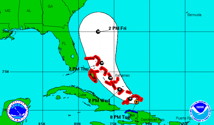
Hurricane Irene is moving west-northwest at 12 mph and is expected to pass near or through the southeast Bahamas overnight and through the northwest Bahamas Thursday.
The storm is still expected to strengthen to a Category 3 by the time it passes 175 miles off Florida’s east coast overnight Thursday into Friday.
The center of Irene is forecasted to remain offshore the Florida coast, placing east-central Florida within the western/weaker semi-circle, with impacts most likely over coastal waters and the immediate coast.


