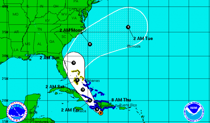
Tropical Storm Emily is still on a path, according to forecasters, that could bring her up Florida’s east coast. Currently, she is “meandering” just south of Hispaniola, causing heavy rains in the area.
The maximum wind speeds have not increased and remain at yesterday’s level of 50 mph, but she has essentially stopped her movement. She had been on a westward path and was expected to swing northwest last evening.
Though there are no current watches or warnings for Florida, that could change as the storm begins to approach.
Forecast models show Tropical Storm Emily reaching the southern tip of Florida around 2 a.m. Saturday and be in the Treasure Coast area sometime before 2 a.m. Sunday. The Treasure Coast remains within the cone of error for the National Hurricane Center’s forecast model.
Indian River County Emergency officials warn that even if the storm stays out to sea, it could whip up ocean swells that could result in dangerous rip currents over the weekend. Minor beach erosion could also occur.


