
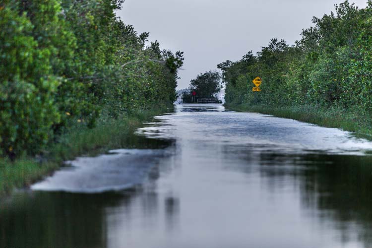
The Indian River Lagoon has been full to overflowing since Hurricane Irma blew by with heavy winds and flooding rains – so much so that high water has rivaled playoff baseball this past week as a topic of conversation. Docks that usually have a several feet of daylight beneath them have been awash and at times submerged, and the lagoon has crept up over low-lying roads and covered riverside land.
Record-breaking rainfall in September and October, during Irma and after, is the main reason for the brimming lagoon, but other factors are at play too, including wind conditions, a full moon and global warming, according to local scientists and water managers.
Vero Beach, Fort Pierce and Melbourne all set one-day rainfall records on Sept. 10, with more than 13 inches dumped in some locations, and all three cities received more than double the normal amount of rain between Sept. 1 and Oct. 4 when, according to one expert, the lagoon may have reached a historic high.
“It’s higher than I’ve ever seen it in my 45 years here,” said Dr. Grant Gilmore, a marine biologist at Harbor Branch Oceanographic Institution for 32 years and now senior scientist at Estuarine, Coastal and Ocean Science, Inc., who has observed the lagoon for more than four decades.
Besides rainfall, Gilmore said easterly winds have been driving ocean water onto the lagoon, noting there were two days last week with steady 20 mph winds out of the east, pushing water in the inlets.
The waxing moon, full on Oct. 5, added its gravitational force, said Gilmore and Indian River Farms Water Control District supervisor David Gunter, making for three king tides last week, pulling still more water into the overflowing estuary.
And then there is global warming.
Gilmore and Dr. David Cox, an ecologist with his own consulting firm, both say worldwide warming is contributing to rising water levels that magnify storm events.
“It will continue to get higher,” Gilmore said. “It is not surprising for me to say – wow, this is higher. Antarctica and Greenland are melting and the ocean is heating up, expanding more.”
Gunter, who oversees the county’s canal system, agrees the ocean is rising due to higher temperatures, but does not use the term global warming.
In 1929, the “North American Vertical Datum” established a baseline for sea level that is still used today. It was measured again in 1988, “and it was 1.8 feet higher than 1929,” Gunter said. “Sea level has been rising since the last glacial maximum 16,000 years ago.
“It was 350 feet below what sea level is now. So if you want to follow that trend, then yes, the lagoon is getting higher.”
The temperature of the water has risen “a degree or two,” Gilmore said, and “thermal expansion of the Atlantic Ocean” is contributing to the ocean’s rise. The Atlantic Ocean is hottest this time of year – in September and October – because water reacts slower than air and continues to warm up after summer ends.
With ocean temperature and rainfall peaking in early October, and land still saturated from Irma, the lagoon just kept getting higher as September merged into October.
“My canals are full but they’re not backing up,” Gunter says. “It’s rolling into the lagoon as fast as it can,” with the main relief canal dumping nearly 1,000 cubic feet per second into the waterway on Oct. 5, up from 50 cubic feet per second on Sept. 29. A cubic foot is nearly 7.5 gallons.
The lagoon’s height at Wabasso reached 3.1 feet above mean sea level on Oct. 4, according to the United States Geological Survey website, up a foot and a half from the prior week.
The lagoon subsided to about 2.7 feet above sea level by Oct. 6, but since the land is still saturated, it could fill up again with fall rain events.
“Until the lagoon drops down, it will take weeks for the flooded inland areas to dry out,” said Cox, who mentioned seeing cows wading around in fields near 58th Avenue.


