
INDIAN RIVER COUNTY – Indian River County and the rest of the Treasure Coast remain under a “Hazardous Weather” advisory through today, which could bring 1 to 3 inches of rain to the area.
Thunderstorms, flooding, and rip currents are the expected hazards.
The National Weather Service has detected a trough of low pressure over north central Florida that will combine with a frontal boundary sagging into central Florida to pull deep moisture across the region, and produce numerous to widespread showers and scattered thunderstorms across the region today.
The best chance for storms along the coast will be through the early afternoon, with activity becoming more showery in nature late, as the storms shift westward into the interior. Today’s main storm threats will be cloud to ground lightning strikes, torrential downpours, and wind gusts of 30 to 40 mph.
Rainfall amounts from today’s showers and storms could reach 1 to 3 inches in some areas, with locally higher amounts possible, mainly near the coast north of Cape Canaveral.
Because of the high water table and continued standing water in some areas, much of east central Florida remains very susceptible to rapid onset ponding and inundation of urban locations and other low lying and poorly drained areas.
Be prepared to take action to protect life an property in the event that a Flood Advisory or Flood Warning is issued for your area. Never drive into areas where water covers the road.
Wind gusts of 30 to 35 knots will be possible today in showers and storms that will become increasingly gusty as the day progresses, especially over the Atlantic waters. Today’s activity will move east at 15 to 25 mph.
As strong high pressure north of Florida builds southward into the region, expect increasing east to northeast winds up to 20 to 25 knots with seas building as high as 5 to 7 feet near shore and 8 to 10 feet well offshore through tonight. These conditions will spread from north to south through the adjacent Atlantic waters, and a Small Craft Advisory has been issued for entire area.
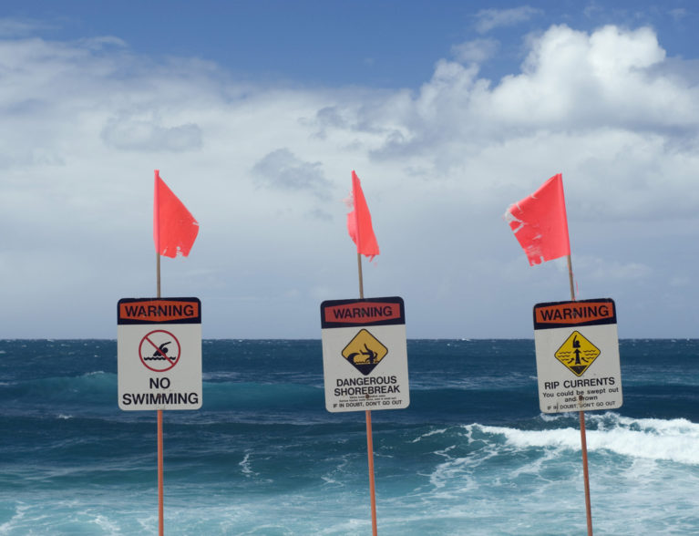
A lingering long period ocean swell will lead to a moderate risk for rip currents at area beaches today. The greatest threat today will be between 8 a.m. 2 p.m., due to tidal effects.
Remember to always heed the advice of local beach patrol before entering the water, and only swim within sight of a lifeguard.
While formal activation of spotter networks is unlikely today, spotters are requested to report any rainfall amounts of two inches or greater to the National Weather Service.


