
People who live on or near the ocean or the Indian River Lagoon naturally fear flooding from storm surge or other causes when a powerful storm like Irma bears down on the county, but it turns out many inland neighborhoods – including modern, recently build subdivisions – are vulnerable, too.
 Many homes in a string of gated subdivisions built in the current millennium along Oslo Road between 43rd and 58th avenues lay within a flood zone that, according to the Federal Emergency Management Agency, has a 1 percent chance of flooding during a given year.
Such terrain is known as a 100-year flood zone, one likely to suffer inundation once a century.
Last weekend the die thrown by the heavens produced a one.
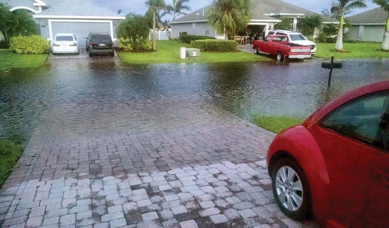
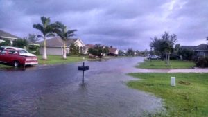
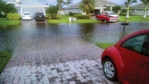
Hurricane Irma deposited about 14 inches of rain in Indian River County, leaving residents in South Lakes, Diamond Lake, Hunter’s Run, Legend Lakes and Citrus Springs unable to get out of their own driveways, much less their neighborhoods, because of high water.
The storm, with 70 mph winds, knocked out power in the subdivisions as well, but electricity was restored well before the water receded.
Four days after Irma, the entrance to South Lakes was still underwater. Water also stood in the entrances to Diamond Lake and Legend Lakes.
Living in an otherwise desirable neighborhood located in a 1 percent flood zone seems like a reasonable risk. But the name is somewhat misleading.
“The 1 percent means that the area within that zone is prone to flooding,” said Roland DeBlois, chief of Environmental and Code Enforcement for Indian River County’s Planning Division. “People who own homes in those areas are required to have flood insurance.”
FEMA’s color-coded map of Indian River County displays a distinct swath of dark purple that shows the extent of the inland 1 percent flood zone. Roughly speaking, the zone stretches west from 43rd Avenue almost to 82nd Avenue between State Road 60 and the St. Lucie County line.
There is, however, a single splotch 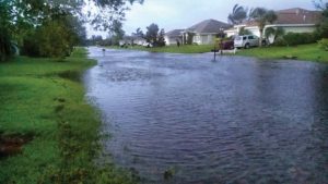 of white in that purple expanse: The original section of South Lakes is not in the 1 percent zone. That phase, launched in 2004, totals 54 lots, slightly more than half of the home sites in the community.
So how did those lots escape flood zone designation when FEMA drew its current map, while others in the same development did not?
Neighborhood lore puts original builder James Adams at the center of the story. Longtime residents say Adams brought in tons of fill dirt to raise building sites above what’s known as the county’s “base flood elevation.”
That enabled buyers to choose whether they wanted to purchase flood insurance, and kept them high and dry when Irma blew through the county.
But there is more to the white area on the map than micro-geography.
It turns out other homes in South Lakes that were built later, and homes in other nearby subdivisions, are eligible to be removed from the flood zone.
GHO Homes finished the South Lakes development and company owner Bill Handler stressed that any lots on which his company built adhered to all existing county requirements.
Civil engineer Joe Schulke, who helped prepare those lots, said they meet the requirements to be exempted from the flood zone.
“I promise, any of GHO’s lots in South Lakes will meet that requirement,” he said.
Schulke also pointed out what many homebuyers likely don’t know: All it takes to be removed from the flood zone is what’s known as a “revalidated letter of map change” for Indian River County that certifies a property’s elevation is high enough to be exempted from the flood zone.
 Since FEMA last updated its flood zone map in 2012, using up all that purple ink, a number of developments along Oslo have submitted revalidation letters that resulted in hundreds of homes and home sites being reclassified – taken out of the flood zone without any change in location or geography.
So when the new FEMA map comes out, there will be a lot more white in the midst of the 1 percent flood zone between SR-60 and the St. Lucie County line.
Unfortunately, none of that helped with the flooded streets in South Lakes last week. The 14 inches of rain Irma dumped on the county overwhelmed the drainage system in the subdivision, filling the namesake lakes – which serve as stormwater retention basins – to near overflow, leaving no place for water in the streets to go.
Water removal since the storm has been dependent on seepage and evaporation, a maddeningly slow process. Each day since Irma the water level has receded, but even four days after the storm departed there were still places in South Lakes where water completely covered the road.


