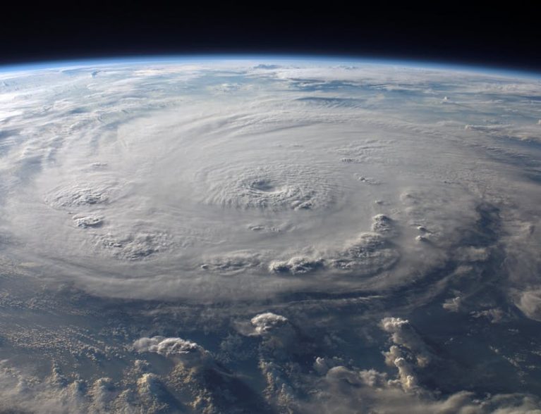
INDIAN RIVER COUNTY — Hurricane Irma remains a Category 3 storm Saturday evening with sustained winds of 120 mph. The outer bands are beginning to strike areas of South Florida.
Irma is still expected to strengthen back to a Category 4 or 5 before making landfall in Florida. The track for the storm is shifting farther west, but Indian River County remains under a Storm Surge Warning. There is no Hurricane Warning for Indian River.
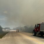
Currently, there are no road or bridge closures and no mandatory evacuations or curfews. However, conditions could change and bridges will be shut down if winds hit a sustained speed of 39 mph.
Forecasters expect the storm to hit the southern tip of Florida as a Category 4 and start to weaken as it moves through western central Florida.
“Even though the hurricane has shifted west, east central Floridians should not let down their guard,” officials said in a statement they released earlier today.
Tropical Storm force winds are expected Sunday morning and hurricane force winds are expected Sunday evening through Monday morning. The area will see a moderate threat for tornado activity.
The following is pulled from http://calendar.ircgov.com/alerts/fri-99-hurricane-irma-press-release/
- Follow evacuation orders. If a mandatory evacuation is put into effect, the following areas in Indian River County would be affected:
- Barrier island
- Areas known to flood
- Manufactured homes
- Sub-standard housing
- Areas east of U.S. 1
- Follow your hurricane preparedness plan and be sure to check in with family and friends by texting or using social media.
- If you have general questions related to Hurricane Irma, do not call 9-1-1. Instead, call 772-226-3930.
Friday, Sept. 8
Hurricane Irma remained a steady category 4 storm throughout most of Friday until about 11 p.m., when it picked up wind speeds and became a category 5 storm.
The catastrophic storm will directly hit South Florida in just a few days.
Hurricane Irma was downgraded from a category 5 to a category 4 hurricane with 155 mph winds earlier on Friday, according to weather meteorologists. It upgraded back to a category 5 hurricane when wind speeds reached 160 mph late Friday.
A hurricane watch was issued at 11 p.m. Thursday for Indian River County and a hurricane warning was issued at 5 p.m. Friday.
A hurricane watch means that hurricane conditions, which are sustained winds of 74 mph or greater, are possible within the area, according to weather meteorologists. Hurricane watches are issued 48 hours before tropical storm-force winds are anticipated in that area.
A hurricane warning means that hurricane conditions are expected somewhere within the specified area within 36 hours.
Irma is traveling northwest at 13 mph. On Friday, Irma was passing over the Bahamas, and later over Cuba. It’s expected to bring significant damage to Indian River County on Sunday and Monday.
A storm surge watch was put in effect for parts of the Treasure Coast, including Indian River County, on Friday. A storm surge watch indicates that life-threatening flooding is possible somewhere within the specified area, generally within 48 hours.
Everyone, regardless if they are in the storm surge or hurricane watch or warning area, should follow evacuation orders and other instructions from local officials.